
 Utilities in Cambridge
This page covers information about Cambridge water, lighting, gas etc.
The most important utility is water. This is mostly to drink, but there are other uses. There were different attempts to provide water in Cambridge.
The river is, of course, the main water course in Cambridge.

While you can walk along the river down river of Magdalene Bridge, and up river from the weir near Silver Street bridge, the colleges own the banks in between. So you can only see the river by crossing bridges. There are three public bridges in this area (although the colleges have their own bridges).
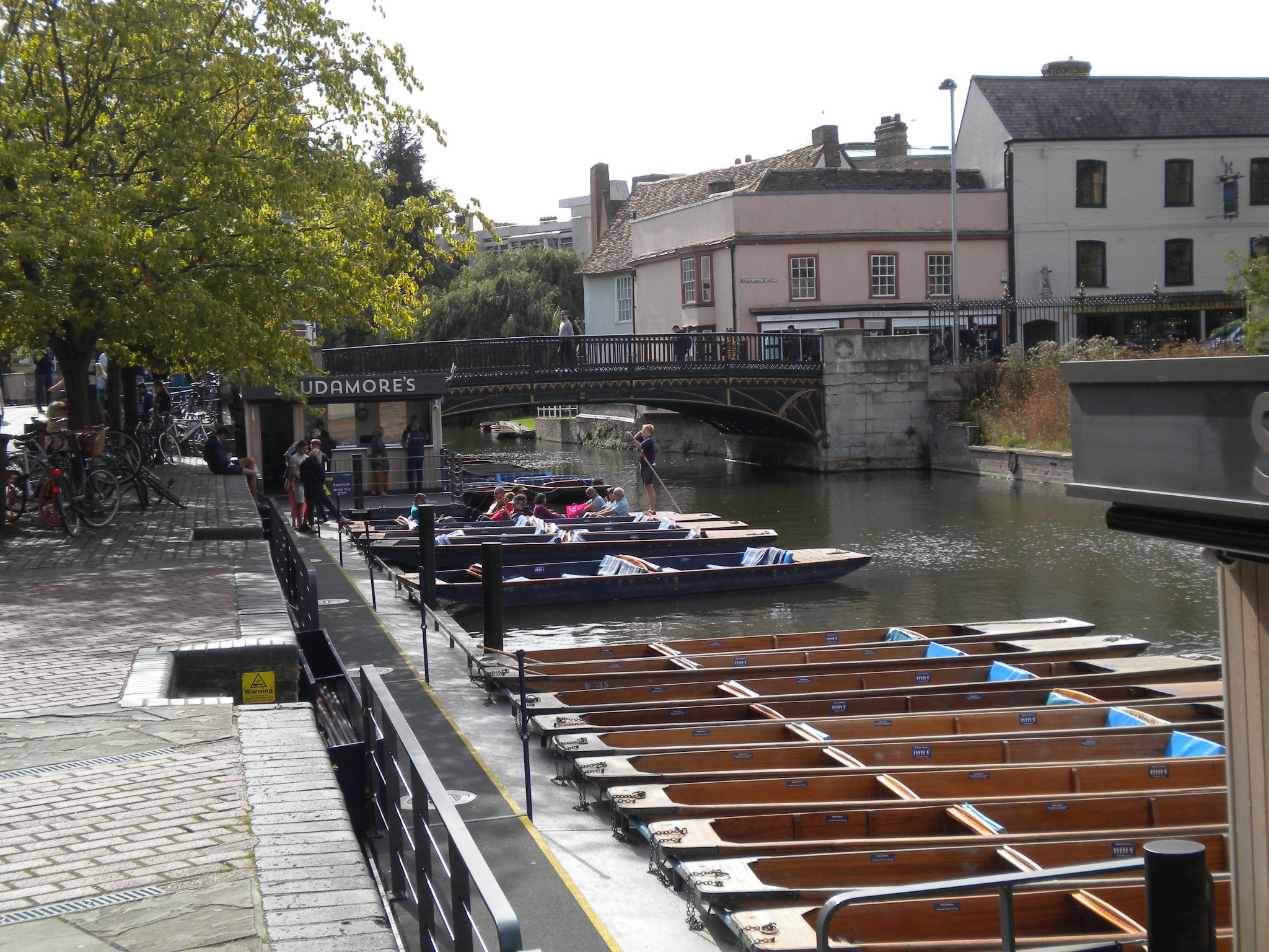
This was the main bridge of Cambridge, called the Great Bridge, but is now Magdalene Bridge (after the college). This particular bridge was built in 1823 and is listed grade II. In Cambridge, we spell Magdalene with a final 'e' (Oxford doesn't). Both Oxford and Cambridge pronounce it as 'Maudlin'.
The Roman name for Cambridge was Duroliponte. No archaeological dig has found a Roman bridge. However, the Saxons did build a bridge here, and called the town Grantebrycge (or Granta-bridge) since the river was the Granta. But this gradually changed to Cambridge. The river was still called the Granta, and at some point this was thought silly, so they changed the name of the river as well! It is still called the Granta up river.
This area is called Quayside. It was used to load and unload cargo, as Cambridge was an inland port. Now there are punts.

Garret Hostel bridge is the only public bridge across the river between Magdalene bridge and Silver Street bridge. It is a foot bridge (apart from fast cyclists!) It is a good place to see part of the Backs, and watch punts.


There were several "hythes" (quays) along this part of the river, as well as at Quayside.
Garret Hostel Bridge is a modern bridge. In the past, there was a network of streams and ditches on the other side of the river, with various foot bridges over them. The river has even changed course at this point.

The third public bridge in the centre (and second bridge for traffic) is Silver Street bridge, which is listed grade II. It was designed by Sir Edwin Lutyens in 1932 and built in 1958-59. But there was a bridge here in the past.
There are other bridges, both up river and down river, including busy traffic bridges such as Victoria Bridge, Elizabeth Way Bridge and Fen Causeway. There are many foot bridges. Some of these replaces ferries. One bridge in Midsummer Common is even called Cutter Ferry Bridge! It replaced a ferry across the river. Most of the footbridges have paths by them, which originally led to the ferry, although some are often used by boat houses. The cartoon is from "A Cambridge Scrap-book" by John Lewis Roget (1859).


The river provides a natural boundary to the town. In the Middle Ages it was part of Cambridge fortifications (the other part was the Kings Ditch). The river probably provided drinking water, and disposal of sewage and other rubbish. This would cause problems for drinking water, so alternative sources of water were found, such as conduits, pumps, wells and springs. The river would provide food, fish, and possibly even swan! It could be used to wash clothes, on Laundress Green (see above). It could be used as a power source, to grind wheat (which also provided food). The wheat could be brought in by boat, and the flour returned by boat.
Modern usage of the river include punts (the best way to see the Backs for the tourists), rowing, and walking along the various water meadows. Some people even live on the river, in house boats.
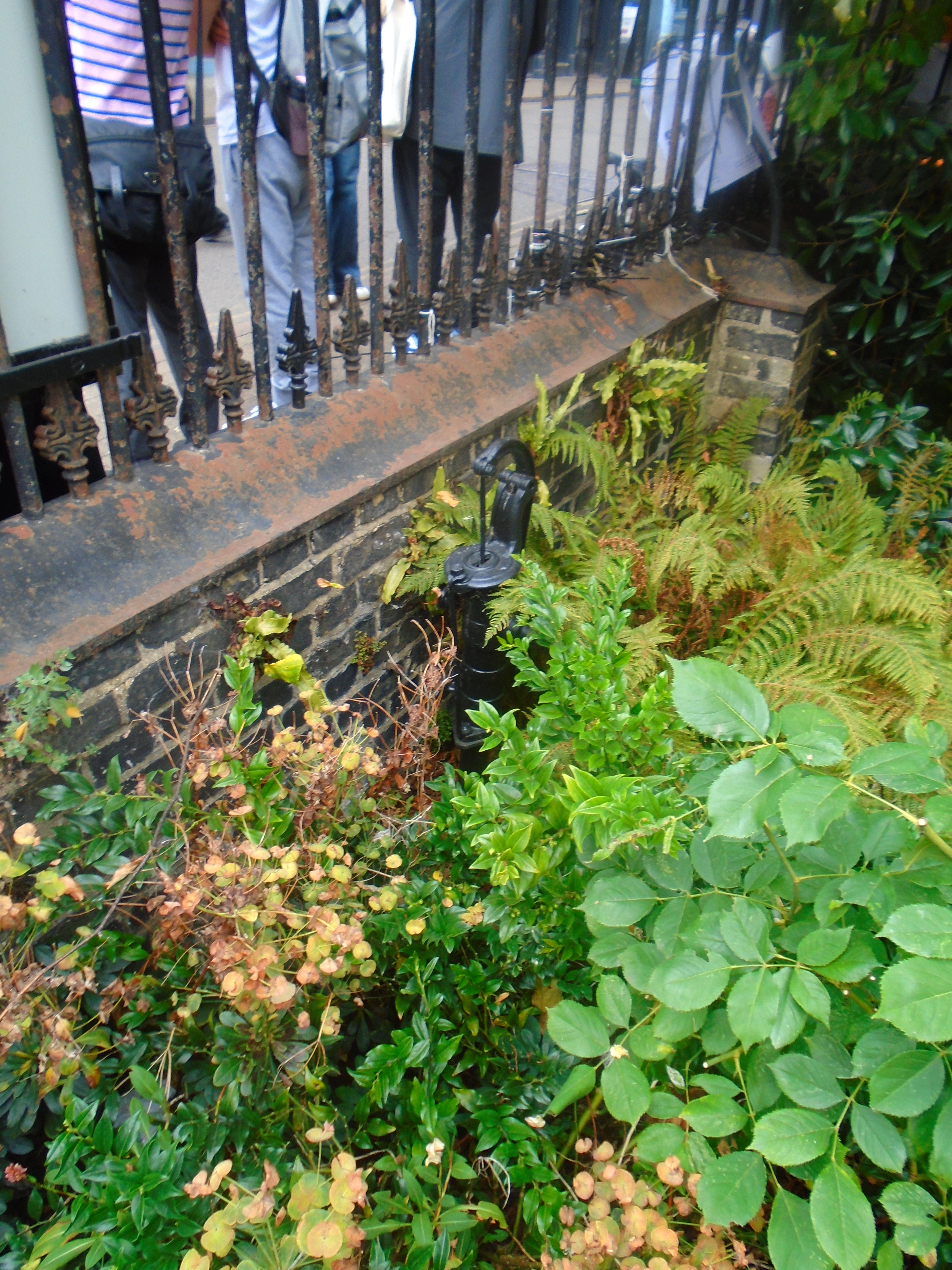
This parish pump is just within St Benets churchyard, to the left of the entrance. Here is yet another source of drinking water. Before the establishment of the Cambridge Water Company in 1853, some Cambridge people got their drinking water from such pumps. The pumps were often placed against churchyard walls. St Celements, St Boltolphs, St Giles, Holy Trinity and the Round Church all had a churchyard pump. In one of these churchyards, the sexton opened a grave to make a second burial, and found it kept filling with water. When he worked the pump nearby, the water disappeared. When news of this spread, some of the parishioners decided to stop using that pump for their drinking water!
There was another parish pump in Green Street, belonging to St Matthews. In 1816, it was stolen, and the annoyed church wardens offered £10 for the apprehension of the delinquents.
There were springs providing water as well. Barnwell Abbey was called after "The children's well" which was a spring. All that is left of the Abbey now is the Cellarer's Chequer in Beche Road.

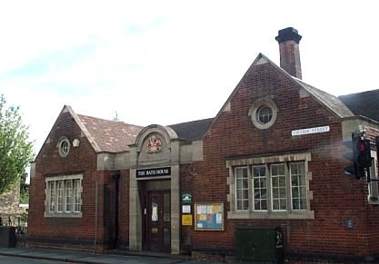
There was a spring at the end of Gwydir Street. Later on, there was Dales Brewey and the Bath House.

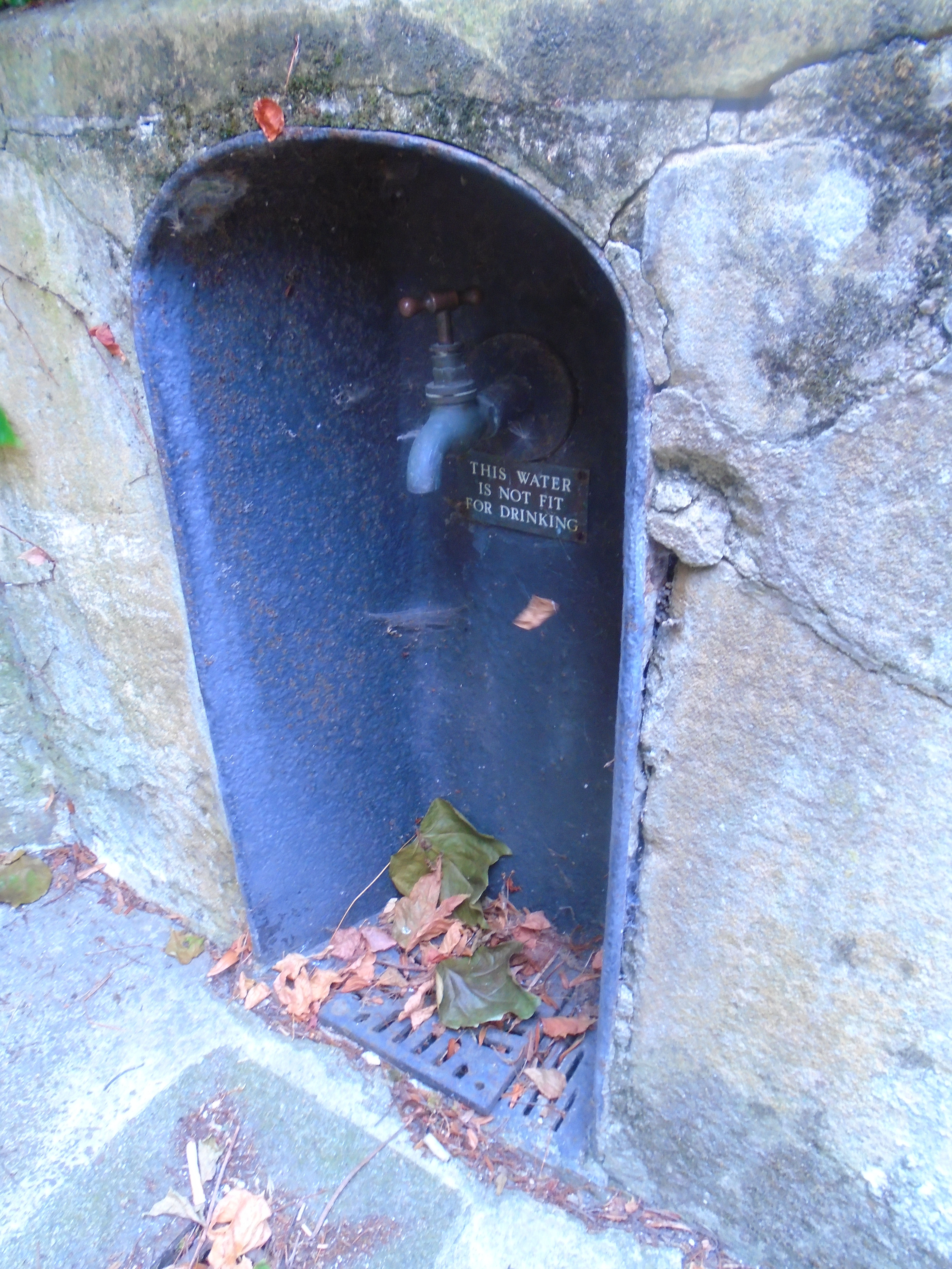
At the foot of the south tower of Trinity Gate there was a public water supply whose source was in a field near Madingley Rise and it was brought via the conduit pipe that crossed the river opposite the north end of Trinity Library.
F A Reeve, 'The Cambridge Nobody Knows' (1977), writes about the water supply set up by Franciscan Friars in 1325. Their house was on the site of Sidney Sussex College. They acquired a piece of land about a mile long and two feet wide from Bradrusshe, in what is now Conduit Head Road, which led to their Friary. Along this strip they lay lead pipes which cross streets, brooks and the river, passing through what is now Trinity College. A well house and pump was set up on the outer wall of the Friary and Sidney Street was for a long time called Conduit Street.
In 1439, the college of King's Hall (later part of Trinity) obtained the right to tap the conduit as it pass through their site. After the Franciscan Friary was dissolved in 1538, Henry VIII granted full rights to the conduit to Trinity College. Later, the portion between the college and the Friary was discontinued.

Water from the conduit still feeds the fountain in Trinity Great Court though it is supplemented by an artesian well. Trinity College has rights to prevent any interference with acess to the conduit along its route. The actual Conduit head lies 300 yards west of the Observatory. At various points en route to the city small stones indicate its presence below. (I can't find any of these!)

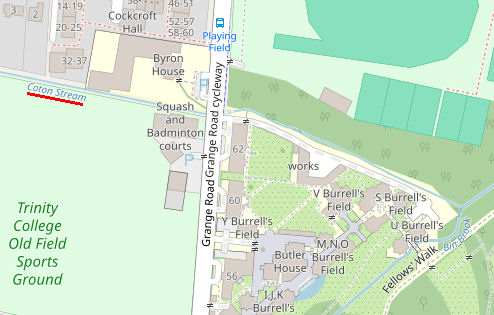
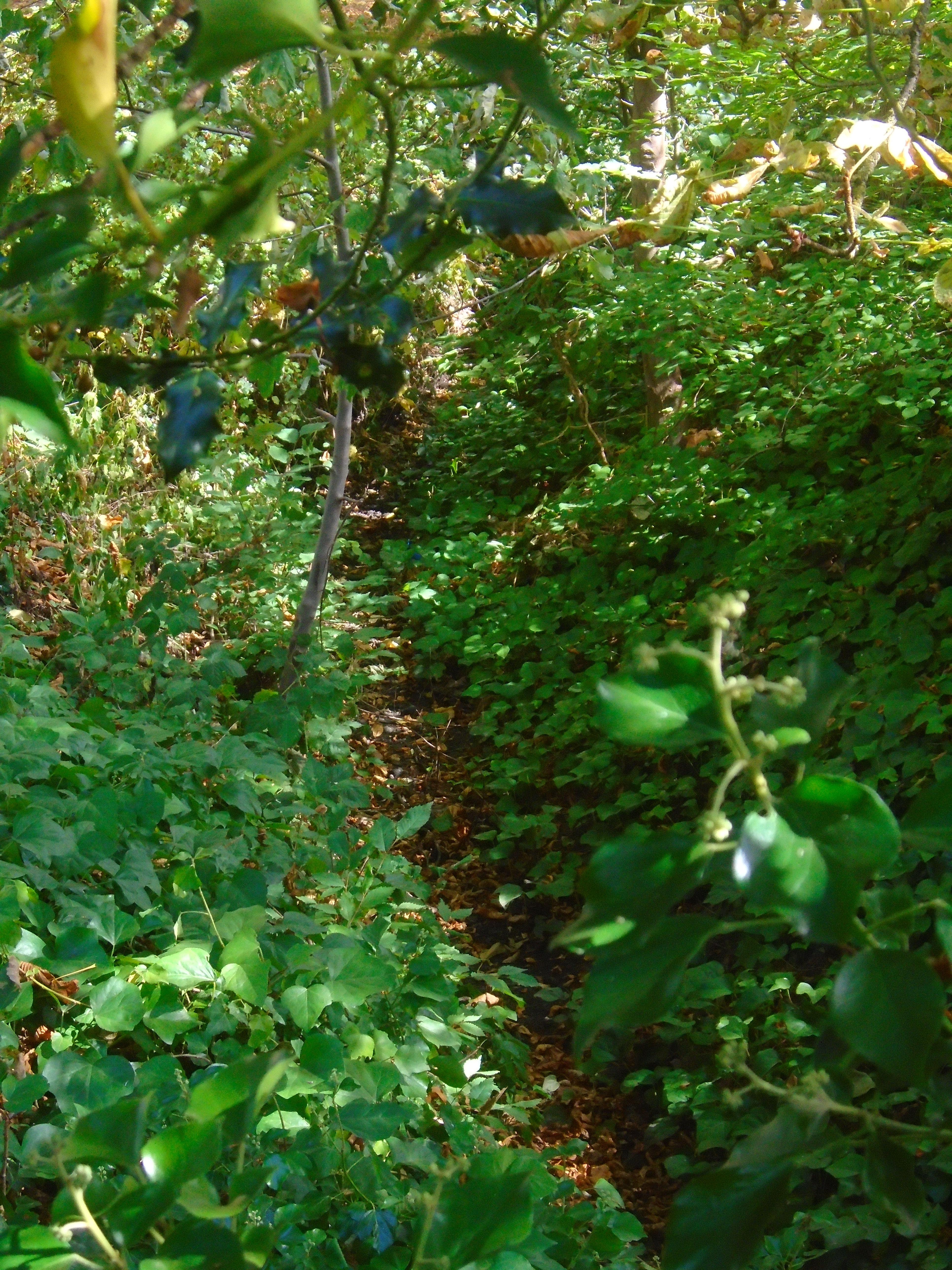
The Trinity conduit must cross Grange Road somewhere. This map, Baker's Map of the University and Town of Cambridge 1830 (above), is the only map that I can find which gives a clue to where the conduit ran. It shows "Conduit" (underlined in red, top left) and "Conduit Ditch" (underlined in red, heading bottom right) - click on map for larger version. If you look at this area on a modern map, this is called Coton Stream, which joins with Bin Brook (which we see later). Perhaps the conduit fed into Coton Stream at some point. Or perhaps the Baker map is just wrong! You can see the Coton stream (or rather, dry ditch) just before 62 Grange Road, on the left.
Trinity Conduit must also cross underneath the river somewhere near Trinity bridge.
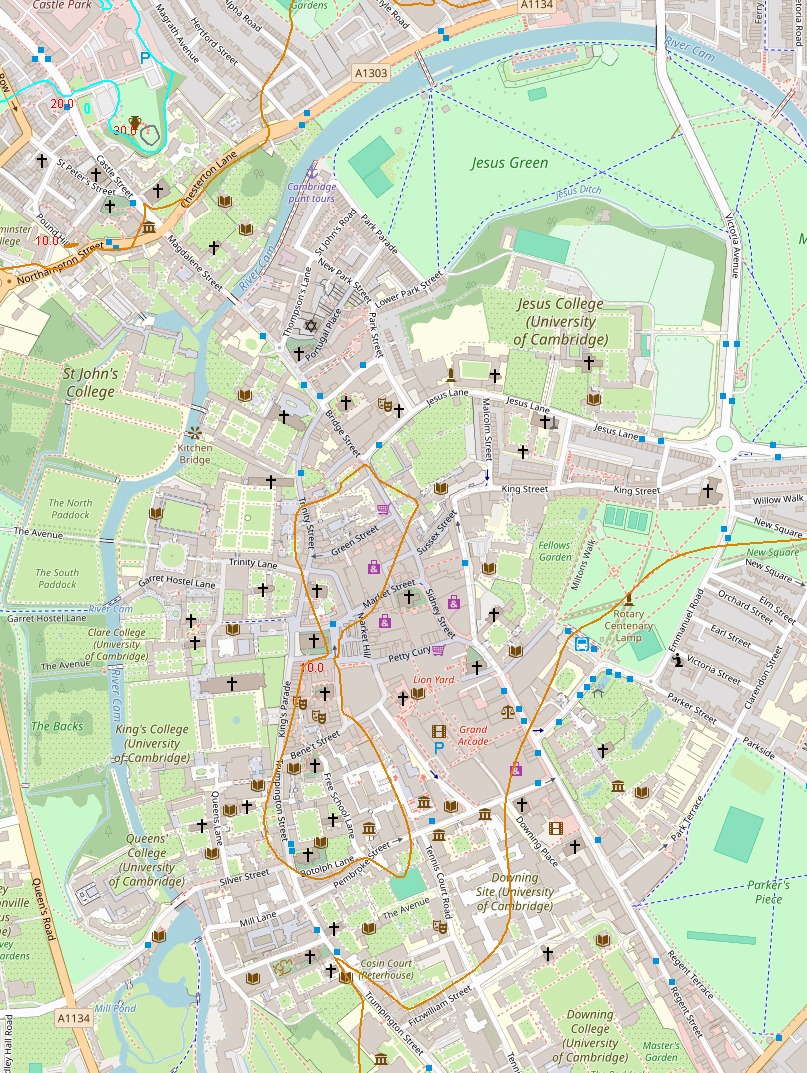
Here is a modern map of the whole area.

Hobsons Conduit, also called Hobson's Brook, is a watercourse that was built from 1610 to 1614 by Thomas Hobson and others to bring fresh water into the city of Cambridge, England from springs at Nine Wells, a Local Nature Reserve, near the village of Great Shelford. It is now a Scheduled Ancient Monument and historical relic. The watercourse currently runs overground until Cambridge University Botanic Garden and Brookside, where it is at its widest. At the corner of Lensfield Road stands a hexagonal monument to Hobson, which once formed part of the market square fountain, and was moved to this location in 1856, after a fire in the Market. The flow of water runs under Lensfield Road, and subsequently runs along both sides of Trumpington Street in broad gutters towards Peterhouse and St Catharine's College, and also St Andrew's Street.
The scheme was first devised in 1574 by Andrew Perne, Master of Peterhouse, who proposed that a stream be diverted from Nine Wells chalk springs through the town and the King's Ditch to improve sanitation. The design was revived by James Montagu, Master of Sidney Sussex College and built at the expense of the University and town. Although Thomas Hobson was just one of those involved in the construction he endowed a Hobsons Conduit Trust to deal with maintenance of the waterway, which still exists today (see website). The new river was dug from Vicar's Brook near Long Road to the conduit head at the end of Lensfield Road as a joint venture between the University and the city. Here the flow of water was divided into four separate branches for different uses.
Hobson's Brook from Nine Wells to the conduit head
Hobson's Conduit was originally formed by diverting the water from Vicar's Brook. From its source in chalkland springs at Nine Wells, near Great Shelford, this stream flows east of Trumpington under bridges on Long Road and Trumpington Road until reaching Coe Fen, where it forms the first tributary of the River Cam above Cambridge. The man-made channel Hobson's Brook branches off from Vicar's Brook between the two bridges and initially runs parallel to Vicar's Brook, enclosing a stretch of common ground, now used for allotments. A public footpath, formerly known as Finch's or Senior Wrangler's Walk, follows this portion of the watercourse. The stream widens as it skirts the western boundary of the University Botanic Gardens until passing under Bateman Street. The water from Hobson's Conduit provides water for the Botanic Gardens.

The channel flows between Brookside and Trumpington Street through gardens enclosed by 19C wrought iron railings. There are attractive little bridges over the conduit.

Hobson's Conduit Head is on the corner of Trumpington Road and Lensfield Road. It is listed grade II*. From 1614 to 1856 this conduit head stood in Market Hill where it served as a fountain. It was moved here in 1856.

At the conduit head, it divides into various branches, some underground.
Trumpington Street branch
The original branch still functions as sluices along Trumpington Street, where it is known as the Pem (east side) and Pot (west side). The City Council's Drainage Engineer controls flow through the sluices and sometimes water flows along these channels.

These Hobson's Conduit runnels were created between 1794 and 1815, so they were not part of the original scheme. They are listed grade II.
A run also used to feed into the basement of the old Addenbrooke's Hospital, which became the location of the Judge Institute by 1995.
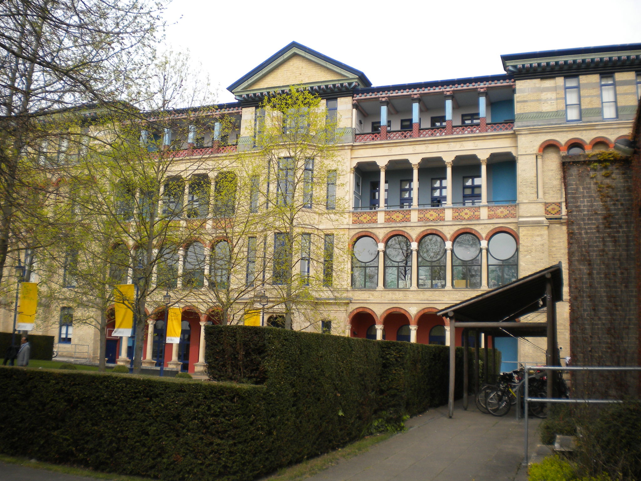
Feeds run into Peterhouse college (left) and Pembroke college (right).


Little bridges have been made over the channels to make it easier for pedestrians to cross. This modern one names the conduit.

Market Place branch
Completed in 1614, this branch brought fresh water to the Market fountain in the centre of the Cambridge Market Place.
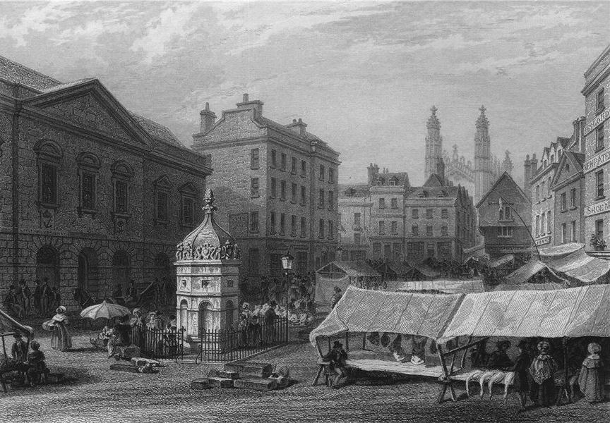
Following a fire in 1849, the Market Square was redeveloped and in 1855 the original fountain was partly moved to form the monument in Lensfield Road (now called the conduit head - see above), and the remainder demolished. Flow to this branch was cut off in 1970 during construction of the Lion Yard development and has never been restored.
St Andrew's Street branch
Added in 1631, this branch flowed from the conduit head along Lensfield Road. It still does, but underground, so it's not visible. It then runs along one side of Parkers Piece, and here you can find signs, such as named manhole covers:

It then ran along St Andrew's Street toward Drummer Street where it split into feeds that ran into Emmanuel College (left) and Christs college (right).


There was also a public dipping point which no longer exists.
Much of the open conduit along St Andrew's Street was covered in 1996 as part of pedestrian improvements, but there are markers showing some of its route, plus a grill covering the conduit..


Hobson's Conduit is an open brook bringing water into Cambridge from Nine Wells, a series of chalk springs 3 miles outside Cambridge. The conduit head is now on the corner of Trumpington Road and Lensfield Road. It has been moved there from its original position in the market place, where it supplied drinking water to the public for over two centuries. Before the advent of this conduit, however, most townspeople in medieval Cambridge had little access to fresh drinking water. A popular alternative was to drink beer and there were many breweries in the town.
It was not until the late 16th century that a plan to bring fresh water to the town was established by Vice Chancellor of the University, Andrew Perne. This finally came into fruition as a joint Town and Gown venture in 1614, with local carrier Thomas Hobson, providing most of the funding.
Hobson's Conduit - or the 'New River' as it was known - was a considerable feat of engineering. Fresh water was distributed through the town, eventually reaching the market place via an underground pipe. At a time when waterborne diseases were a major killer, Hobson's Conduit undoubtedly increased people's chances of survival.
One map below shows where the conduits ran (I'm sorry to say that I got this map off the internet, and don't know who drew in Hobson's Conduit.) The other is Loggan's map of 1688, and the pale blue lines show open water where some of the conduits ran. I have heard that one reason for Hobson's Conduit was to flush out the Kings Ditch, which may explain why both are marked. Click on the maps for large scale versions.


Here is some more information about about Thomas Hobson (c.1544-1631).
He was a successful local entrepreneur, operating a mail delivery service from his stable and renting out his horses to students and Fellows at the weekends. He insisted on strict rotation - so that only the best rested horses were hired out. Hence the phrase "Hobson's choice"; meaning no choice whatsoever!

This painting is in the Museum of Cambridge. It was donated by John Meynard Keynes.The inscription reads (spelling modernised):
Laugh not to see so plain a man in print
The shadow's homely yet there's something in't
Witness the bag he wears though seeming poor
The fertile mother of a thousand more
He was a thriving man through lawful gain
And wealthy grew by warrantable pain
Then laugh at them that spend not them that gather
Like thriving sons and such a thrifty father.
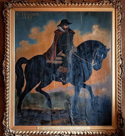
The painting of Thomas Hobson is in the Guildhall.
John Milton, the famous poet, who studied at Christ's College, wrote this sonnet about Hobson. Apparently, Hobson was not allowed to travel freely because of the plague, and then he died. Milton imagines that since he was forced to stay still, Death was able to finally catch up with him! Hobson died in 1631, and Milton was born in 1608, so he was quite young when he wrote the poem.
On the University Carrier
Who sickened in the time of his Vacancy, being forbid to go to London by reason of the Plague.
Here lies old Hobson. Death hath broke his girt,
And here, alas! hath laid him in the dirt;
Or else, the ways being foul, twenty to one
He's here stuck in a slough, and overthrown.
'T was such a shifter that, if truth were known,
Death was half glad when he had got him down;
For he had any time this ten years full
Dodged with him betwixt Cambridge and The Bull.
And surely Death could never have prevailed,
Had not his weekly course of carriage failed;
But lately, finding him so long at home,
And thinking now his journey's end was come,
And that he had ta'en up his latest Inn,
In the kind office of a Chamberlin
Showed him his room where he must lodge that night,
Pulled off his boots, and took away the light.
If any ask for him, it shall be said,
"Hobson has supped, and 's newly gone to bed."
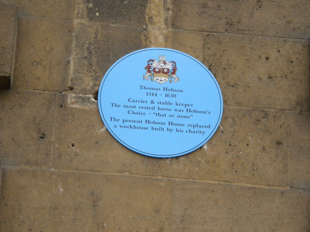
In Regent Street, there is Hobson House (about to be made into a hotel). A blue plaque on the wall says 'Thomas Hobson 1544-1630 Carrier and stable keeper. The most rested horse was Hobson's Choice - "that or none". The present Hobson House replaced a workhouse built by his charity.'
There are many different ways to use water courses.
Drinking: Presumably Cambridge became a settlement because the river provided drinking water. However, it was probably used as a sewer as well! So various other drinking water supplies were found. Trinity Conduit was made in 1325 to bring in water from a spring, near the Madingley Park and Ride carpark. There was public access to the water originally in Sidney Street, and there is still a tap in Trinity gatehouse (but it tells you not to drink the water!) There were other springs within Cambridge. This parish pump still survives. It is just within St Benets churchyard, to the left of the entrance.
Hobsons Conduit was built in 1610 to bring in water from Nne Wells, near the Gog Magogs. There was public access to the water in the Market place.
They didn't just drink water! Trinity brewhouse shows that Trinity brewed beer (healthier to drink than water, as the brewing process sterilises the water, to a certain extent). It is positioned next to the river, so is likely to have used it for its water supply.

Sewage and rubbish: I'm sure some ended up in the river! The Kings Ditch seems to have been used unofficially as a sewer. One reason for building Hobsons Conduit was to flush out the Kings Ditch, but I don't know if it ever worked.
Washing: For washing clothes and bedclothes, you need to do laundry. There is a green area below Silver Street bridge called Laundress Green. They could do their washing in the river (which is fairly clean, as it is upriver from Cambridge) and dry it by spreading it on the grass.
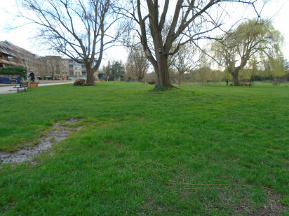
Boundaries: Water provides a natural border to land. Cambridge started on top of Castle Hill, but in Saxon times, moved to within the bend of the river. At some point, perhaps in Saxon times, the Kings Ditch was built to enclose the town, providing a simple fortification.
Many of the colleges have ditches round, using waterways such as Bin Brook. For example, here is the ditch at the back of St Johns college. These may have been used to drain to land, but they also form boundaries between one college and the next.
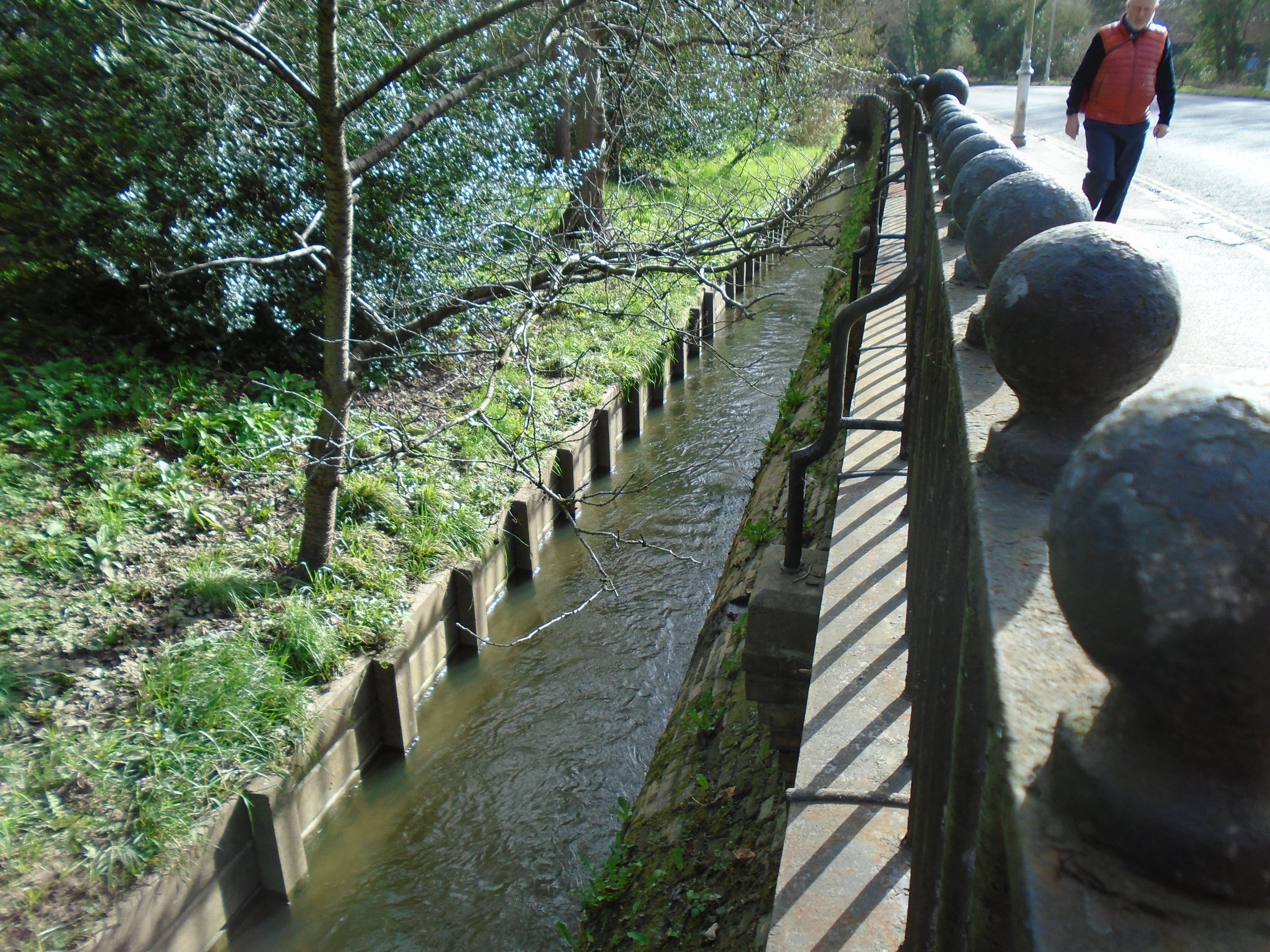
Drainage: This was always important in Cambridge, as it is low-lying and far from the sea, so liable to flooding. The ditches round the colleges (above) may have been used for this. There are also large green areas next to the river which are water meadows, which may flood without causing harm to housing. These include Sheeps Gree, Coe Fen, Laundress Green, Jesus Green, Midsummer Common and Stourbridge Common. Perhaps the Backs were originally water meadows as well. An area that was slightly higher than the rest, and so more likely to stay dry, became known as a "hill", such as Market Hill or Pease Hill, which bemuses people, as these are now flat.
Transport: Cambridge was an inland port in medieval times. That was one reason why the Saxons and the Danes settled here. Quayside still exists (although it's now used for punts).
But there used to be "hythes" or quays, along what is now the Backs, before the university colleges started occupying the land. The bed of the river is gravel. Apparently, the boats were drawn by horses, and the colleges used to charge the boats for access to the banks of the river. So they gravelled the river bed to allow horse to walk actually in the river itself!
Power: Mills were powered by the flow of the river. There were three mills below Silver Street bridge. Two were demolished when the railway came to Cambridge, and the new mill was built next to the station.

The other mill building is still there, but not working as such, of course. It's near Newnham. The mills were positioned here where they wouldn't interrupt the boat traffic using the "hythes".
Food: The water of the River Cam is not murky and is clean enough from its source to its confluence with the Great Ouse to support fish. The fishing rights on the west bank are leased annually to the Cambridge Fish Preservation and Angling Society. This is fishing for leisure, or as a sport, rather than for food. But presumably, since there is fish, it would have been caught and eaten in the past.
Up until the late 1980s, St John's College May Ball menus traditionally included 'cygnet St Jean' or 'roast swan'. Only a very few institutions in the country (other than the monarchy) were allowed by law to serve the dish. However, while swan was indeed being eaten at St John's quite regularly in the Victorian period, the so-called 'swans' of the late twentieth century were actually chicken or goose, with swan necks and wings of wax. I have no idea whether the Victorians actually used local swans!
The mills were grinding wheat to flour, to make bread, and the wheat arrived on boats, then the flour went out on boats, so here are more ways that the river helped with food.
Leisure and sport: There are still boats on the Cam, but these are punts and rowing eights. Punting began in the nineteenth century, originally to transport cargo along waterways, and for other river-related tasks, such as fishing. A punt's flat base makes it a very stable watercraft, and its lack of keel enables it to pass through shallow areas of water, making it an excellent vessel for these purposes. In the shallow waters of the Fens around Cambridge, punts were already integral workboats for regional trades such as eel fishing, reed-cutting, and fowling. 'Pleasure punting' - for passengers rather than cargo - was introduced to the River Thames during the latter half of the nineteenth century, and became a popular pursuit. Scudamore's Punting Company was founded in 1910, and is still working.
The oldest college boat club is Lady Margaret Boat Club (St Johns). It was founded in 1825. In 1829, a challenge is sent from Cambridge to Oxford: "The University of Cambridge hereby challenge the University of Oxford to row a match at or near London each in an eight-oar boat during the Easter vacation." The challenge was accepted and the first race was rowed at Henley on June 10th 1829.
Housing: There are now many house boats along the river, below Jesus Lock.
Cambridge castle was built by the Normans, and there are various ditches and banks round it, by the Romans, Normans, and even Oliver Cromwell! However, these are designed to control Cambridge rather than protect it. Cambridge never had a wall round it.
The Kings Ditch was dug as part of Cambridge fortifications. The river protected the town to the west and north, and the Kings Ditch, to the eat and south. It ran from the weir south of Silver Street bridge, and rejoined the river down river from Magdalene Bridge. It was referred to in King Henry III's plans to fortify Cambridge in 1267. However, archaeologists have found earlier pottery in the ditch, and they think it may date back to Saxon times.
Kings Ditch ran along Mill Lane. Note the slope! If there was water in the Kings Ditch, then it would have to run the same way as the river, from above Silver Street bridge to below Magdalene Bridge. But this would mean the water running uphill here. So I suspect that there was never flowing water in the ditch.
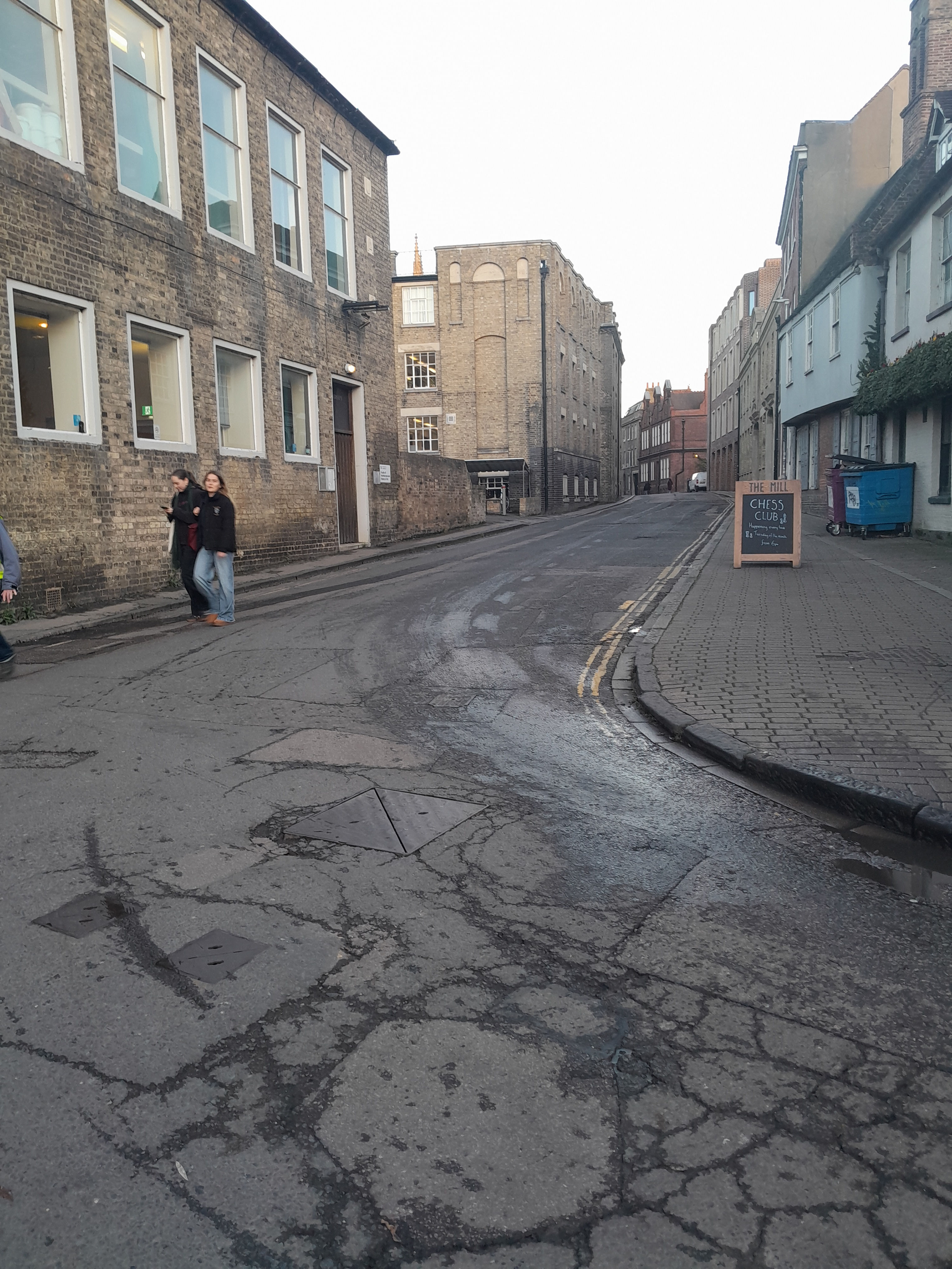

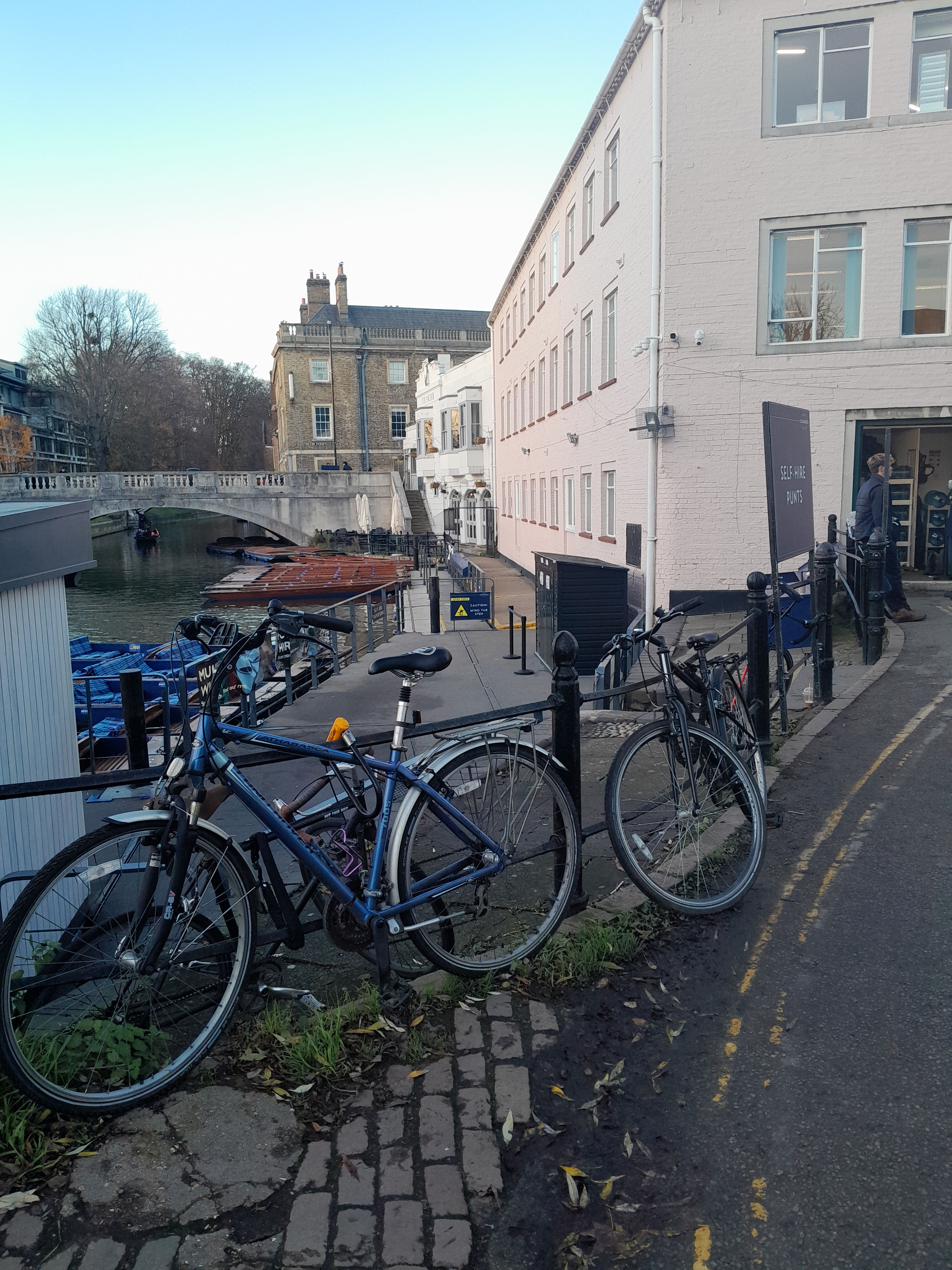
The Kings Ditch went up Mill Lane, and crossed. A gate was built here by Henry III, called Trumpington Gate. Hobsons conduit runs to near here. One reason for building Hobsons Conduit was to flush out the Kings Ditch, which tended to accumulate sewage and rubbish. But it doesn't seem to have been successful.
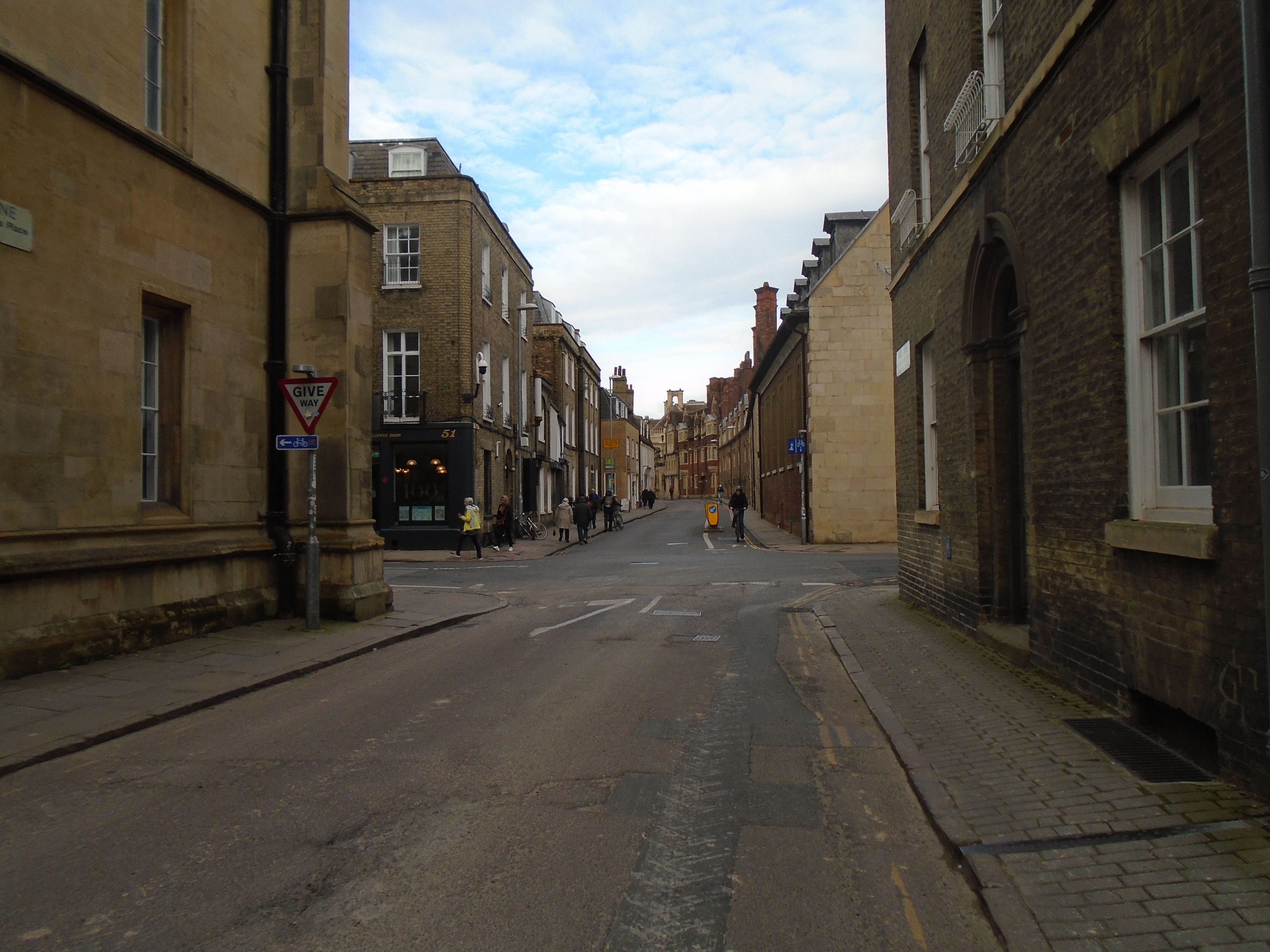
The Kings Ditch continues along Pembroke Street.

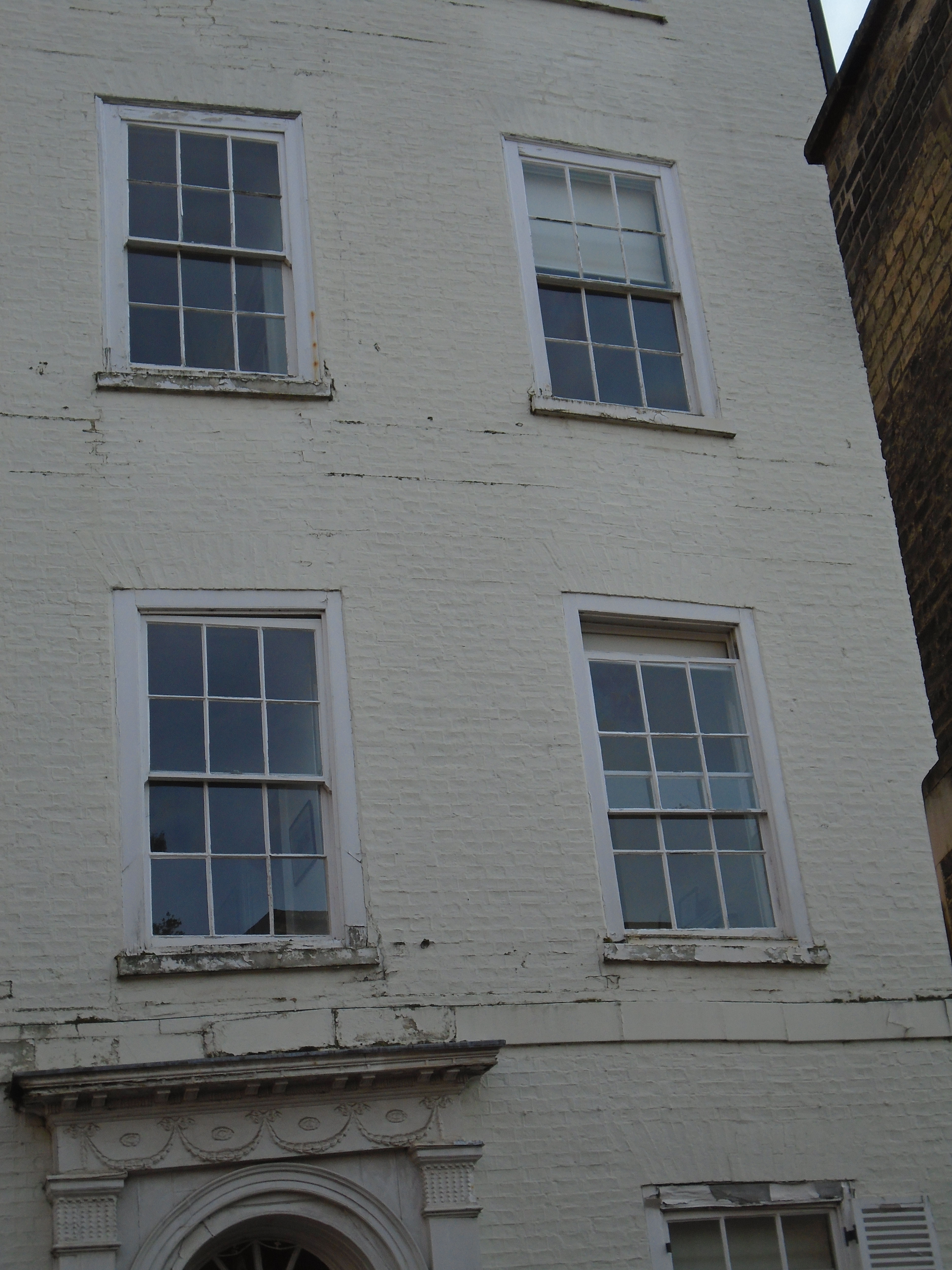
At the end of Free School Lane is a white building called Charles Adams House (formerly Botolph House), circa 1790, grade II. You can see that above the door, and some of the windows has sagged. The map shows that the King's Ditch went right under the house, and this has caused subsidence problems.


At this point, the Kings Ditch disappears under the new Museum site, and the Grand Arcade and Lion Yard. We can rejoin it at the passage way that runs behind St Andrews the Great church.

The Kings Ditch now crosses the Roman road, near Christs college. There was a gate here called Barnwell Gate. This was also part of Henry III's fortifications.

There is an awkward angle at the end of Hobson Street to St Andrews Street, and this is because of the Kings Ditch crossing the Roman road.

The Kings Ditch ran along the route of Hobson Street. Street names round here changed over the centuries. King Street used to be called Wall Lane (although Cambridge never had a wall). When Hobson Street became a street (as opposed to a ditch), it was called King Street, which is logical enough. But eventually King Street got its present name (and it never had any of Kings Ditch in it) and so did Hobsons Street (which never had the Hobsons conduit in it). Who needs logic?
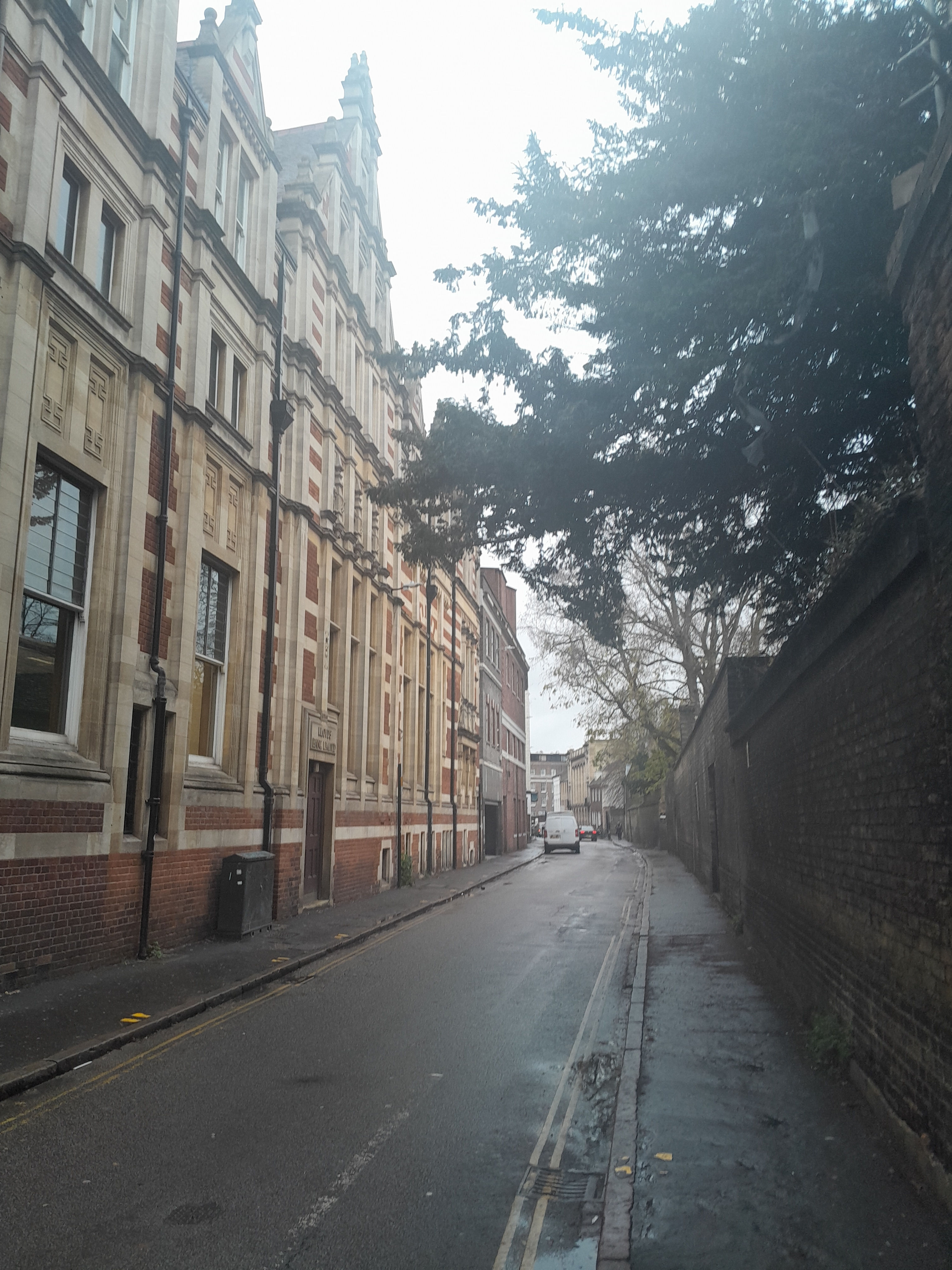
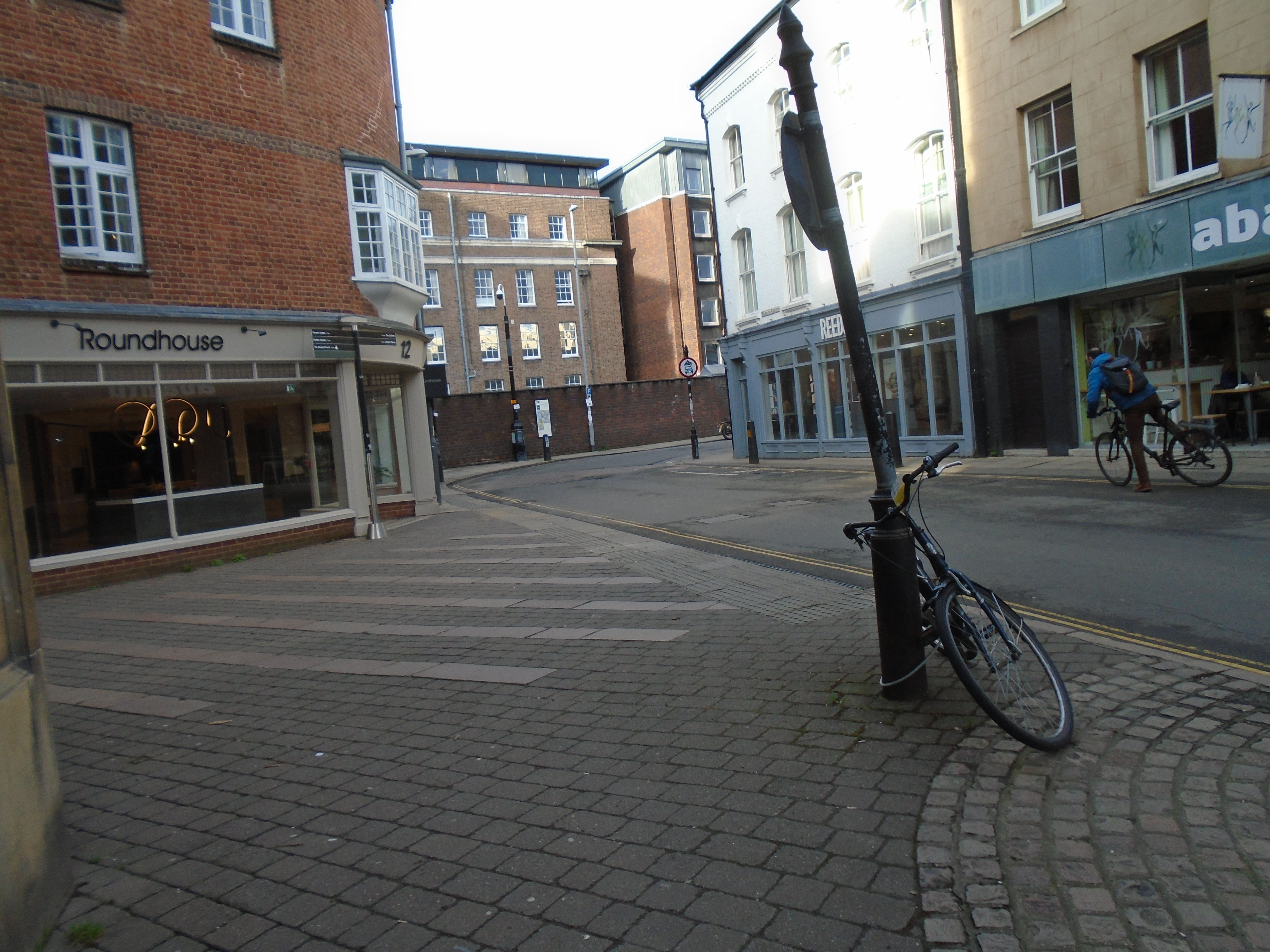
Notice the sharp left turn between King Street and Hobson Street. Kings Ditch ran straight through what is now Sidney Sussex colege. The only surface remains are near the squash court in the Fellows' garden, Sidney Sussex College.
We can pick up the route of the Kings Ditch again the other side of Sidney Sussex college, where Park Street meets Jesus Lane.
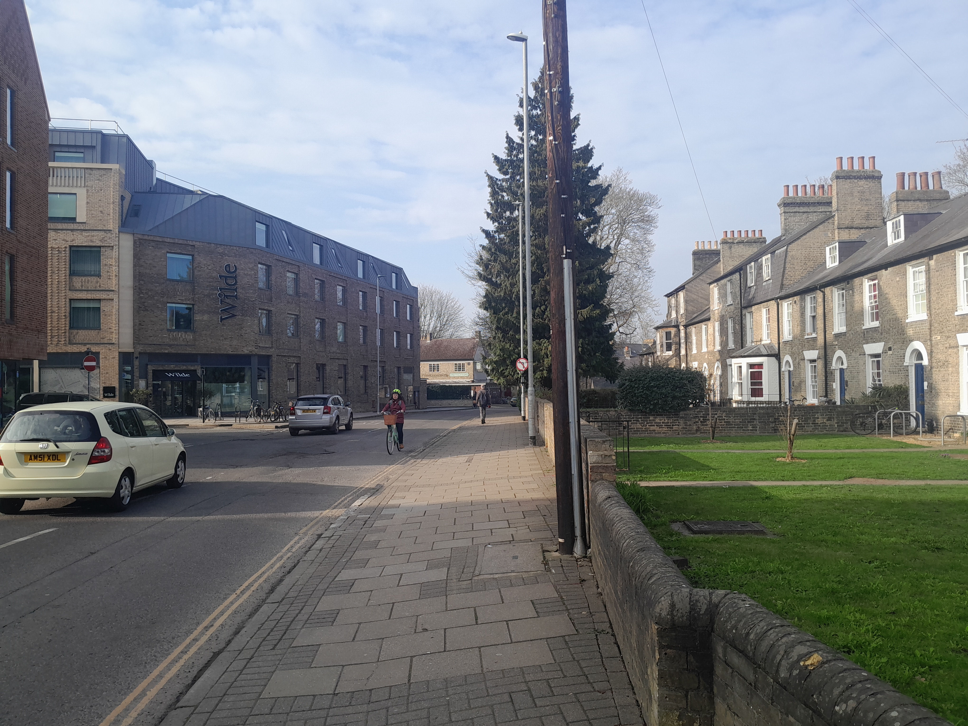
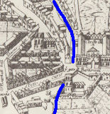
The route of Kins Ditch doesn't quite run along Park Street, but close to it. It came out down river from Magdalene Bridge, where the board walk now is. The map is from the Tudor map of Cambridge.

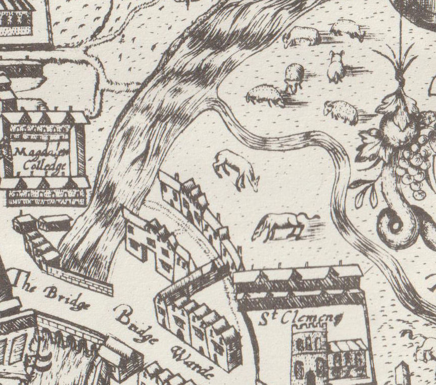
The Kings Ditch is marked on a Tudor map of Cambridge, dated 1574, and also on William Custance's map of 1798, although part of it might have been underground by that time. Click on the maps for large scale versions.

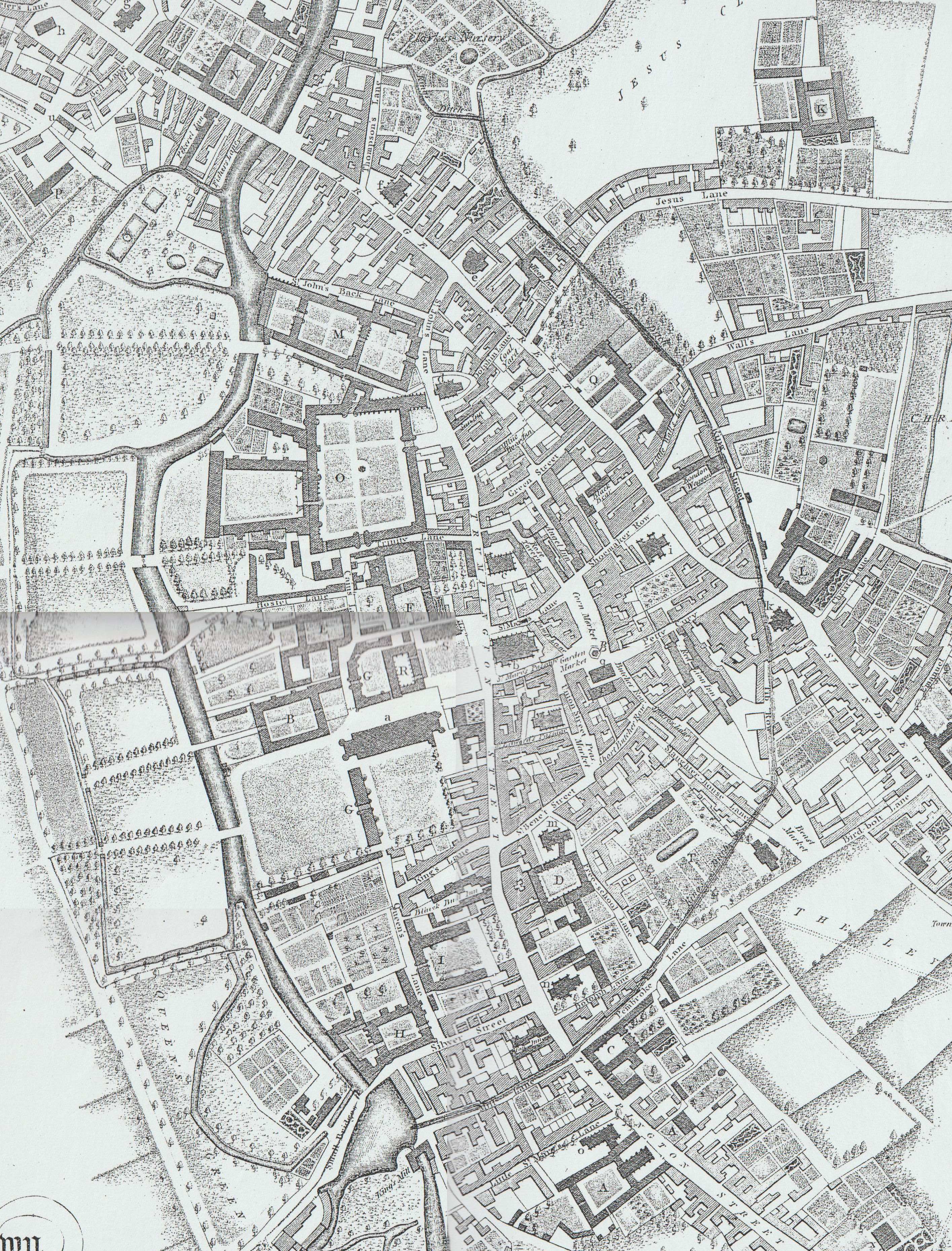
The Kings Ditch was not a water course. The Tudor map shows water in it, but Mill Lane is the start of the Kings Ditch, and that has quite a slope, uphill! There were various problems with this - see under Sewage.
In 1267 Henry III was at Cambridge actively fortifying the town during a period of war against the Barons.
Hist. Univ. Camb by T Fuller, ed. Prickett and Wright, pp. 40:
Only the south and east of the town lay open, which the King intended to fortify. In order whereunto he built two gates, Trumpington Gate by St Peter's Church, now ruined, on the south; Barnwell Gate by St Andrew's Church now decayed on the east. And because gates without walls are but compliments in matters of strength, he intended to wall the town about, if time permitted him. Meantime he drew a deep ditch (called King's Ditch at this day) round about the south and east parts of Cambridge. Presently news is brought to him, that Gilbert, earl of Clare, had seized on the chief city of the realm. No policy for the King to keep Cambridge and lose London the while. Thither marched he in all haste with his army, and may be said to carry the walls of Cambridge away with him, the design thereof sinking at his departure.
According to the 1959 Royal Commission on Historical Monuments Survey of Cambridge, the King's Ditch was the original boundary and defensive ditch to the S and E of the old town, possibly pre-Conquest and remodelled in the 13th century.
Little visible remains; in Richard Lyne's street map of 1574 the ditch is shown and can be traced along the line of the modern roads starting at the Cam with Mill Lane, running along Pembroke Street, across the site of the old Botanic Gardens, along St Tibb's Row and Hobson Street, across the fellow's garden of Sidney Sussex College and along Park Street to rejoin the river nearly opposite the Pepys Building of Magdalene College. (The Old Botanic gardens were replaced by the new Museum site. St Tibbs Row is now under shopping malls!)
In 1960 the City of Cambridge published a Report on the Main Drainage of the City. This included a review of historical drainage including the King's Ditch. It notes that it was constructed in 1215 on the orders of King John as a defence line; further development happened in 1267 under Henry III. However it mainly functioned as a public open sewer. During the 14th and 15th centuries there were numerous complaints and in 1445 annual cleaning of the ditch was proposed. In 1610 there was an attempt to flush the Ditch but this was not very successful and a further survey was carried out in 1629. Gradually the Ditch was culverted; one of the last lengths to be so covered was that adjacent to Park Street which was open until c.1800.
When the Grand Arcade was built, archaeologists used the opportunity to research the Kings Ditch. They found 11-12C pottery in it, which demonstrates ts age. These are now in the Museum of Archaeology and Anthropology, with this map showing part of the route of the Kings Ditch.


This might help to explain the location of the KIngs DItch.
The brown line is 10 metres above sea level, so the river and the Backs, plus Petty Cury and Sussex Street, are less than 10 metres, while Green Street, Free School Lane and Parkers Piece is above 10 meteres. (Below Jesus Lock, the water level is below 5 metres, but this isn't shown on the map).
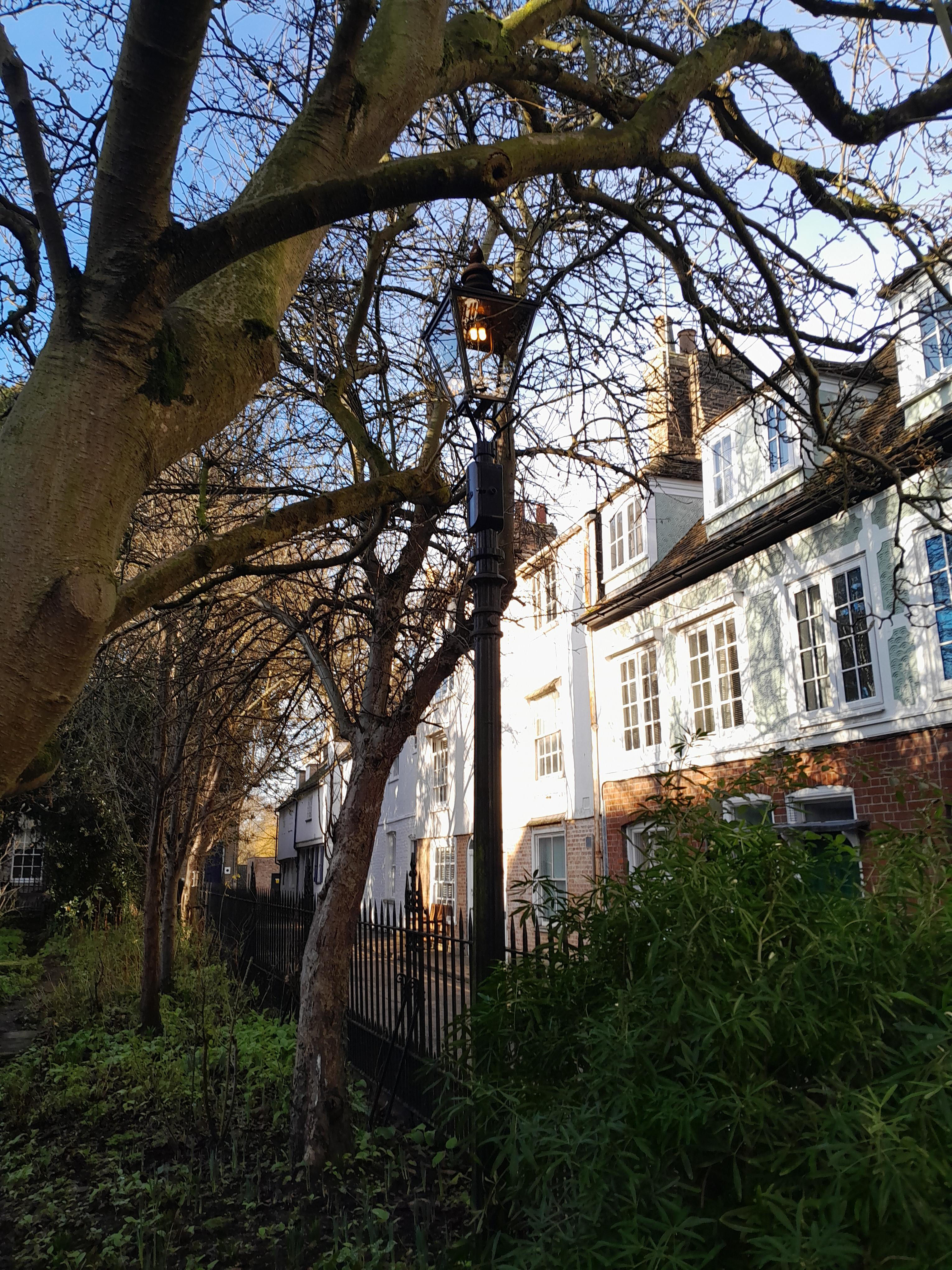
Lighting is a more recent utility.
There are various gas lights around Cambridge, but most of them has been converted to electricity. However, there are two working gas lights in Little St Marys Lane, one near Trumpington Street and one on the other side of the road, in Little St Mary's churchyard.

Here are some of the gas lights converted to electricity - outside Trinity college, and along Garret Hostel Lane.


To see what Richarson Candles replaced, the two lamps outside Trinity are mid C19, and would have orginally been gas lamps. They are listed grade II.


There are Richardson Candle lamps along Trumpinton Street, Kings Parade, Trinity Street, and elsewhere.They were made in in 1957. The history is given in the listing, where it says "Sensitive to the strong perpendicular lines of the Cambridge townscape, including the iconic King's College chapel, Richardson took the REVO Festival lamp as his inspiration to produce a simplified, more slender model with smoother lines and less embellishment. In a speech in Cambridge in 1957 he said, 'The lighting in a city should be regulated by the city itself, by the condition and formation of the streets, by the buildings and houses and certainly with regard for vistas and silhouettes.' REVO were commissioned to produce the Richardson Candle exclusively for Cambridge. Only 120 of these lamps were manufactured in total and it never appeared in REVO's catalogue."
On 8th November 2024, the BBC reported: "Three unique street lamps known as Richardson candle lamps have been stolen from Cambridge city centre in what experts have called a 'heritage crime'. The listed lamps appear to have been taken at various times between about 13 September and 1 October from Jesus Lane, St John's Street and Trumpington Street." (I'm not sure about this - there aren't any of these lamps in Jesus Lane!) Later "Of three lamps taken, one was found damaged in a churchyard, while the other two were recovered by police in Barkway, near Royston, Hertfordshire, in January 2025." And finally "After extensive repairs approved by the city council's conservation team, two of the lamps were recently returned to Trumpington Street. The third had been reinstalled in March 2025."
The lamps are either stand-alone, or fastened to the wall. The photo on the right shows the modern Cambridge street lights, also vertical like Richardson Candle, but they throw the light downwards rather than outwards, to reduce light pollution.
Enid Porter in 'Victorian Cambridge' using the diary of Josiah Chater writes at length about the protracted battle between two rival gas companies to supply the city of Cambridge. On 1st June 1868 Josiah made his first reference to the issue: "This evening our new Gas Company lighted up the town with paraffin lamps – the Old Company also lighted up, and we looked very brilliant."
In November 1867 the Cambridge Improvement Commissioners had advertised for new tenders for lighting the streets and for the private supply of gas because their contract with the Cambridge University and Town Gas Lighting Company was due to expire on 1st June 1868. The Gas Company's prices were considered too high, so new tenders were taken from the University and Town Gas company and a new company, the Cambridge Consumers' Gas Company.
A new contract was awarded to the Cambridge Consumers' Gas Company; the other company started legal proceedings. On 15th April 1868 the new company had its first AGM and two days later the foundation stone of the first gas holder at a site near Coldham's Common was laid. It was soon obvious that the deadline of 1st June to provide lighting would not be met and the company were granted an extension of a month which allowed them to use paraffin lamps instead. However, the extension was revoked and the contract declared void after only one day of the extension. In the meantime, representatives of the former company, The Cambridge University and Town Gas Lighting, had gone round and smashed about 100 of the new lamps!
The Consumers' Company still intended to lay gas pipes in the streets so the University and Town Co. applied for an injunction to stop this. In the end the University and Town Co. renewed their contract with the city.
The original Cambridge Gas company was based off East Road. There used to be a street called Old Gas Lane (from a map in 1898), but this was removed when the East Road flats were built, off Norfolk Street.
There is a little square and footpath to Tescos off Newmarket Road. In the square is a war memorial which just says "In remembrance of our fellow workers that fell in the Great War" and "in the Second World War" with the names. Tescos was built on the site of the old gas works, and this is the gas workers memorial.

Sewage disposal as a utility is a modern idea. In the past, they expected people to deal with their own waster, and tried to deal with those who didn't through statues and fines.
The Kings Ditch was not a water course. The Tudor map shows water in it, but Mill Lane is the start of the Kings Ditch, and that has quite a slope, uphill! The Kings Ditch was built as a fortification. However, we know it caused frequent problems as it was used (unofficially) as a sewer. A statute of 1388 ordered the King's Ditch should be cleared of "dung and filth of garbage and entrails, as well of beasts killed, as of other corruptions". In 1502, three heads of Colleges were fined by the Town Court for having "privvies" (toilets) overhanging the Ditch.
Later on, one of the aims of Hobsons Conduit was to flush out the KIngs Ditch, as it was, presumably, still stinking. This doesn't seem to have been successful, so the ditch was gradually filled in and built over.
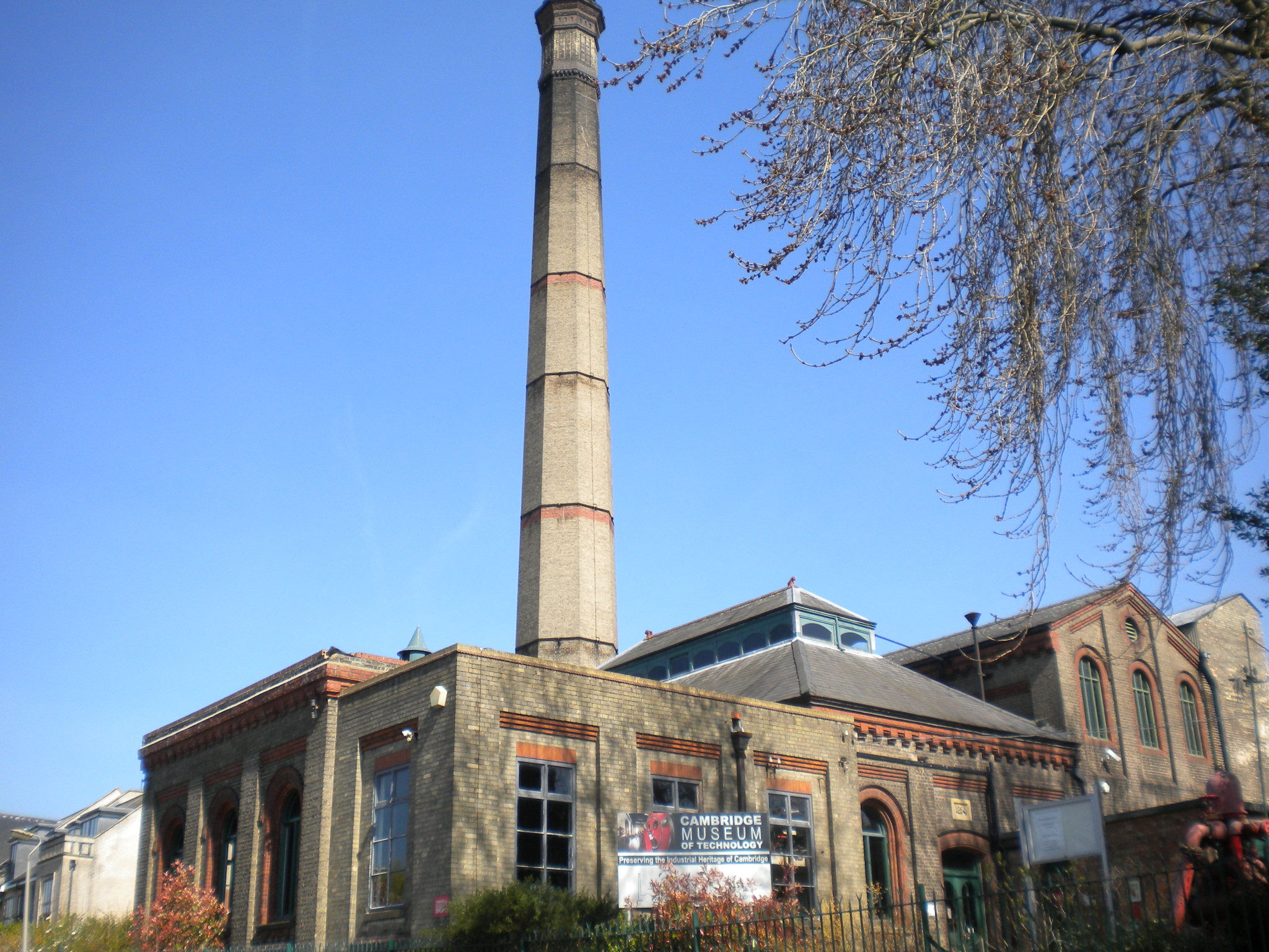
The Pumping Station is on Riverside. It is now the Museum of Technology.
The Cheddars Lane Pumping Station was originally opened in 1894 in a scheme which also saw the creation of a sewage farm at Milton, two and a quarter miles away. Household rubbish was burnt to raise steam, to power the engines which pumped sewage to the Milton sewage farm. At the farm, it was used as a fertiliser to grow the crops which fed the horses that pulled the carts which collected the rubbish and brought it to the pumping station. Even the ash from the burnt rubbish could be used in road making. The purpose of two Hathorn Davey steam engines was to lift foul water (sewage and rain water) from the sump immediately below it to the sewage farm at Milton, the total lift being about 43 ft. These engines were designed to pump 250,000 gallons of sewage per hour, a job which they undertook until 1968, when a new electric engine house was built adjacent to the station, although this site shut down in 1994. One of these is still fully operational and often runs on steam weekends in the museum.
© Jo Edkins 2026 - Return to Walks index