| U3AC walks | U3AC walk - Barnwell Priory and Chesterton |
Route: South of Grafton centre, East Road, Elizabeth Way roundabout, Newmarket Road, Abbey Road, Priory Road, Riverside, Equiano bridge, St Andrews Street, St Andrews churchyard, Chesterton Rec, Elizabeth Way, Chesterton Road, High Street, Chapel Street, St Andrews Road, Cutter Ferry Path, Midsummer Common, Kingsley Walk, Newmarket Road, Napier Street, north of Grafton centre
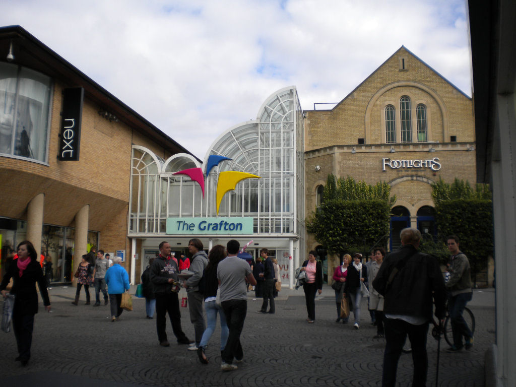
Length: 2.9 miles Start and finish: Grafton centre (corner of Burleigh St and Fitzroy St)
Introduction: Before the Dissolution of the monasteries, Barnwell Priory was an important place in Cambridge. We explore a couple of buildings remaining. Then we cross the river to Chesterton, to see some connections to Olaudah Equiano, an important figure in the campaign against slavery, plus other Chesterton buildings.

Click on photos for a larger version.
We start at the entrance to the Grafton centre.


This sculpture is called "Moonstone, Arrows and Obelisk" by Peter Logan, dating from 1990's. The arrows are a mobile, so the top constantly changes.

Between the Grafton Centre and the Elizabeth Way roundabout, there is a road off to the left, leading to the multi-story carpark. Ignore this road (but not the traffic on it, it can be busy!) and go along a narrow road between that and East Road. After a bit, you will see this artwork on the side of a building, on the left. The title, River Severn, is explained by the name of the road - Severn Place. It is by Issam Kourbaj in collaboration with Richard Bray, and is dated 2011. It is described as coloured glass on brick wall.

Go down the slope or stairs to the roundabout underpass. The tunnels have murals which are relevant to the exits. The tunnel leading to the city centre has a history of Cambridge. It starts with the Romans, then the Danes. The middle section has medieval and Stuarts (who seem fascinated by their computers!) The horse may be Godolphin, one of the foundation sires of the English Thoroughbred, buried at Wandlebury. We also see Cambridge's strong interest in science, leading to the present day with children hard at work on their experiments. A strand of DNA winds along the bottom, mirroring the Roman mosaic pattern at the start.

Cross the open space in the middle, then go through the Stourbridge Fair tunnel. Stourbridge Fair was a large medieval fair, originally held to fund the Leper Chapel (which still exists!) Click here for more on Stourbridge Fair. The income from another medieval fair, Midsummer Fair, went to Barnwell Priory. That fair still happens. Both fairs had charters from King John, and both fairs were taken over by the city council.
We now start to look for the remains of Barnwell Priory. Click here for more information

Go along the (unpleasantly busy) Newmarket Road. This is the first building connected with the Priory, Abbey Church (formerly known as St Andrews the Less). It is early 13th century, built by Barnwell Priory. The church was restored in the 19th century. It stands in part of the Priory grounds. It is listed grade II.

Return back along Newmarket Road, and turn right.

The priory fell into disuse at the Dissolution of the Monasteries, but good building stone can always find another home! I suspect that the wall of Abbey House has stones from the priory. The wall is listed grade II.

Abbey House was built in the 1670's. Click here for more on Abbey House. It is listed grade II.

Looking at the front of the house, you might be able to see a ruined small archway in the garden. That is part of the Priory.
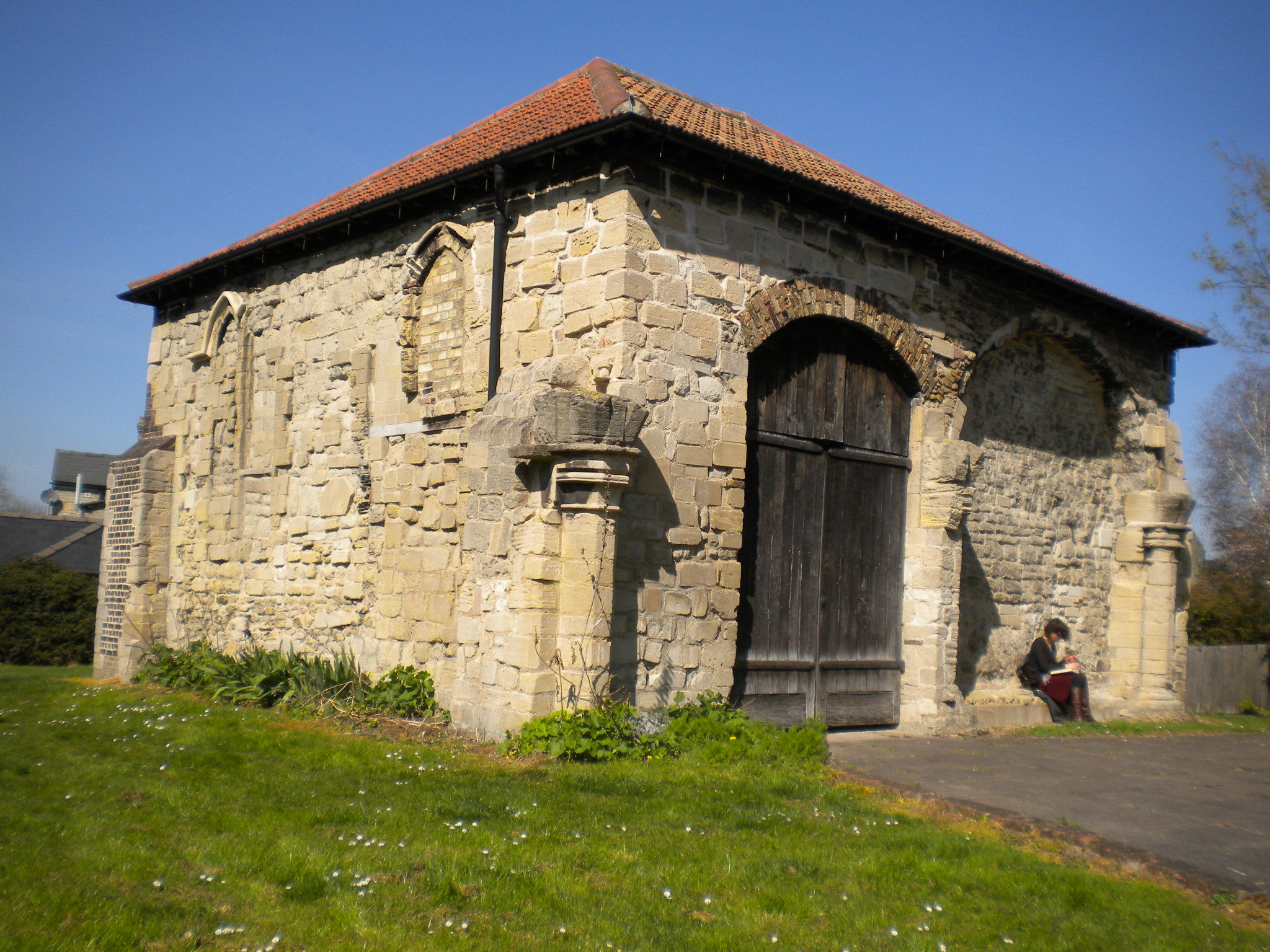
Round the corner is the other priory building which still stands, the Cellarer's Checker, which is listed grade II*. This was the office where the cellarer checked his stores and accounts. Now it is owned by the council. There is a board outside with information. Barnwell Priory was built in 1209.

Across the road, in the grounds of Abbey House, there is also part of a wall that came from the priory. This is listed grade II. That is all that is left of Barnwell Priory.
Walk round Priory Road to the river.


At the bottom, you will see a spiky letter box. There are various explanations for the spikes. Proabably the most authoritative is to stop people using it to climb into the local gasworks (now replaced by Tescos). Other suggestions are to stop a craze of leapfrogging postboxes, or (my favourite) to deter German parachutists in WWII!
There is another point of interest about this box. Most post boxes have a monarch's cypher on, such as EIIR. This doesn't. Boxes manufactured by Handyside & Co between 1879 and 1887 omitted the 'VR' cypher from the front and are known as 'anonymous' boxes.
Next to it is one of the famous Cambridge Dinky Doors. These are anonymous artworks, made to cheer us up! I think they started around 2018. Click here for where the other Dinky Doors are, and photos of them. This one is an "emailerator".
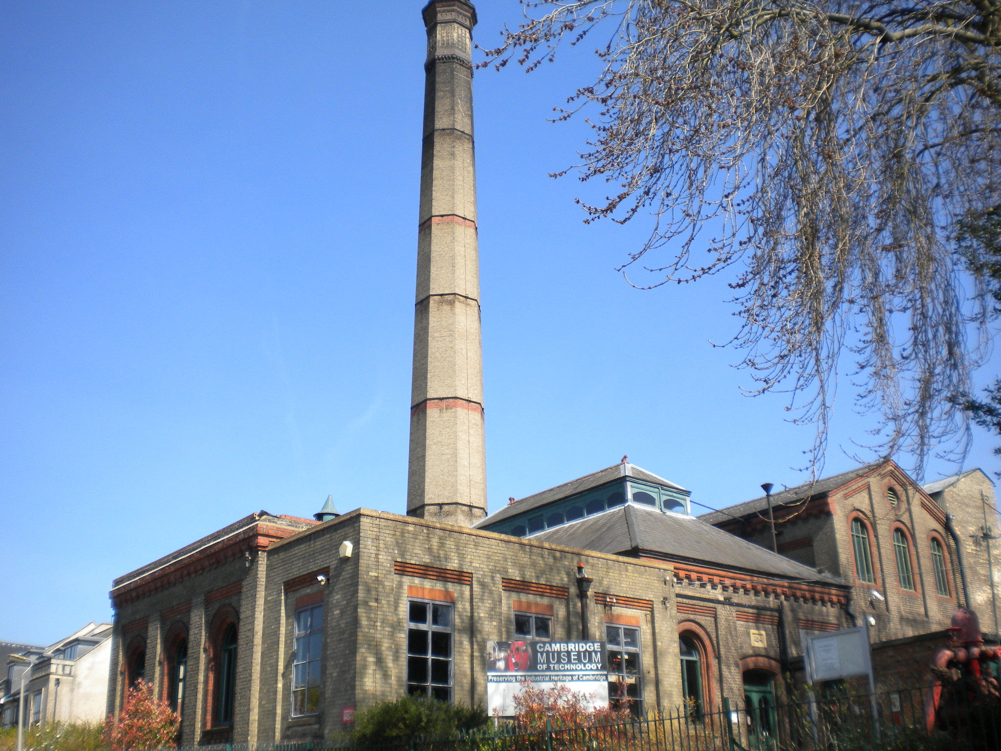
On Riverside, we see the Museum of Technology, which used to be the sewage pumping station for Cambridge. It has steam engines, a print room, and various industrial equipment from local firms. Click here for the museum website.
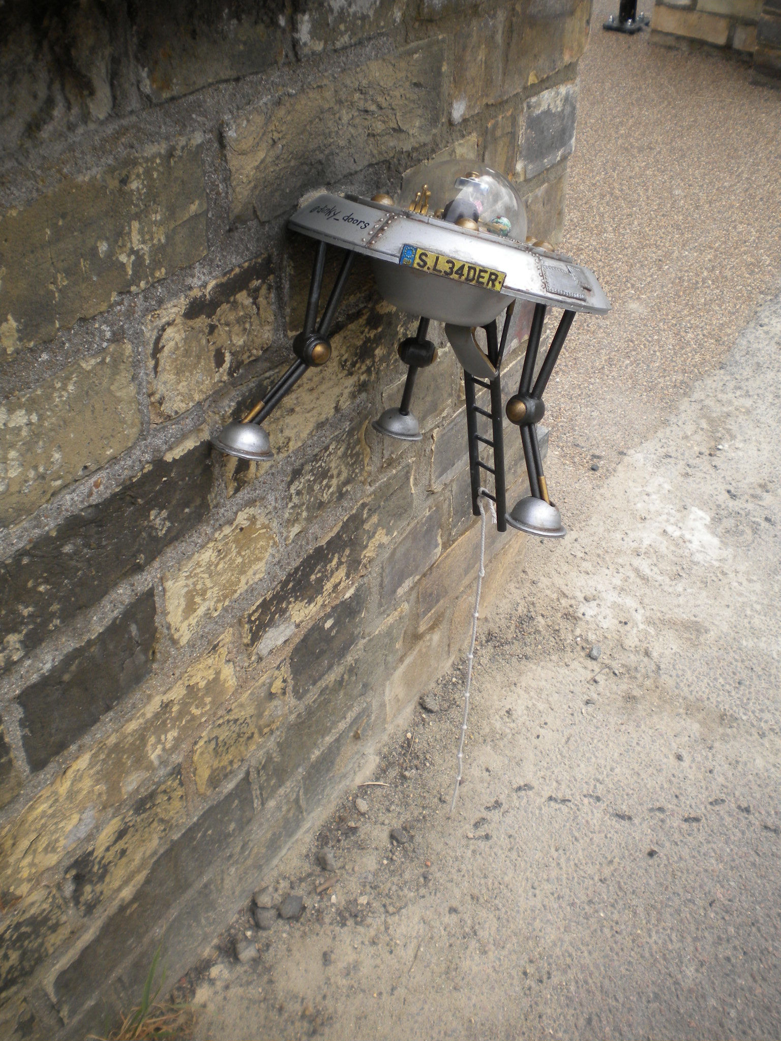
On the wall outside, another Dinky Door. A spaceship seems to have crashed into the wall.

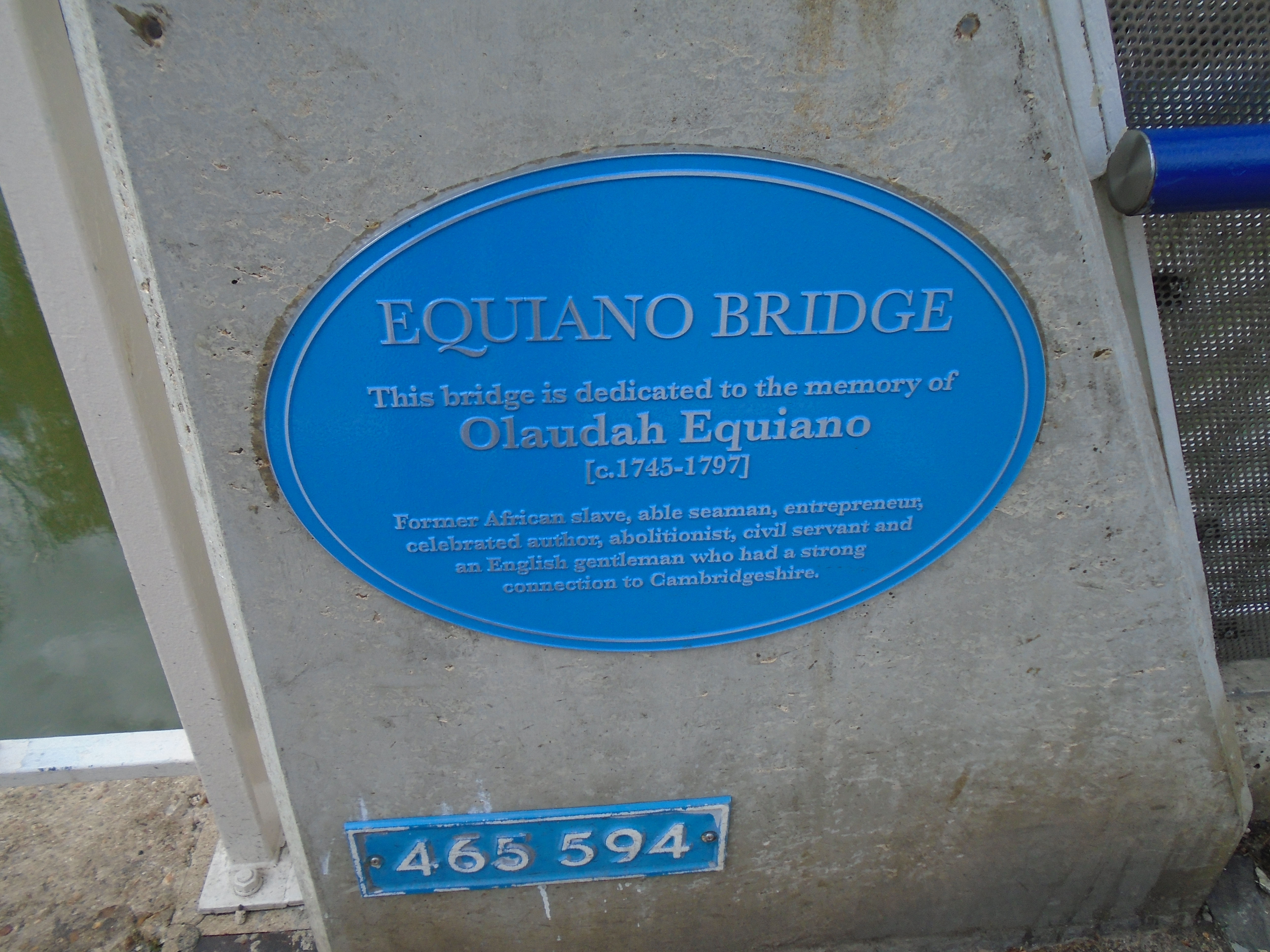
We now cross over the foot and cycle bridge (making sure we keep to the pedestrian part!) This bridge has recently been named Equiano bridge, after Olaudah Equiano. This introduces the second theme to our walk.
Olaudah Equiano or Gustavus Vassa was living in what is now Nigeria when he was captured from his village at the age of 11 and sold into slavery. He was taken to Virginia as a slave. He was eventually sold to a ship's captain and travelled widely. After 16 years as a slave he managed to save enough money to buy his freedom. He came to England and wrote a book about his experiences, called The Interesting Narrative of the Life of Olaudah Equiano or Gustavus Vassa the African, written by himself. It was published in 1789 and became a best-seller. It turned many people against slavery.
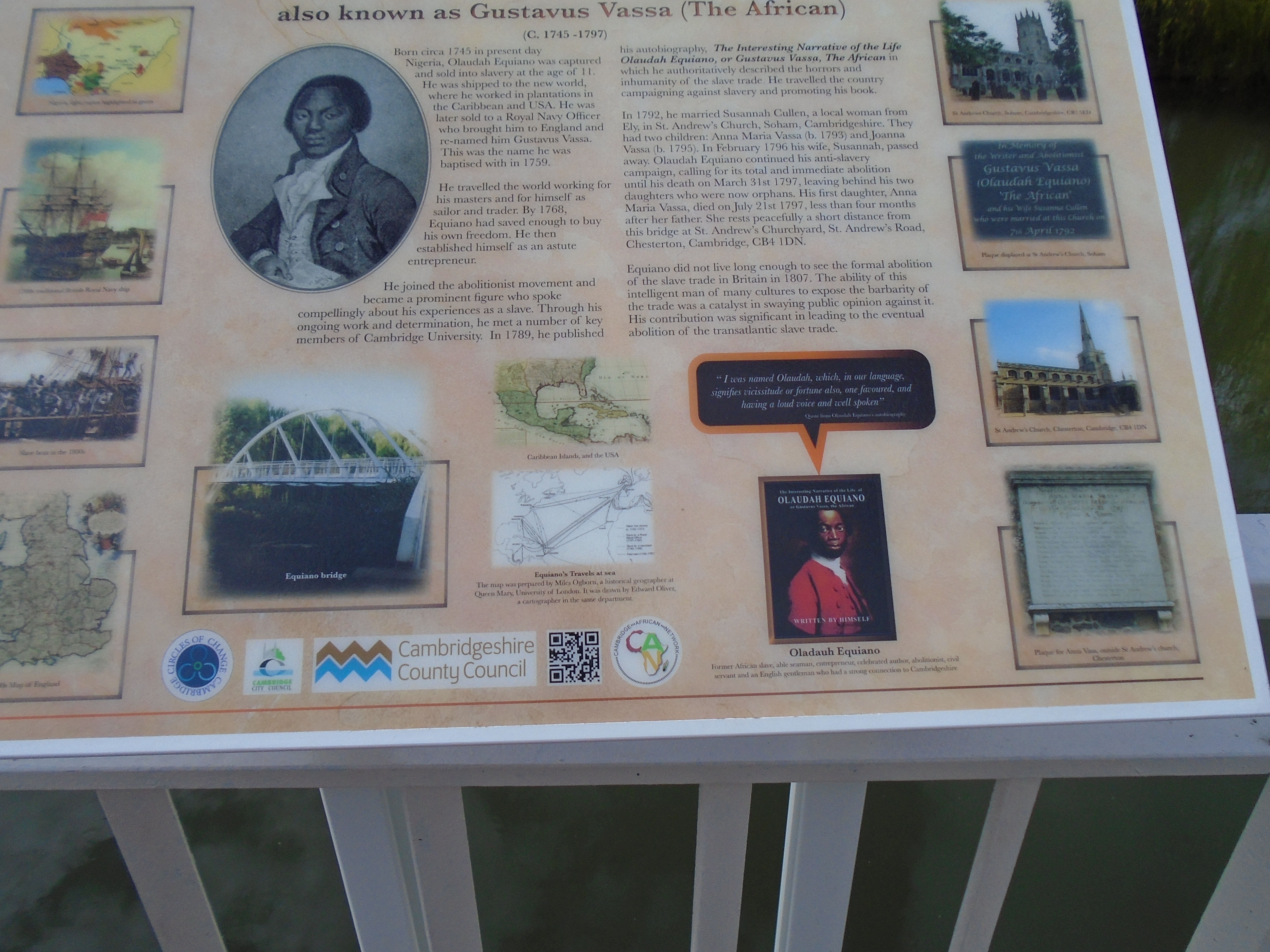
This information board is by the plaque. Click on the photo for a larger, readable, version.
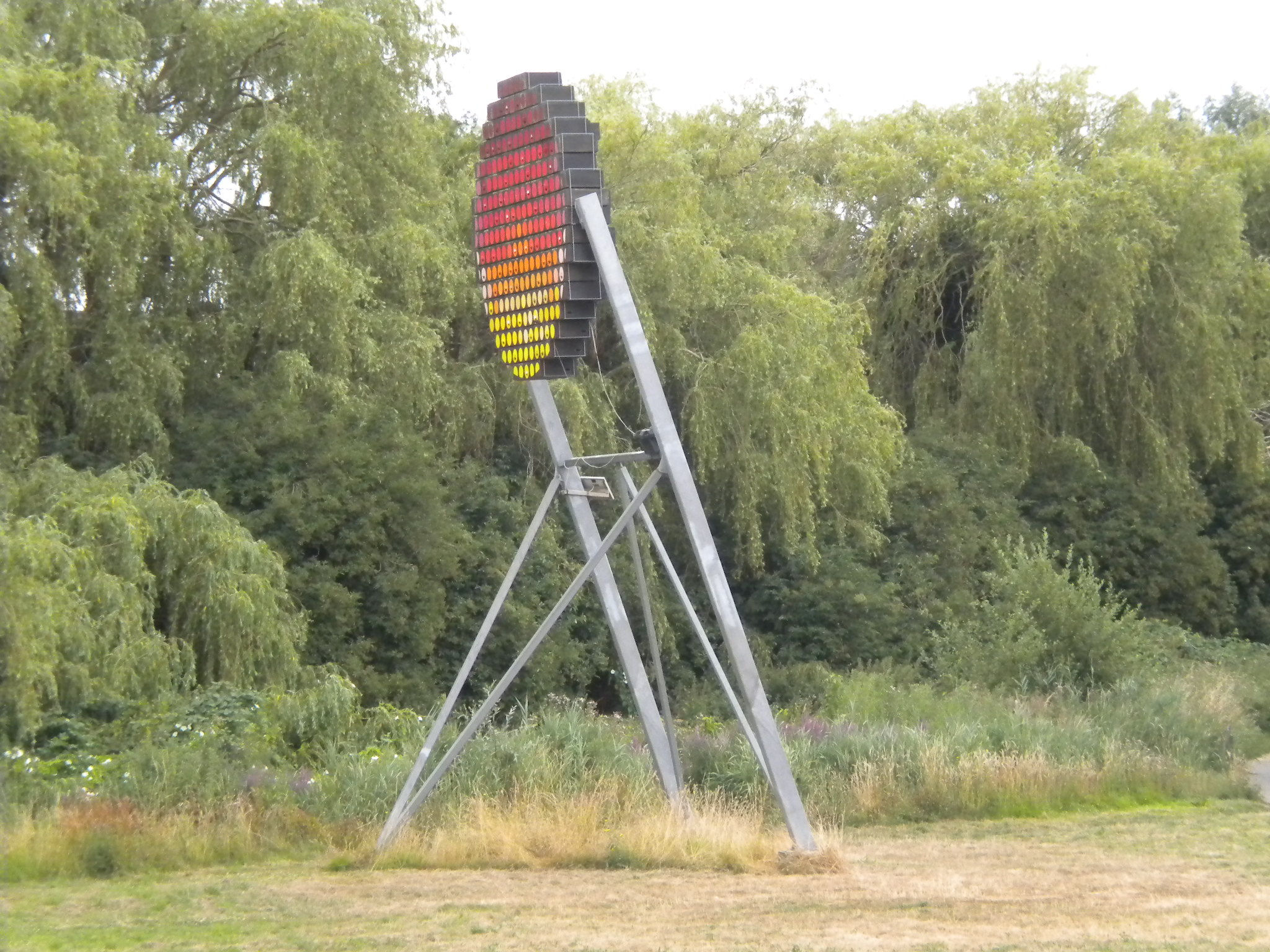
The green area is a nature reserve called Logan's Meadow. On it is this, which is both an artwork and a home for swifts! "Swift Code is its title, and "swift tower" is its function. It is by Andrew Merritt, who describes it here. I think it was installed in 2011.

This is the old Manor House, listed grade II. It was built around 1700 but enlarged and altered at several later times.

This is St Andrews, Chesterton (as there are several St Andrews churches in Cambridge!) It is listed grade I. There are some interesting memorials in the churchyard.

Outside the church, to the left of the entrance, there is a plaque to the daughter of Olaudah Equiano or Gustavus Vassa (see above). The plaque says:
Near this Place lies Interred ANNA MARIA VASSA Daughter of GUSTAVUS VASSA, the African. She died July 21 1797 Aged 4 Years.
|
Should simple village rhymes attract thine eye, Stranger, as thoughtfully thou passest by, Know that there lies beside this humble stone A child of colour haply not thine own. Her father born of Afric's sun-burnt race, Torn from his native field, ah foul disgrace: Through various toils, at length to Britain came Espoused, so Heaven ordain'd, an English dame, And follow'd Christ; their hope two infants dear. But one, a hapless orphan, slumbers here. To bury her the village children came. And dropp'd choice flowers, and lisp'd her early fame; And some that lov'd her most, as if unblest, Bedew'd with tears the white wreath on their breast; But she is gone and dwells in that abode, Where some of every clime shall joy in God. |


In the churchyard, by the church entrance, there is a gravestone with a skeleton on it, holding an hour glass, and, I think, an arrow. This is a memento mori (reminder of death).
The church website says "In the churchyard, north of the church, are a number of 13th century stone coffin lids. It seems that the coffins were dug up during the Reformation. The 18th century antiquary William Cole visited Chesterton and found several of these coffin lids used as capstones in the churchyard wall. He commented: ‘It is shocking to think how far these depredations [the stripping of parish churches] were carried, for not content with what they could find above ground, they dug open vaults and graves in search for imaginary treasure, tossed the bones out of stone coffins and made use of them for hog troughs, while the tops went to the covering of some old wall, of which many a one about this city doth yet bear testimony’. Perhaps chastened by this, the lids were later moved and laid in the churchyard.


Inside the church, there are Doom paintings on the wall - pictures of the Last Judgement, dating from before the Reformation. From the church website: "On the left of the arch there is a picture of the new Jerusalem, with its towers and walls, and the souls of the righteous are rising to everlasting heaven. A faded St Peter welcomes the just into the celestial city on our left.On the right of the arch a number of devils are pulling people from their graves (including kings, popes and monks) and dragging them off to punishment. A red flat-footed devil tugs one unfortunate soul towards his destiny, whilst below a yellow devil is transporting his victim piggy-back. There is even a picture of a devil wearing reading glasses and ticking off names on his list. During the 16th century Reformation this whole scene was painted over and the old Catholic image-based faith was superseded by an emphasis on the word. Beneath the figure of Mary (kneeling to the left of the rood) is a fragment of the Protestant decoration, probably the ten commandments. The Tudor rose on the bottom left and the Stuart thistle on the right were part of a later scheme that also included the royal coat of arms of James II (1685-88).
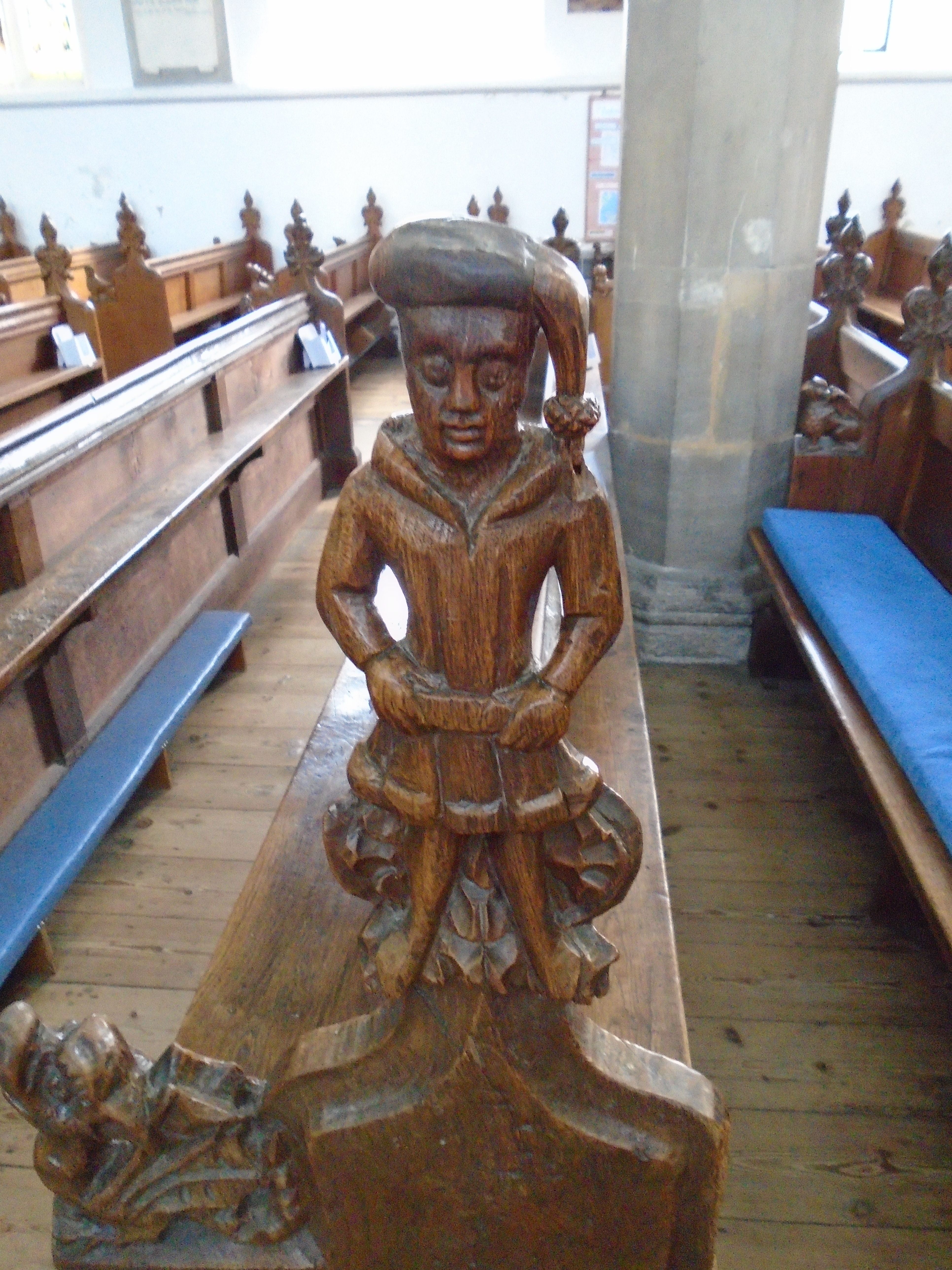
The church website says "The medieval pew ends can be dated to within 1430-40, because of the style of their clothing. About 22 are wholly or partly from this period; the others are Victorian copies. The carved figures are many and various. As well as the three standing figures— one tonsured (a monk), there are wyverns, stags, Talbots, griffins, lions, goats, birds and even a greyhound.
Go through the churchyard into Chesterton Rec. Go diagonally across Chesterton Rec, to East Road. Turn right towards the roundabout.

Chesterton Hall (listed Grade II) is early / mid C17. The roundabout is an unlovely location, but this is a lovely building. It was built by the Hobson family, and Thomas Hobson (of Hobsons Conduit) lived here. Click here for more information about Thomas Hobson.
Turn right along Chesterton Road, believe it or not! Elizabeth Way cut across roads round here.
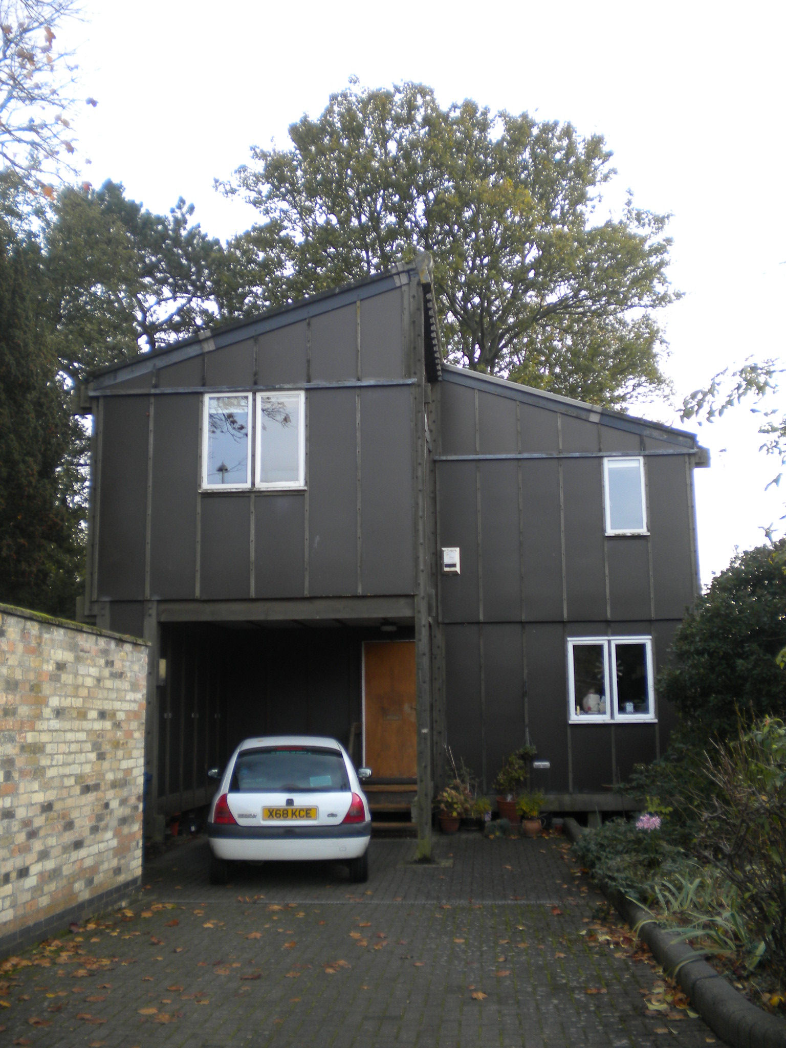
214 Chesterton Road (II), designed in 1971
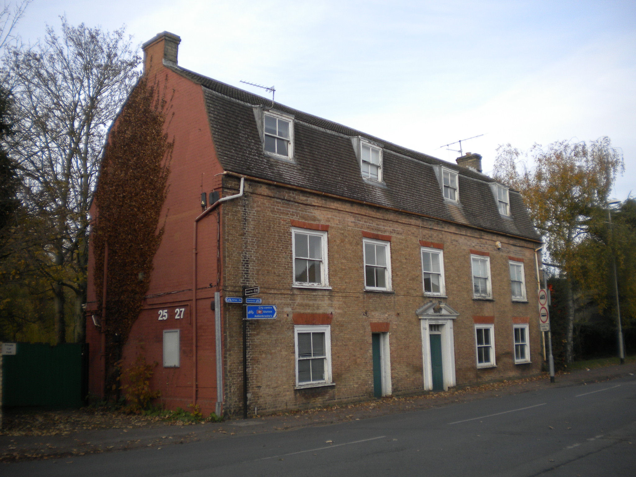
25 and 27, High Street (II), C18
Carry on along High Street. Chapel Street is second right.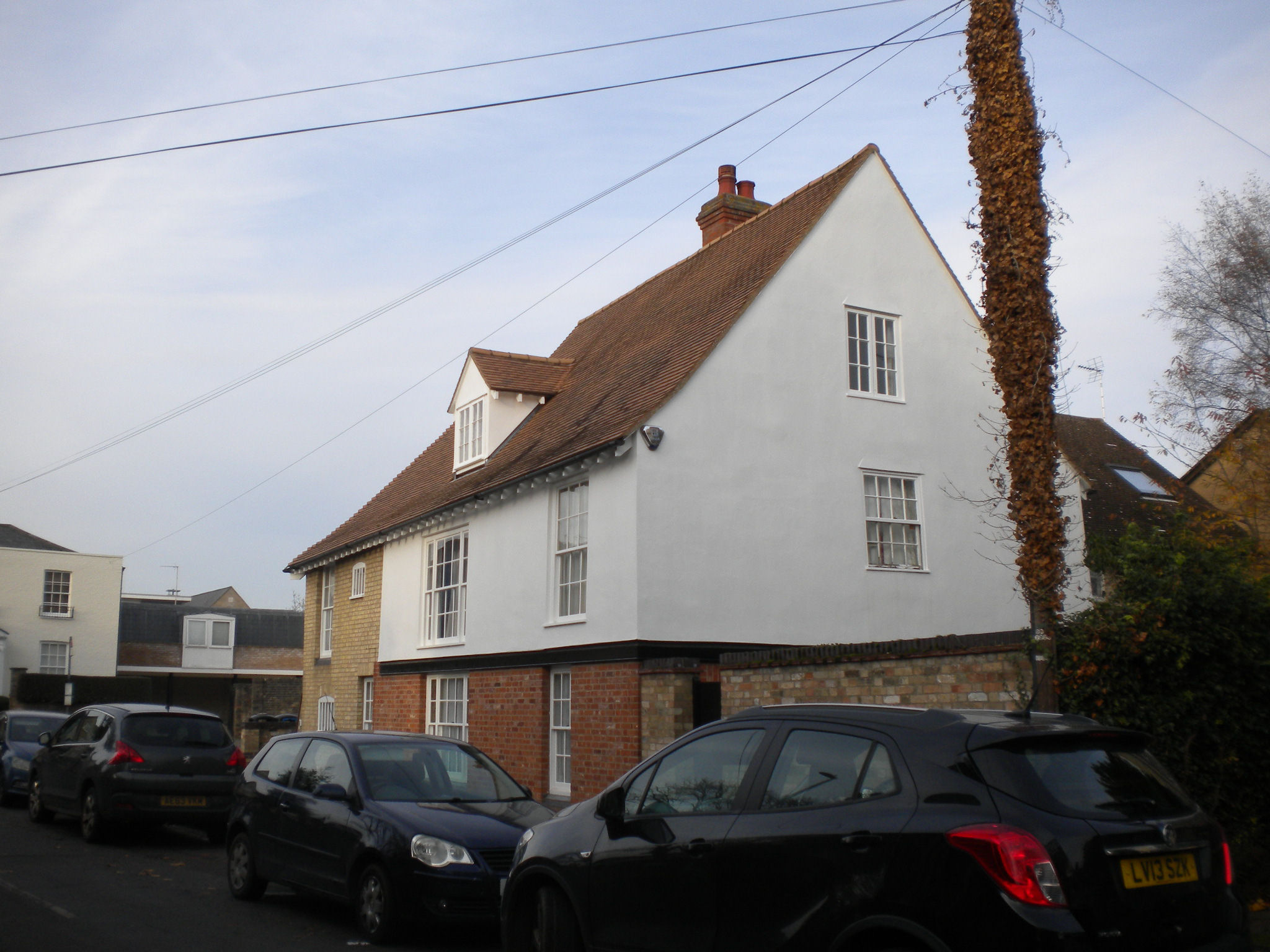
1, Chapel Street (II), C18

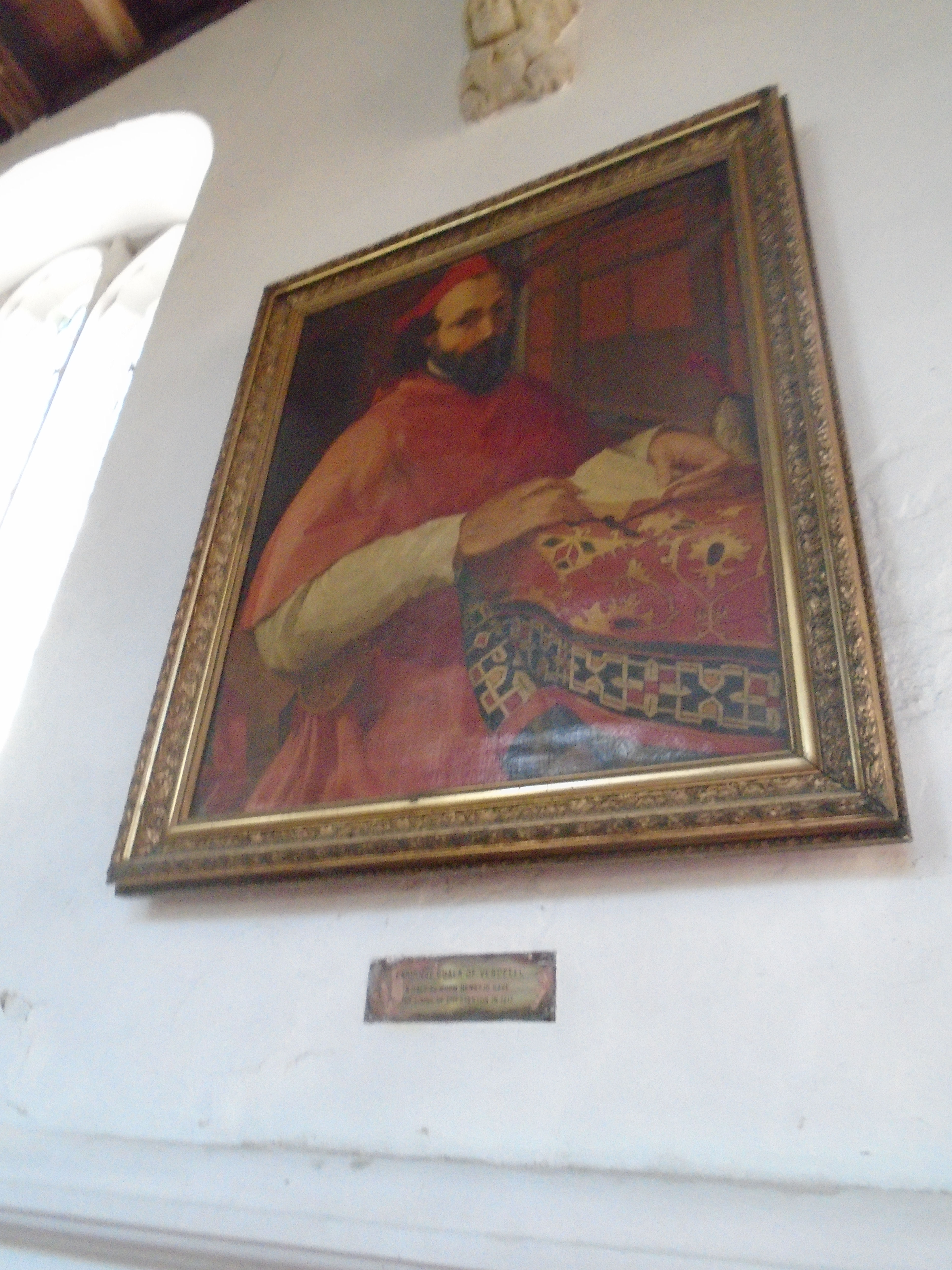
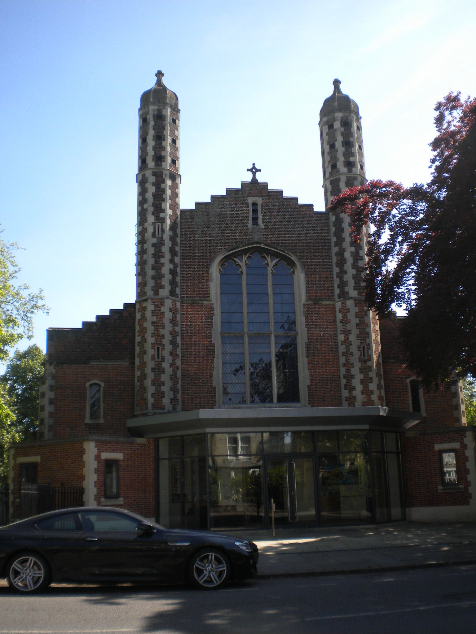
This is Chesterton Tower. It is Grade I listed. St Andrews church website says "Towards the end of the reign of King John, England was on the verge of civil war. The Pope sent a legate to intervene - Cardinal Guala Bicchieri of Vercelli in northern Italy. He successfully made the peace, saw the reintroduction of the Magna Carta and, on John's death, was mentor to Henry III, who came to the throne in 1216 at the age of 9. As a reward for his services the king granted him the rectory of Chesterton - that is, the responsibility for the parish church but also the right to collect the tithes and ownership of considerable rectorial land. The wealth involved was considerable and Guala used it to found a new religious house, St Andrew's Abbey, in his home city of Vercelli. They appointed English vicars to run the church but sent one of their own members to gather the tithes and administer the estate. They built Chesterton Tower in the mid-14th century as their Chesterton residence. The rectory passed to King's Hall and to its successor, Trinity College, who are still the rectors and patrons of the parish today... In the 20th century, Trinity took back possession of the orchard and the Chesterton Towers flats were built in about 1965. The tower was let out, initially as a workshop for the letter-cutter and craftsman, David Kindersley."
There is a portrait of Cardinal Guala Bicchieri (modern copy) hanging on the south wall of St Andrews Church Chesterton.
Walk along to the end, where you see Elizabeth Way. Turn off to the left, and walk under the road.
This is Cutter Ferry Path which originally led to a ferry. St Andrews Church website says 'On 25 May 1668 Samuel Pepys visited Chesterton and wrote in his diary: "walked to Chesterton to see our old walk; and there into the Church, the bells ringing, and saw the place I used to sit in; and so to the ferry, and ferried over to the other side and walked with great pleasure, the river being mighty high by Barnwell Abbey; and so by Jesus College to the town."'
This path now leads to Cutter Ferry bridge (sometimes called Pye bridge). Cross over it to get to Midsummer Common. Turn towards Elizabeth Way bridge, but head for a gate in the wall up the hill. This leads to a modern housing developement with some fun art.


This is the aptly named Playful Seating, by James Hopkins, dated 2014. The two chairs are distorted, but their reflections in the central mirror look OK. The second photo shows the back, and how the artwork in set in a set of concentric circles. The artwork is described here, where it says "Solid cast bronze benches designed through catoptric anamorphosis are placed around a mirror finished stainless steel cylinder. The mirror transforms the distorted benches into the perfect image of two domestic / school chairs. The surrounding amphitheatre completes the artwork as a playful space for residents and visitors that references the sites history as a school since the 19th century."


Head towards Newmarket Road. Look along a path to your left, and you will see a bronze chair. Turn down this path to look at it, but also notice the blocks set into the pavement. These are "carp fish from the monks ponds of the 11th century Barnwell Priory nearby, swimming in the paving, frozen in time as bronze sculptures set in clear resin and glass" (description taken from here). Regretably the "clear" resin isn't, any more. But we have returned to Barnwell Priory! Apparently you're allowed to sit on the chair.

You will now start to see symbols on the pavement. These are part of the Barnwell Sentence. You may recognise some of the shapes as similar to the chair we've just seen.


At the start of Kingsley Walk we have the start of the Barnwell Sentence. The Barnwell Sentence is by Lucy Skaer, dated 2014. It is made of Atlantic lava and Belgium fossil stone, glass bronze and brass. It is described here. This says "the history and heritage of this site: prehistoric archaeology (here a life-sized whale skeleton similar to that lovingly serving the entrance to Cambridge's Museum of Zoology), Strawberry Fair on neighbouring Midsummer Common, and a blazer and the crest of Brunswick Junior School" and "imprints made from a domestic chair". Brunswick Junior School used to be on this site.
Cross Newmarket Road and turn right.

The Buddhist centre was originally the Theatre Royal, built in 1816. It was built here because of prohibition in the University town. The interior is a virtually complete example of a Georgian theatre with a three-tiered horsehoe auditorium with the galleries
supported on cast iron columns. It is listed grade II*.
Turn left into Napier Street.
Christ Church is listed grade II. It was built in 1839.

Turn right at the end of Napier Street to walk along the north side of the Grafton centre. Set into the wall you can see this sign. It says "This wall and the ground on which it stands belong wholly to the Cambridge Refuge, July 1841. This stone was replaced March 10 1881." The Cambridge Refuge was set up to look after prostitutes, until they went in service as maids etc.
For other interesting things in Cambridge, try my Walks round Cambridge website, which covers other subjects as well.
I have indexed all the walks that I have done for the U3AC (including this one) here.
© Jo Edkins 2023 - Return to Walks index