

| U3AC walks | U3AC walk - Castle Hill area |
Route: Magdalene Street, Castle Street, up Castle Mound, back to Castle Street, Buckingham Road to look at New Hall, back down Castle Street, Mount Pleasant, Haymarket Road, Pound Hill, Honey Hill, St Peter's Street, Castle Hill
Length: 1.12 miles Start: Quayside - Finish: St Peters
Introduction: The Romans thought that the best place to live locally was on top of Castle Hill, which could be fortified, and had a good view. Down by the river would be marshy, and often flood. Later on, the Normans built a castle here. Even Oliver Cromwell did some fortifications! Not much is left of these, but there are traces.
There are maps and more information at the bottom of this page. Click here for more information about the building of the castle.

Click on photos for a larger version.
Magdalene College was originally Buckingham College, reflecting the patronage of Henry Stafford, 2nd Duke of Buckingham. However, this association proved unfortunate when the Duke was executed for treason in 1483 (by Richard III). The 3rd Duke of Buckingham was likely preparing to endow Magdalene generously, but his plans were cut short. In 1521, like his father before him, he was executed for treason (by Henry VIII).
You can see a chained swan on top of the building. This is part of the coat of arms of the Duke of Buckingham. I don't know whether it was put there by one of the Dukes, or whether in memory of them. That seems tricky, considering their deaths, but perhaps the college didn't care!
When Lord Audley refounded the College in 1542, he dedicated it to St Mary Magdalene. The choice of name appears to have been partly self-referential, as early documents often spell it phonetically as 'Maudleyn', echoing Audley's own name. The final 'e' was added in the mid-nineteenth century to help distinguish Magdalene College, Cambridge, from Magdalen College, Oxford, particularly with the advent of the postal service.
Keep on the Magdalene college side of the street.
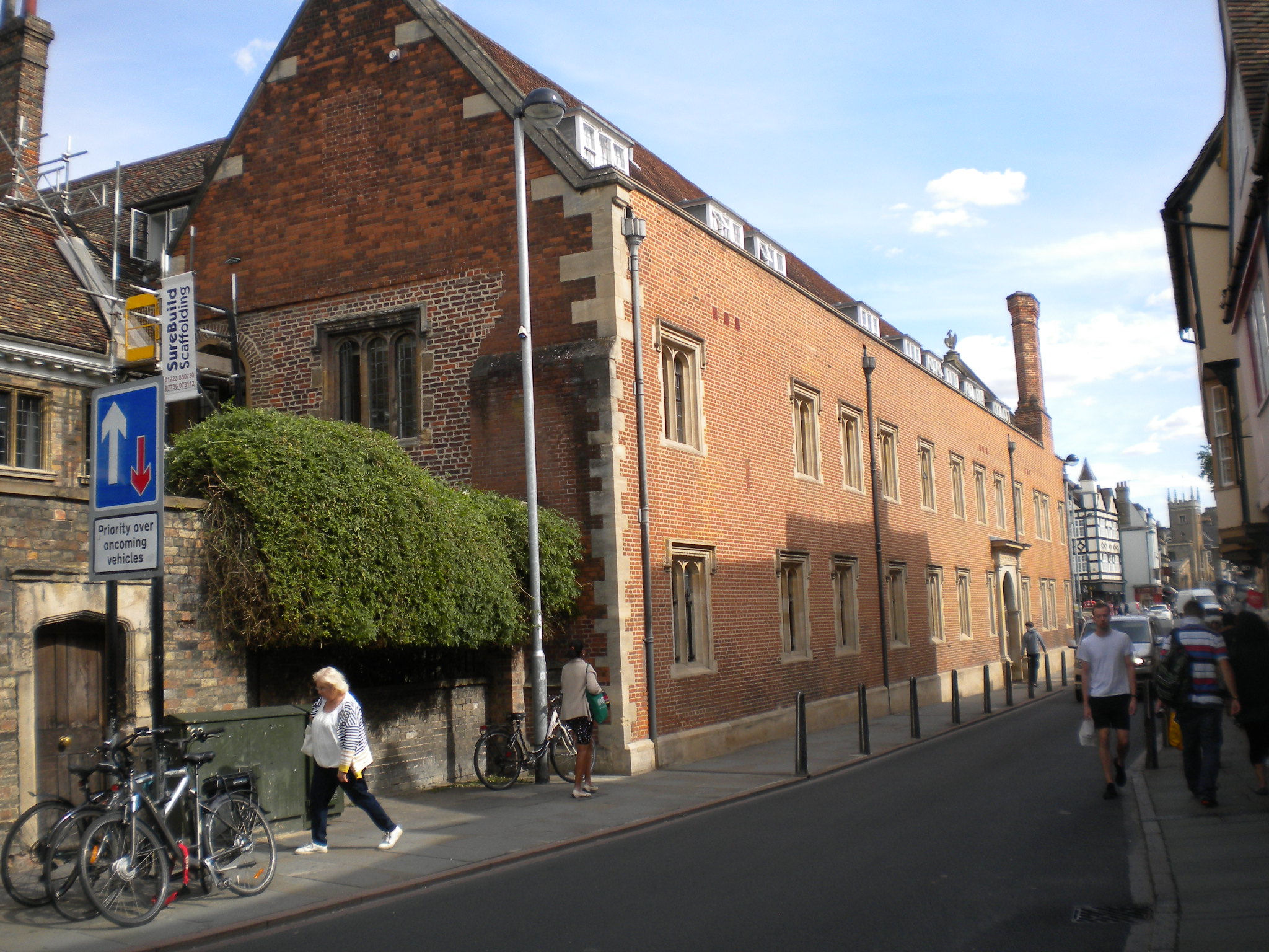
Magdalene College is listed grade I. It dates from 1575.


The wrought iron gate next to it is listed grade II and was designed 1873. It contains a snake, and a duck!
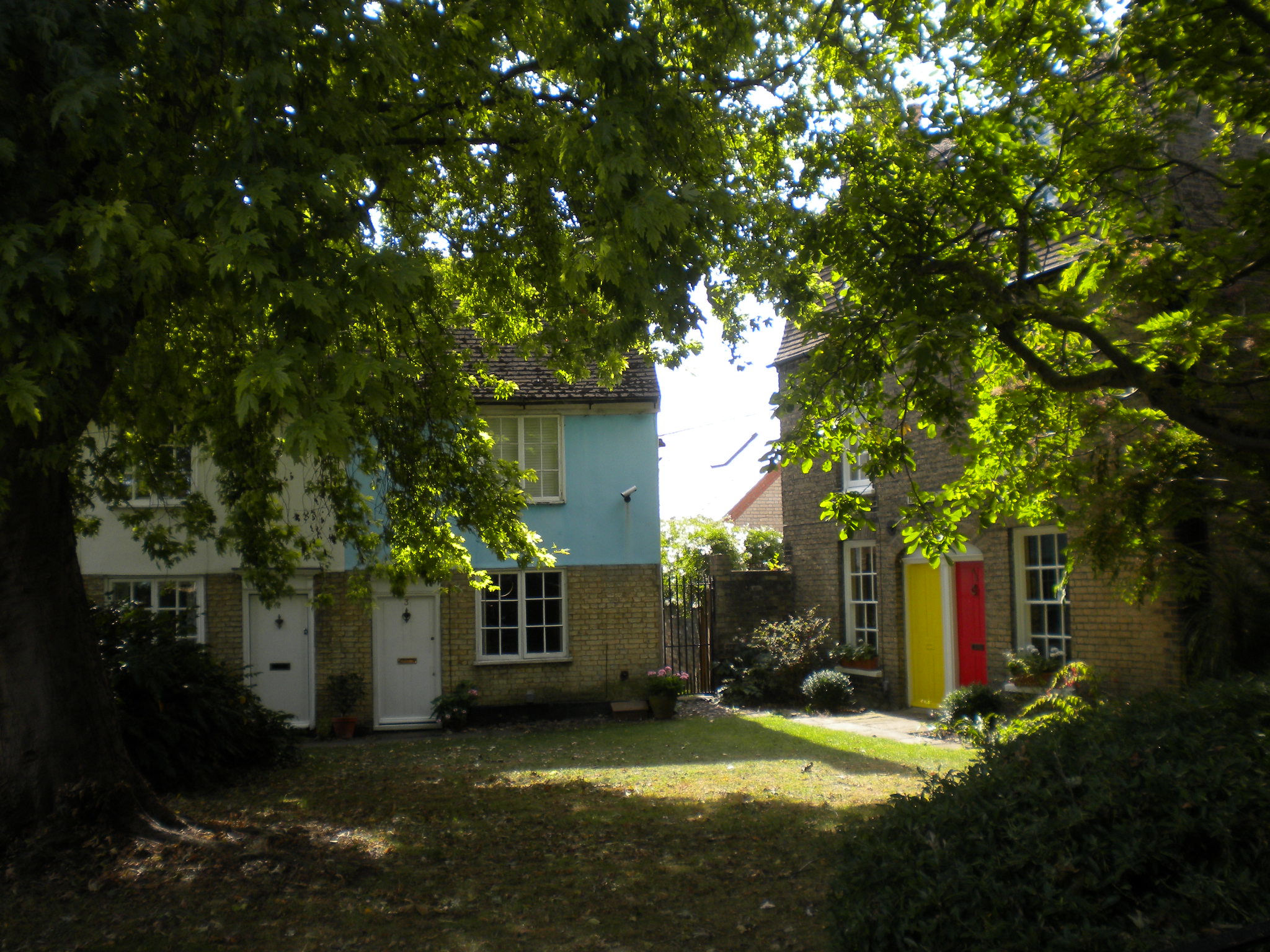
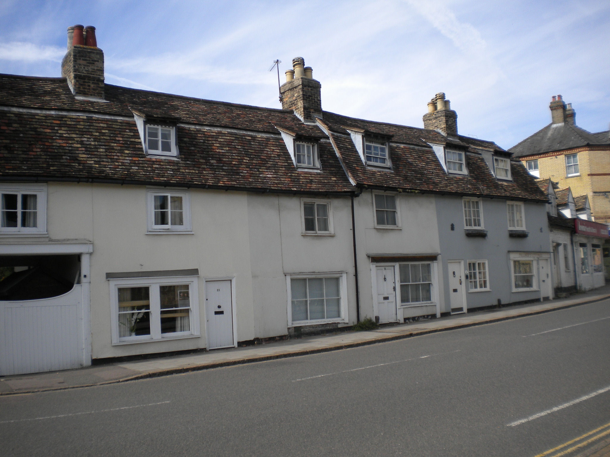
Magdalene Street has narrow pavements and is busy, with buses. Keep in single file until the traffic lights! The west side of Magdalene Street is mostly C16 or C17. You get a good view from this side of the road. Some of the houses have jetties, where the upper stories stick out a little over the street.

25 Magdalene Street is grade II, and dated early 17C.
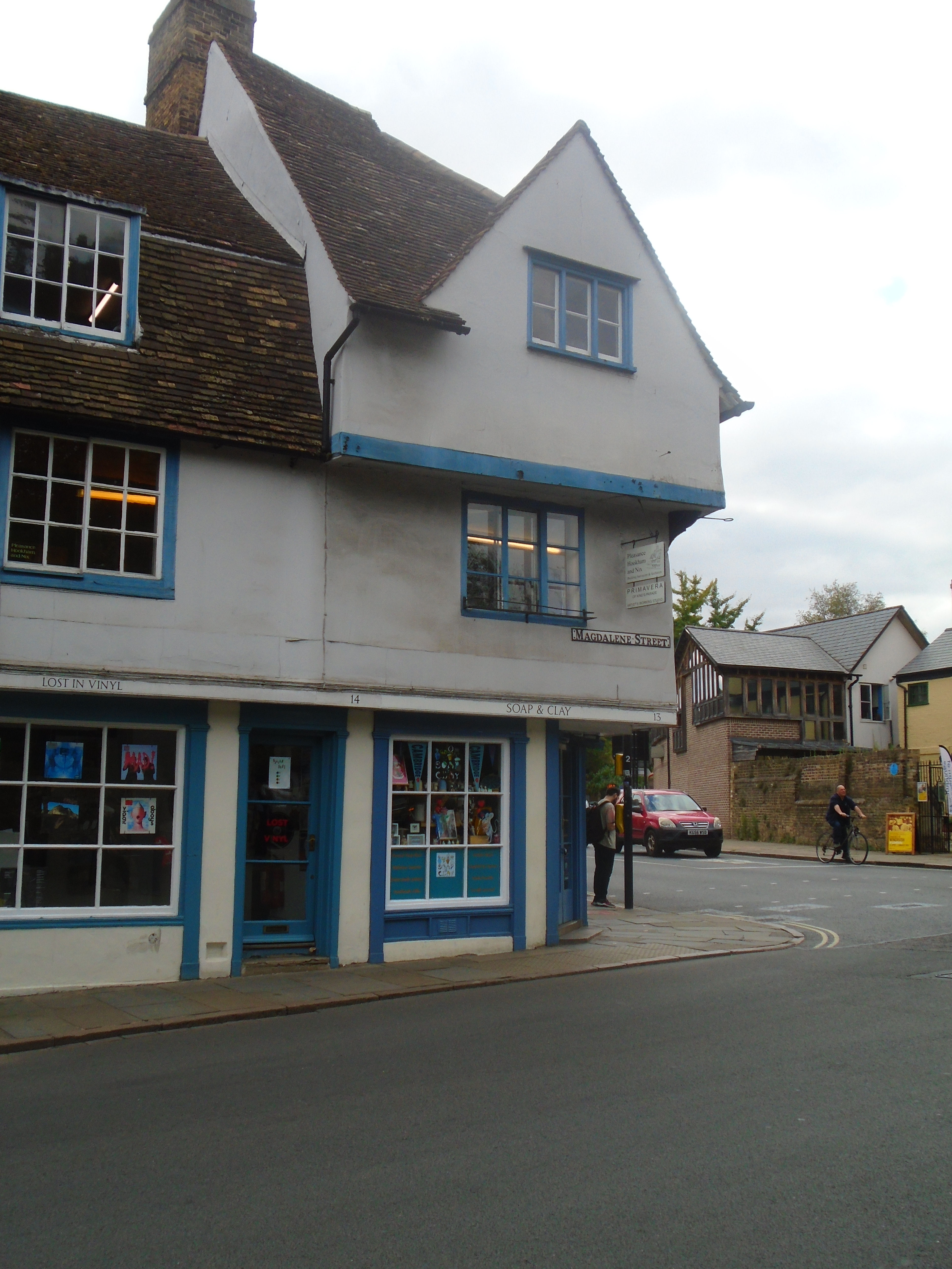
The house on the corner, 1 Northampton Street) has particularly good jetties! It is listed grade II* and is dated late 16C.


The Cambridge Core is on the corner of Magdalene Street and Chesterton Lane. It is described in a plaque nearby, which says "This sculpture, by artist Michael Fairfax, represents layers of Cambridge history dating back to Roman times. It was inspired by finds from an excavation at this site by the Cambridge Archaeological Unit in 2000. The dig revealed a medieval coin hoard - the Magdalene Hoard - now preserved in the Fitzwilliam Museum. Remnants of a Roman Street, first millennium burial sites, Saxon and Medieval buildings and a nineteenth-century public house were also found during the dig funded by Anglian Water. To make the sculpture, oak tree trunks from Wimpole Hall were carved, and then cast in bronze. The wooden model is on display at the Cambridge Folk Museum. This Gateway feature is part of a public art project, which includes Street-Side Bollards and a Bronze Flower Path leading from St John's corner to this point. It was sponsored by Cambridgeshire County and Cambridge City Councils." The Flower Path is the bronze discs with flowers set into the pavement, on the other side of the road. See Northampton Street walk for more information.

The Museum of Cambridge (formerly the Folk Museum) has collection of 20,000 objects, pictures and documents which provide an insight into the history of Cambridgeshire people. It is housed in a 17th-century timber-framed building (listed grade II) which was formerly the White Horse Inn for 300 years.

St Giles is listed grade II*. It was rebuilt in 1875, replacing a medieval church. However, they think that the original foundation was Saxon.
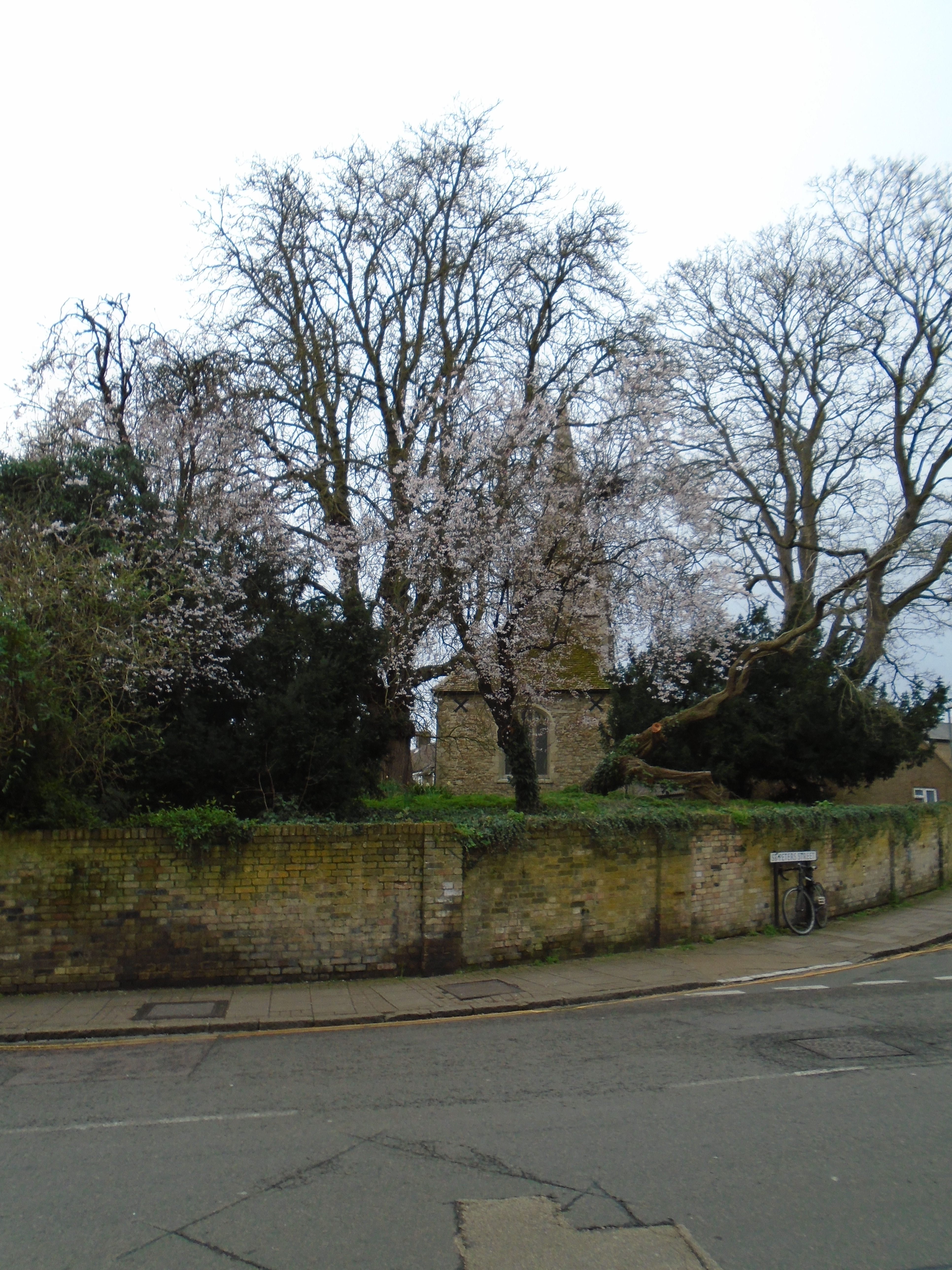

St Giles, on one side of the road, and St Peters, on the other, are both well above the level of the road. It is thought that this might be the entrance to the Roman camp, which would have had earthworks round, defending it.
1-5 Bells Court are listed grade II. They are C18.

When William the Conqueror invaded England in 1066, he subdued the country by causing castles to be built. These were motte-and-bailey - a form of castle situated on a mound (the motte) and an flat area in front (the mailey). Cambridge Castle was built on top of the Roman camp - an obvious location as it was on a hill overlooking the settlement by the River Cam, and the river crossing. The first castle was built of wood. Edward I rebuilt it in stone, but it fell into decay, and now there is only the original motte left, Castle Mound. This is entirely man-made. Castle Mound is the highest point of Cambridge, with a good view.
Tall buildings tend to be the most visible. Here is a list of tall buildings in Cambridge.
| ft | m | |
|---|---|---|
| Addenbrooke's Hospital chimney | 220 | 67 |
| Our Lady and the English Martyrs (RC) | 213 | 65 |
| All Saints, Jesus Lane | 175 | 53 |
| St Johns college chapel | 163 | 49.7 |
| Cambridge University Library | 157 | 48 |
| Cambridge Big Wheel, Parkers Piece | 118 | 36 |
| Great St Mary | 114 | 34.7 |
| Kings college chapel | 94 | 28.7 |
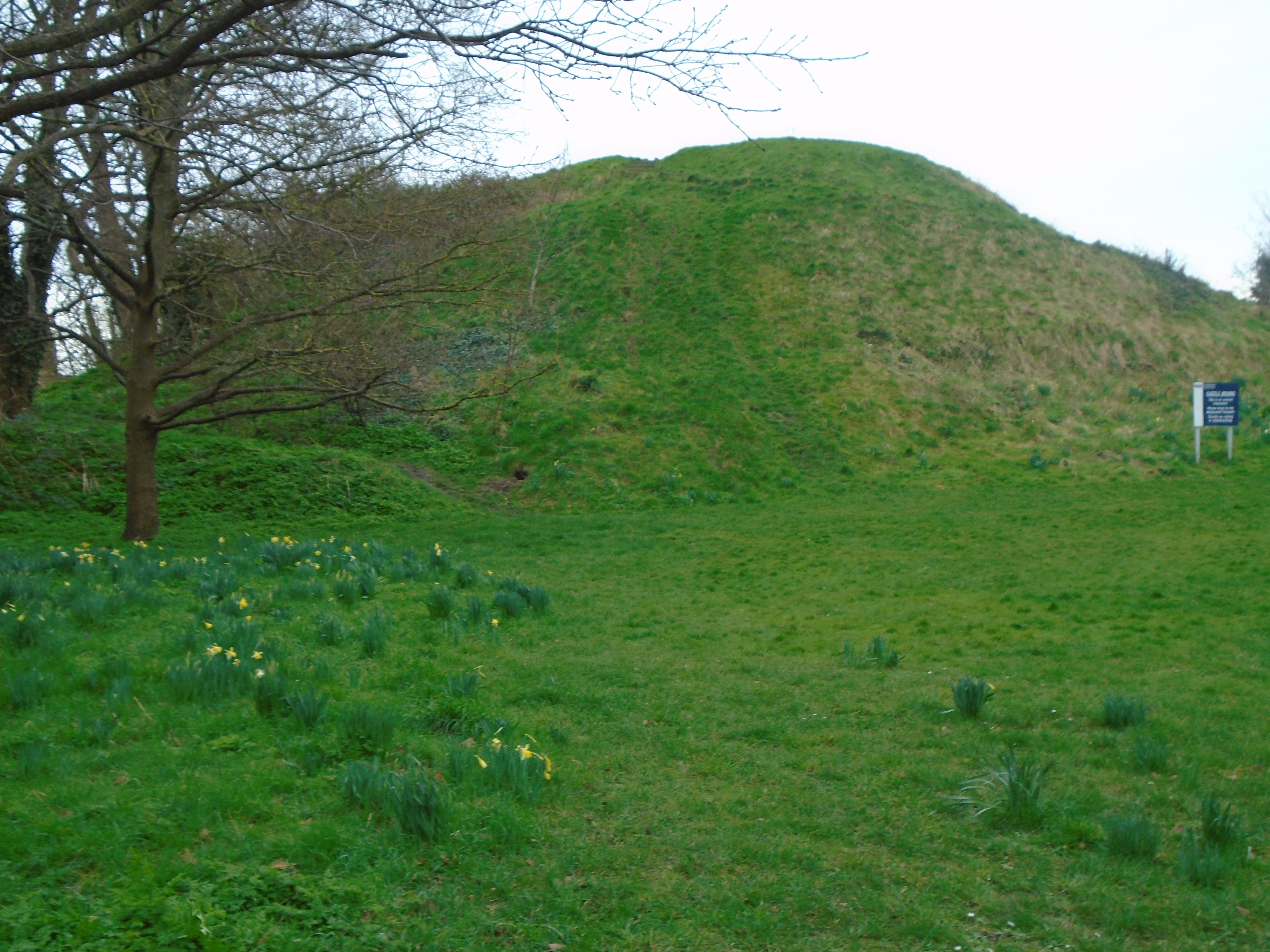
Tucked in behind Castle Mound are some earthworks, which are Cromwellian fortifications - visible on the left in the above photo.

There is a much weathered gargoyle spout in the grounds of Shire Hall.
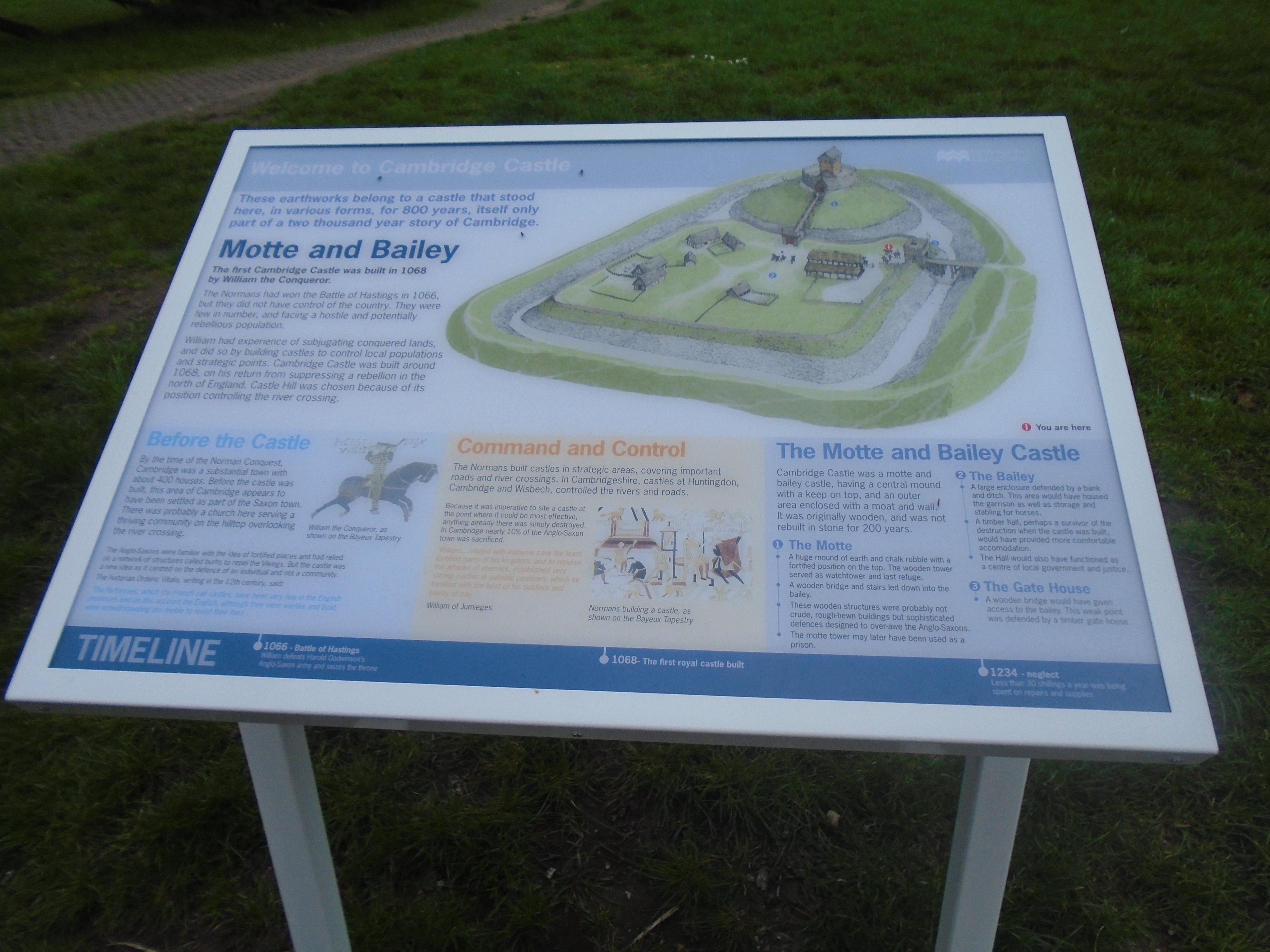
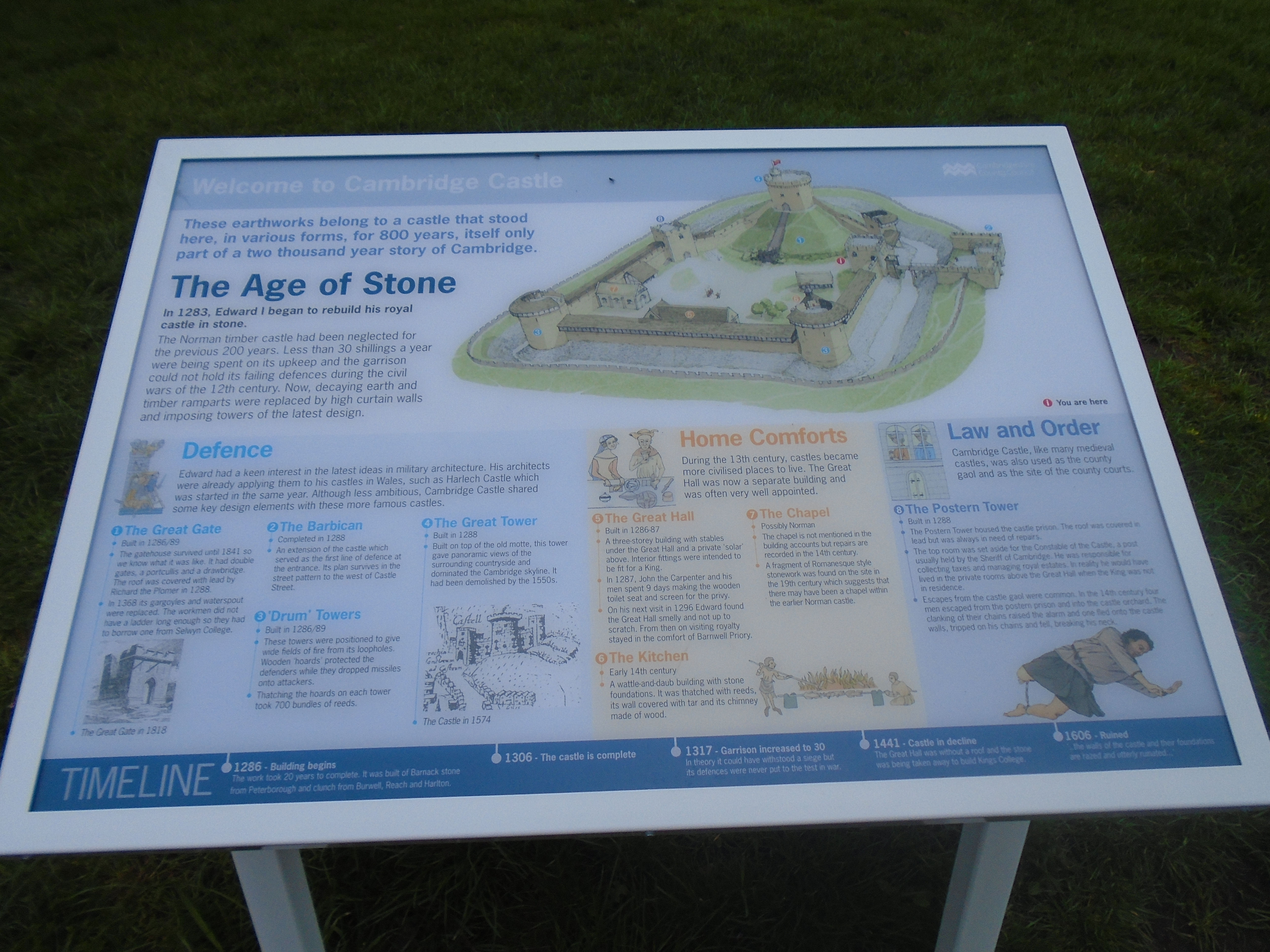
There are also information boards about the castle - see below. Click on a photo for a larger (readable!) version.

Castle Mound is in the grounds of Shire Hall, built in 1932. This used to be where Cambridgeshire County Council met, and where the Register Office was (to register births, weddings and deaths). In 2021, the council moved to Alconbury, some 23 miles from Cambridge, and the nearest Register Office is now at Ascham Road, Cambridge CB4 2BD. They planned to sell Shire Hall to be used as a hotel (while still allowing public access to Castle Mound), but the deal fell through, and now all is chaos!

After the Saxons settled near the river, there were two settlements, one on the hill and the other round the river. The hill settlement was quite large, with three churches dating back to Saxon times - St Giles, which we have already met, St Peters, which we will meet later, and All Saints on the Hill. All Saints got demolished, possibly to build the Norman Castle. As Cambridge grew, the river settlement got bigger and the hill settlement got smaller. Finally the Black Death wiped out the hill settlement. Later, people moved back up the hill, as Cambridge got bigger. So much of the building around is modern, but there are patches of older houses.
55-69 Castle Street are listed grade II. They are C18 or earlier.
On the left, just before Storey's Way, is the original site of the Roman fort. Nothing is left of it! It is also round here that there was one of the lost churches of Cambridge, All Saints by the Castle. The Black Death killed so many of its parishioners that the parish was combined with St Giles, and the church fell into ruin. Nothing left of that, either. Now the parish of St Giles has been combined with St Giles, so there is only one parish in this area. But St Peter survived, and we will see it later.

Murray Edwards was formerly known as New Hall. It was built in 1962-6, but despite being modern, is listed grade II*. It was the third womens college in Cambridge, after Girton and Newnham, and has remained women only, unlike the others.

In Roman times, Cambridge was called Duroliponte. Archaeological digs have shown there was a Roman fortified camp on top of Castle Hill. The map above shows how the camp fits in on a modern map of Cambridge. Click on map for a larger version.
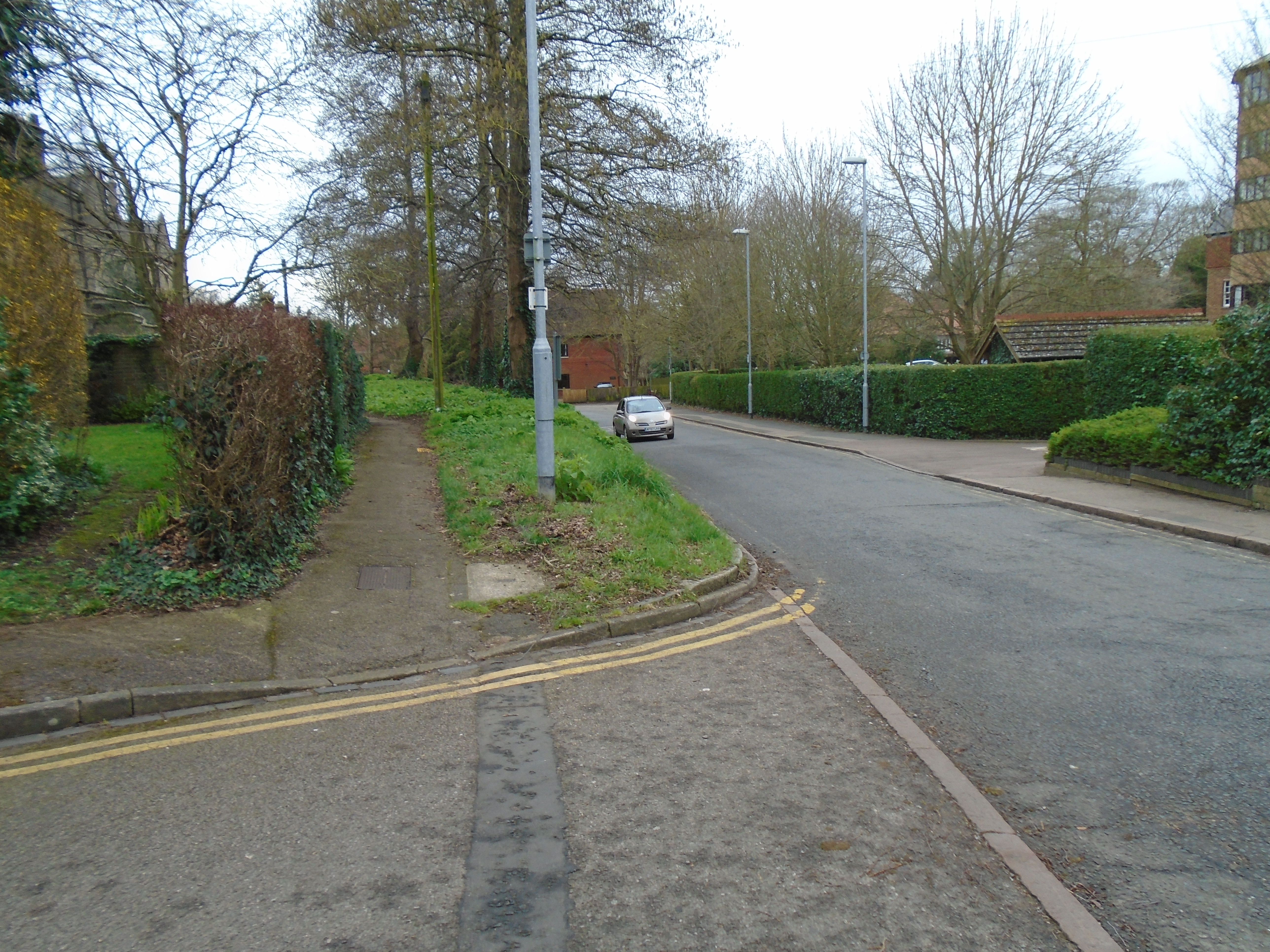


The ditch and walls ran along Mount Pleasant, and even today you can see that one side of the road is considerably higher than the other. You can also see the sharp bend in the road, which may be the edge of the camp. However, the Romans were not the only people to fortify Castle Hill. The Norman castlehad a ditch round, as well, so this may be one or the other.

Storeys Almshouses are listed grade II. They were built in 1844, and are still almshouses, run by The Foundation of Edward Storey, a Cambridge charity which "primarily provides sheltered housing for the over 60s. Our properties are for people in financial need from Cambridgeshire or who have a professional connection to the Church of England." Edward Storey lived in Cambridge and was a captain, gentleman and bookseller. He died in 1692/3 and his will gave money to be used for almshouses. . There is an article about Cambridge almshouses here.

There was a hay market near here, hence the name of the road. These roads all date back to medieval times.

Look to your left to see a Winnie the Pooh weathervane. The next road is Honey Hill. "Honey" means muddy. The locals like to call it Pooh Corner, because Winnie the Pooh liked honey. This might explain the weather-vane!

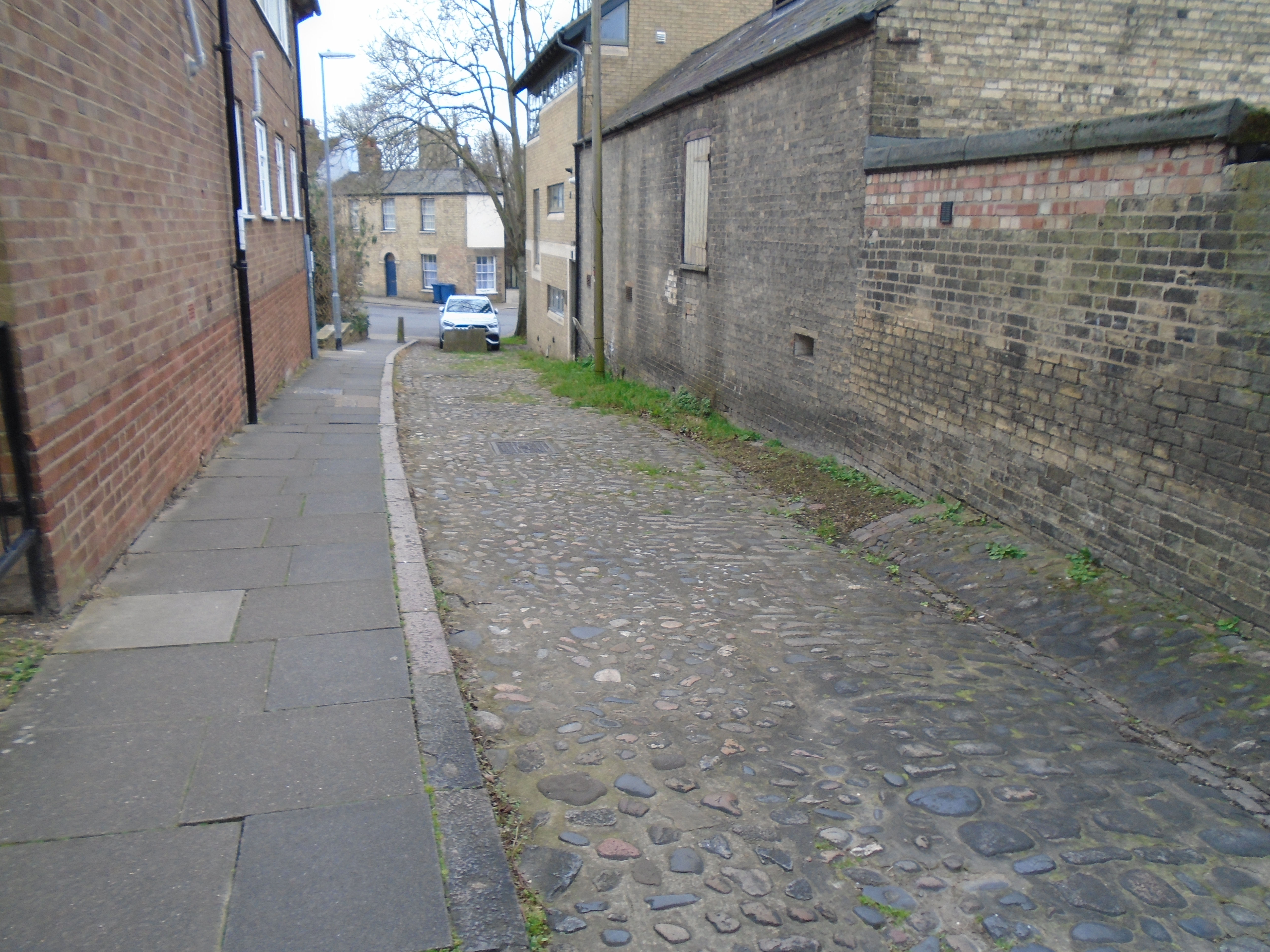
Carry on down Honey Hill. This is still close to the edge of the Roman camp. It went between here and Pound Hill, then bent round, including the site of the current St Peters Church within it.
At the end of the passage, you can see it slopes down to Northampton Street. This shows where the ditch must have been, whether Roman or medieval.
Before the end of this passage, there is a hedge to your left, with a gate in it. Go through the gate, and you are still in Honey Hill.

Look up on your right, and you will see the spire of St Peters Church. At the top of the spire is a weathervane with the initials A.P. This was originally at Peterhouse. A.P. are the initials of Andrew Perne, Master 1554-89 and Dean of Ely 1557-89. He was known a 'the weathercock dean' because he carefully cultivated the support of whichever religious or political faction was in power at the time, switching from traditional Catholicism to extreme Puritanism and then to moderate Protestantism. His initials 'AP' occasioned the wags of the time to say that they stood for 'A Protestant, A Puritan or A Papist'. Supporters could stress that Perne's ability to cultivate the dominant political party ensured that Cambridge University survived the Tudor period with increased wealth and influence. In 1770 the weathervane on the college's Perne Library was blown down in a storm, and the weathervane eventually was installed here.
St Peters Street is a medieval road.

Turn left to see 18-18a St Peter's Street, grade II. It is early C19 with mid C19 workshops (the white buildings along the wall).

On the wall of Kettles Yard new building, on Castle Street, there is this notice about an old turnpike road. It used to be high up the wall, but is now at head height (and has been cleaned). A turnpike is a road for which a driver pays a toll or a fee for use. It says "Godmanchester turnpike road ends here. To the Horseshoe Corner, Godmanchester 14 miles 4 furlongs". There are 8 furlongs to a mile, so the distance is 14 and a half miles, or 23.34 kilometres. Godmanchester is near Huntingdon.


Kettles Yard is a museum of modern art. The entrance is down the alleyway to the right of the photo, by the church. The museum is split into two parts. On the left of the alleyway is the modern gallery area which houses temporary exhibitions. Check their website to see what is on. If you carry on down the alleyway, then on your right is a door. This leads to the house where Jim Ede lived. In the 1920s and 30s Jim had been a curator at the Tate Gallery in London. Thanks to his friendships with artists, over the years he filled his house with a remarkable collection, including paintings by Ben and Winifred Nicholson, Alfred Wallis, Christopher Wood, David Jones and Joan Miro, as well as sculptures by Henri Gaudier-Brzeska, Constantin Brancusi, Henry Moore and Barbara Hepworth. This is also open to visit as part of a guided tour (book at the reception, next to the gallery). The building is listed grade II.


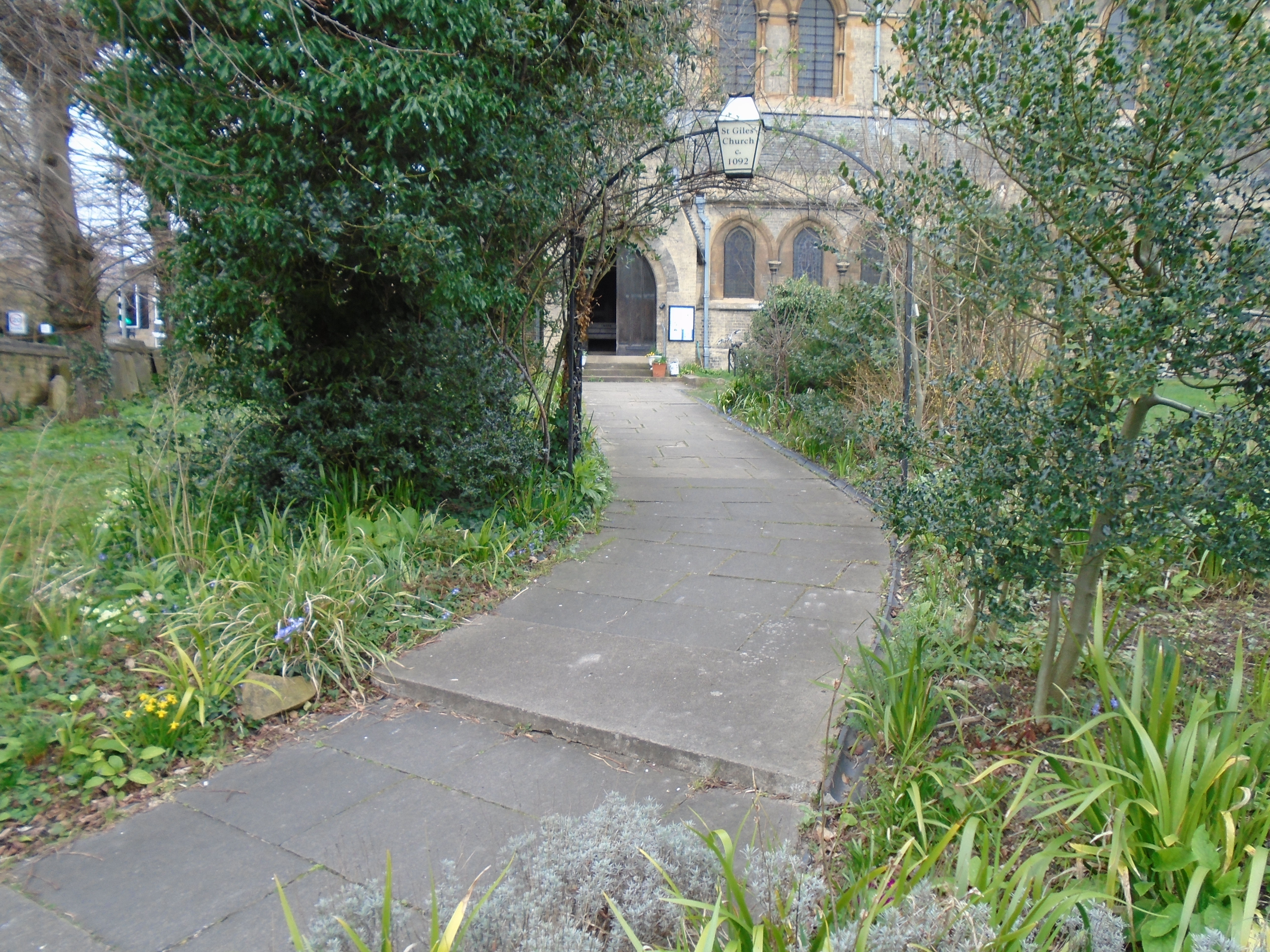
St Peters is listed grade II*. No Roman building survives above ground, but St Peters is built of a mixture of material, and some of this is thin red tiles or bricks. These may be Roman tiles. This church dates back to Norman times, but it has been rebuilt incorporating original features and using the same building materials. There is a good Norman doorway.
Inside there is a 12C font. On the corners, it has mermen with divided tails.


This is taken from "An Historical Map of Cambridge" (isbn 978-1-8380719-5-0) which overlays historical features on a 1925 map. It shows the Norman castle (red) and earthworks by Cromwell (dark grey).
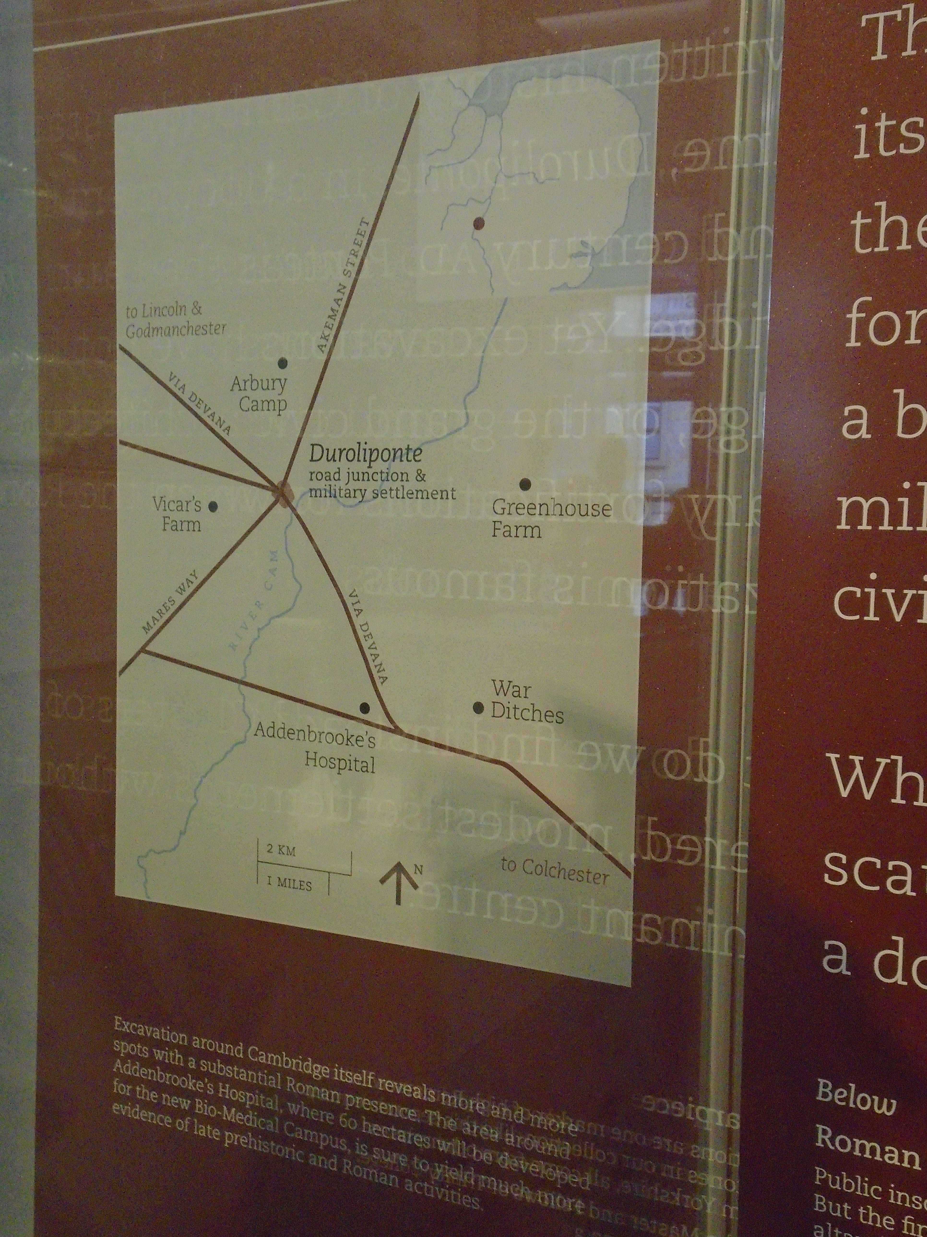
This Roman road map is in the Museum of Archaeology and Anthropology. The "Via Devana" (not its original name!) is Castle Street, Bridge Street, Sidney Street, St Andrews Street, Regent Street, Hills Road, and so on. The cross roads used to at the Roman camp, round Castle Mound, although the roads have changed within Cambridge itself. They can be traced outside Cambridge - Mares Way and Akemund Street (NOT the Akemund Street within Cambridge itself!)
The Museum also says about Cambridge: "The written history of Cambridge starts with its name, Duroliponte, in a document from the 2nd century AD. Ponte is the Latin word for bridge. Yet excavations have not found a bridge, or the grand civic architecture and military fortifications for which Roman civilisation is famous. What do we find instead? Clusters of scattered, modest settlements without a dominant centre.... Architect finds from Cambridge itself ... the objects are more utilitarian. People did make and use a range of technologies, from needles and glass bottles to compasses [for drawing a circle] and keys." There were grander Roman artifacts found outside Cambridge, but the town seems to have been just a small military establishment.
Here is part of a review in the Observer (May 22 2023) about the origin of Kettles Yard.

© Jo Edkins 2025 - Return to Walks index