
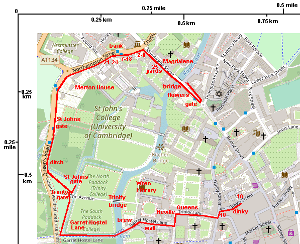
| U3AC walks | U3AC walk - Northampton Street |
Route: Bridge St, Castle Street, Northampton Street, Queens Road, Garret Hostel Lane, Trinity Lane, Green Lane
Length: 1.03 miles Start: Quayside - Finish: Green Lane
Introduction: Some of the older houses in Cambridge are on the Roman road, both north and south of Quayside. Ignore street level - look up! Jetties often show old houses. That is when an upper floor sticks out over the street for a few inches. They were banned in London in 1667, after the Great Fire of London.
Click on photos for a larger version.
Cross the road and walk a little towards the city centre. Look down, to see the Flower Trail.
This is both a large and small scale artwork! There are small bronze flowers set into the pavement, along Bridge Street and Magdalene Street (on one side of the street only). The artwork is by Michael Fairfax, 2001. This website says "Four different cast bronze flower. Six hundred in all scattered in the pavement along the route Magdalene and Bridge Street 1 - 1 1/2 KM. The flowers link to the architectural flowers on buildings along the route." Some of the flowers are on St Johns gatehouse, which we will see on the Backs walk. But the other two we will see on this walk.

Look at the white flowers in this gate to St Johns College. Either this, or a similar gate near the Round Church, inspired one of the flowers.


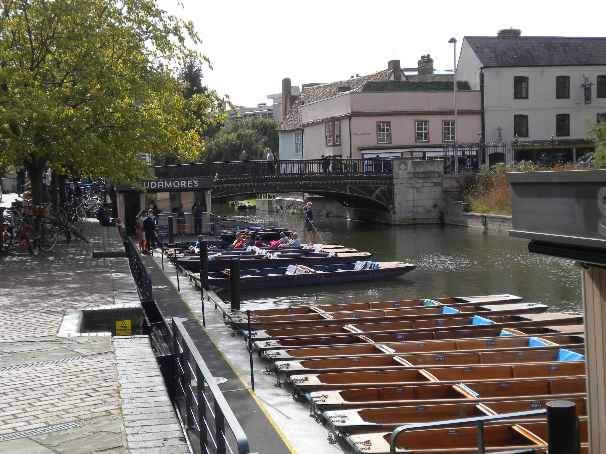
This was the main bridge of Cambridge, called the Great Bridge, but is now Magdalene Bridge (after the college). This particular bridge was built in 1823 and is listed grade II. In Cambridge, we spell Magdalene with a final 'e' (Oxford doesn't). Both Oxford and Cambridge pronounce it as 'Maudlin'.
The Roman name for Cambridge was Duroliponte. No archaeological dig has found a Roman bridge. However, the Saxons did build a bridge here, and called the town Grantebrycge (or Granta-bridge) since the river was the Granta. But this gradually changed to Cambridge. The river was still called the Granta, and at some point this was thought silly, so they changed the name of the river as well!
Castle Street pavement is very narrow, and there are buses. Keep to the pavement, and walk in single file.
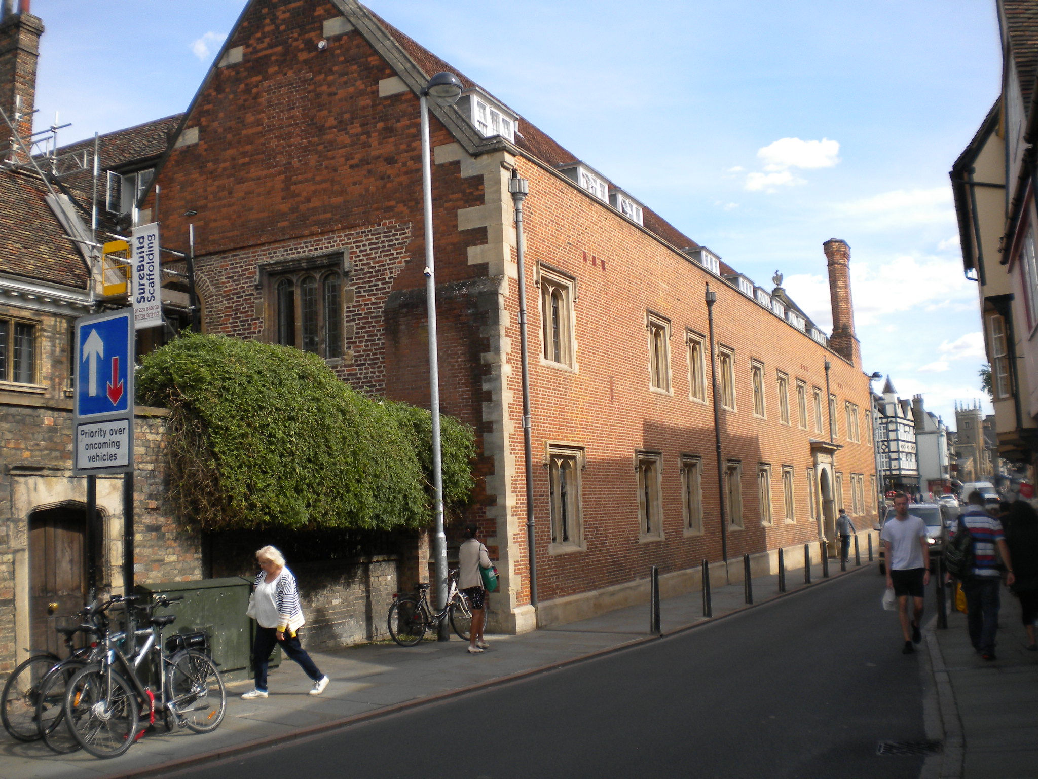
Magdalene College is listed grade I. It dates from 1575.
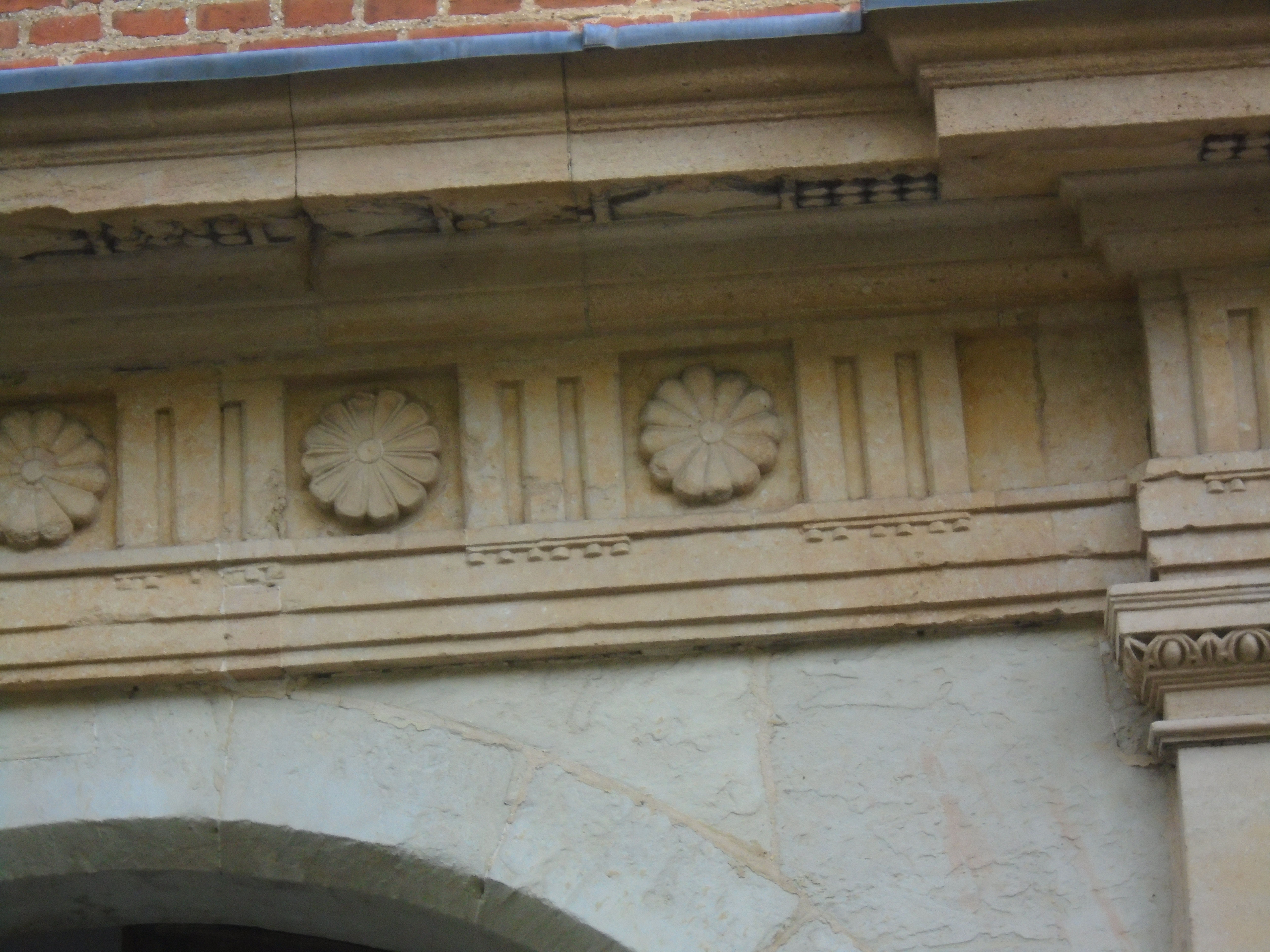
Look above the doorway to see one of the Flower Trail flowers.


The west side of Magdalene Street is mostly C16 or C17, remodelled later. 25 Magdalene Street (grade II) has grotesques supporting the jetties. There is a local story that these used to advertise a brothel! However, it is more likely that these grotesques were a protection against witchcraft.
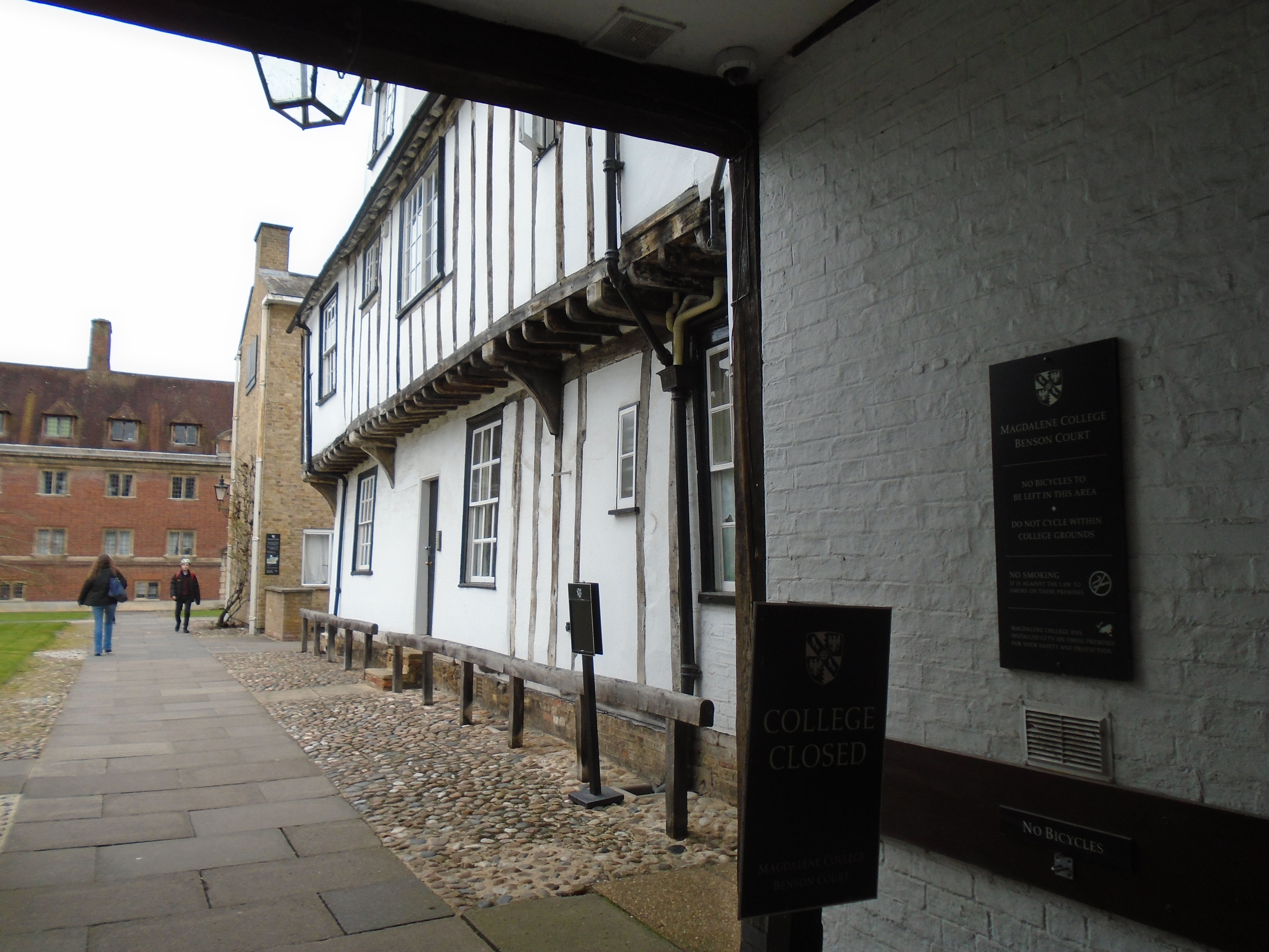
Between the houses were entrances to yards, which led to poor housing and small industries. It all belongs to the colleges now, but if a gate is open, you might see the remanents.

We don't cross the road, but if you look across, you can see that there is a slope up towards Kettles Yard and St Peters. This shows that the Roman ditch surrounding the camp ran along Northampton Street.

On this side of the road, 2-6 Northampton Street is called Cory House. It is listed grade II*. It consists of two distinct C16 houses, with an early C18 building between, in what was a carriageway.
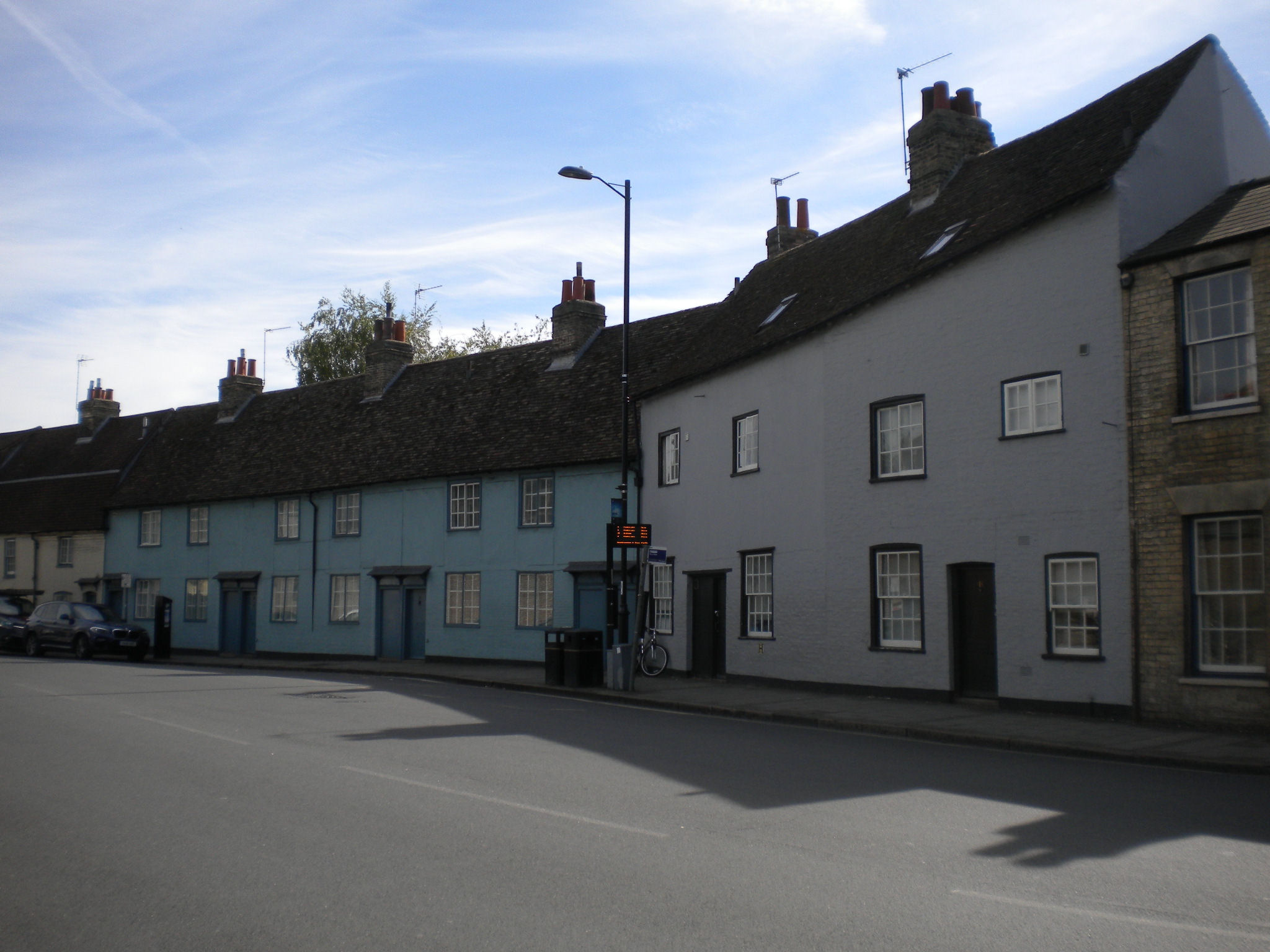
7-18 Northampton Street is listed grade II. They are C18.
21-24 Northampton Street is listed grade II. It was built in 1729 as Storey's Almshouses.
Merton House is listed grade II. It was built in early 19C. Ephraim Wayman was living here in 1881. In 1888 he was responsible a major criminal financial scandal that lead to at least one suicide and the ruin of many families in the Cambridge area. Wayman fled the UK with £100,000 (which was millions of pounds then).
The Backs are the backs of the colleges along the river. They own the land both sides of the river, and so it is hard to see much of it, except in a few places (or from a punt). There are some fine wrought iron gates to the different colleges.
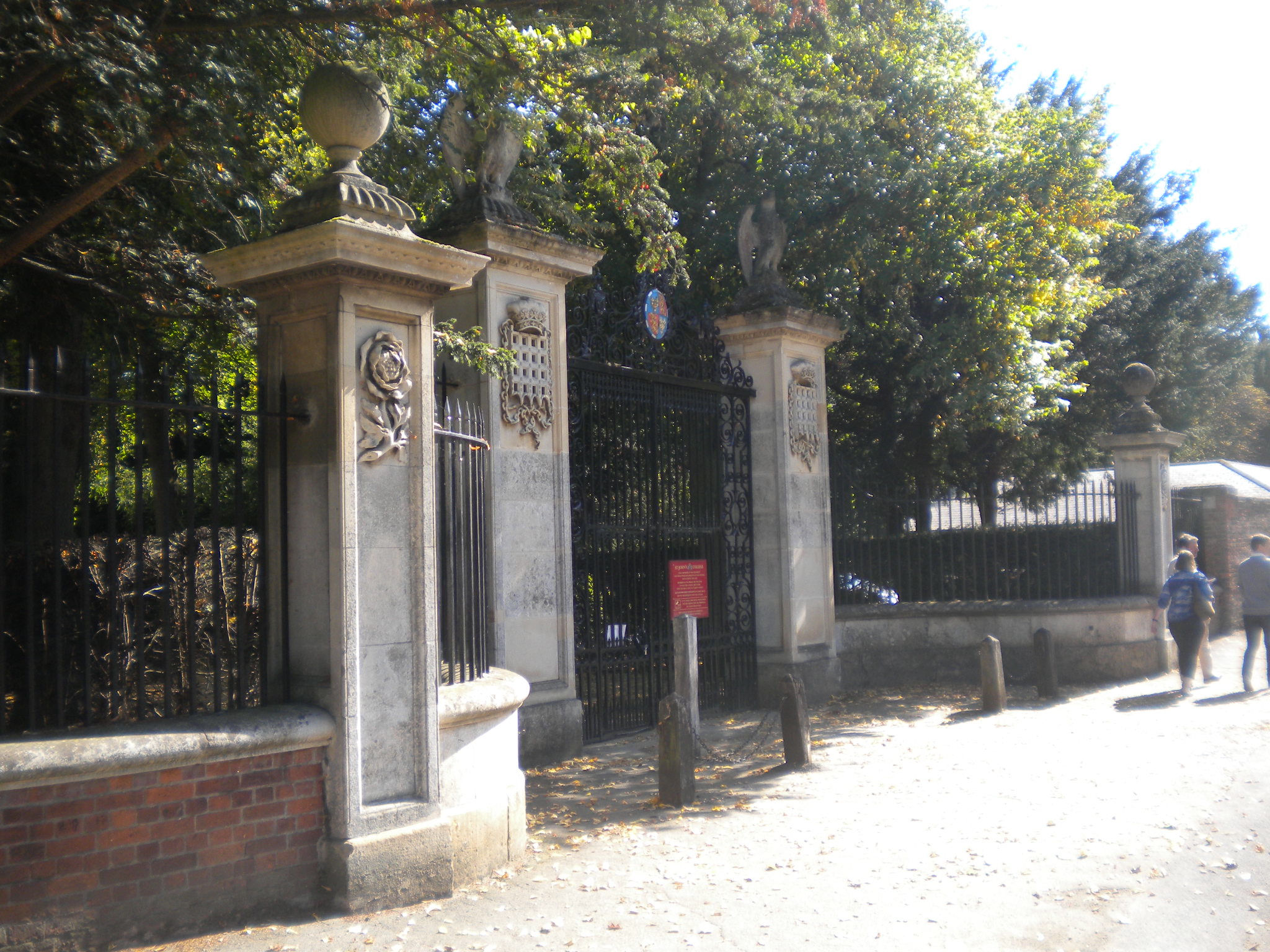
Here is the first of the gates to the Backs. It is the St Johns field gate, and is listed grade II. It was made in 1822, but to a C17 design.
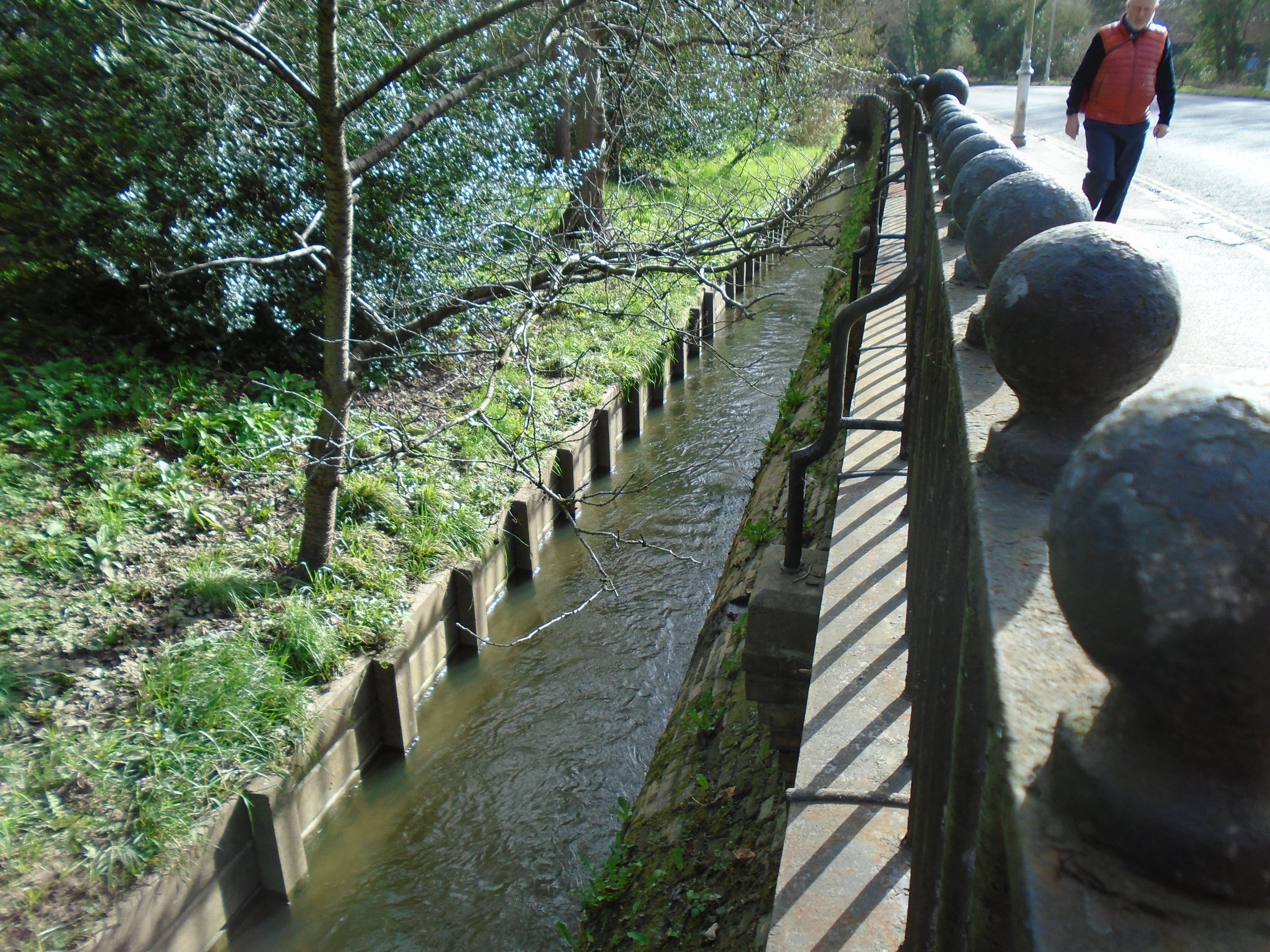
As you walk down Queens Road, you can see the ditch round St Johns, on the other side of the fence. Many colleges have ditches round them. The reason that Cambridge was originally settled up the hill was because it was marshy round the river. These ditches helped to drain the water from the soil. They may also discourage students creeping into college after hours, but I doubt it! This particular ditch is part of Bin Brook, which flows through West Cambridge.
Follow the public path on the left, away from the road.

This is another St Johns gate. This one is listed grade II*. It was erected 1780 in a different positon, and in the present position in 1822. Probably from the Horseheath Hall sale of 1777, so from early or mid C18. This gate leads to St Johns Wilderness, which was designed by Capability Brown

Look across the river to see Trinity Wren Library. It is listed grade I. It was built in 1676-95 by Sir Christopher Wren.

This gate to Trinity Backs is listed grade I. It was also from the Horseheath Hall sale of 1777, so early or mid C18.
In the early days of the university, there were colleges and hostels. Hostels were more informal places, where students would find accomodation, then hire a tutor to teach them. Eventually, they were replaced by colleges, although some college accomodation is still called hostels. This lane keeps the name of one of the original hostels, which was acquired in 1329 by Michaelhouse, (which became part of Trinity). Garrett Hostel was demolished in the 17th century.

Garret Hostel bridge is the only public bridge across the river between Magdalene bridge and Silver Street bridge. This is an inportant route from the centre to the University Library, so beware of fast cyclists! The bridge is rather a steep hump, so cyclists need to build up speed to cross it.

Trinity Bridge is listed grade I. It was built in 1765.
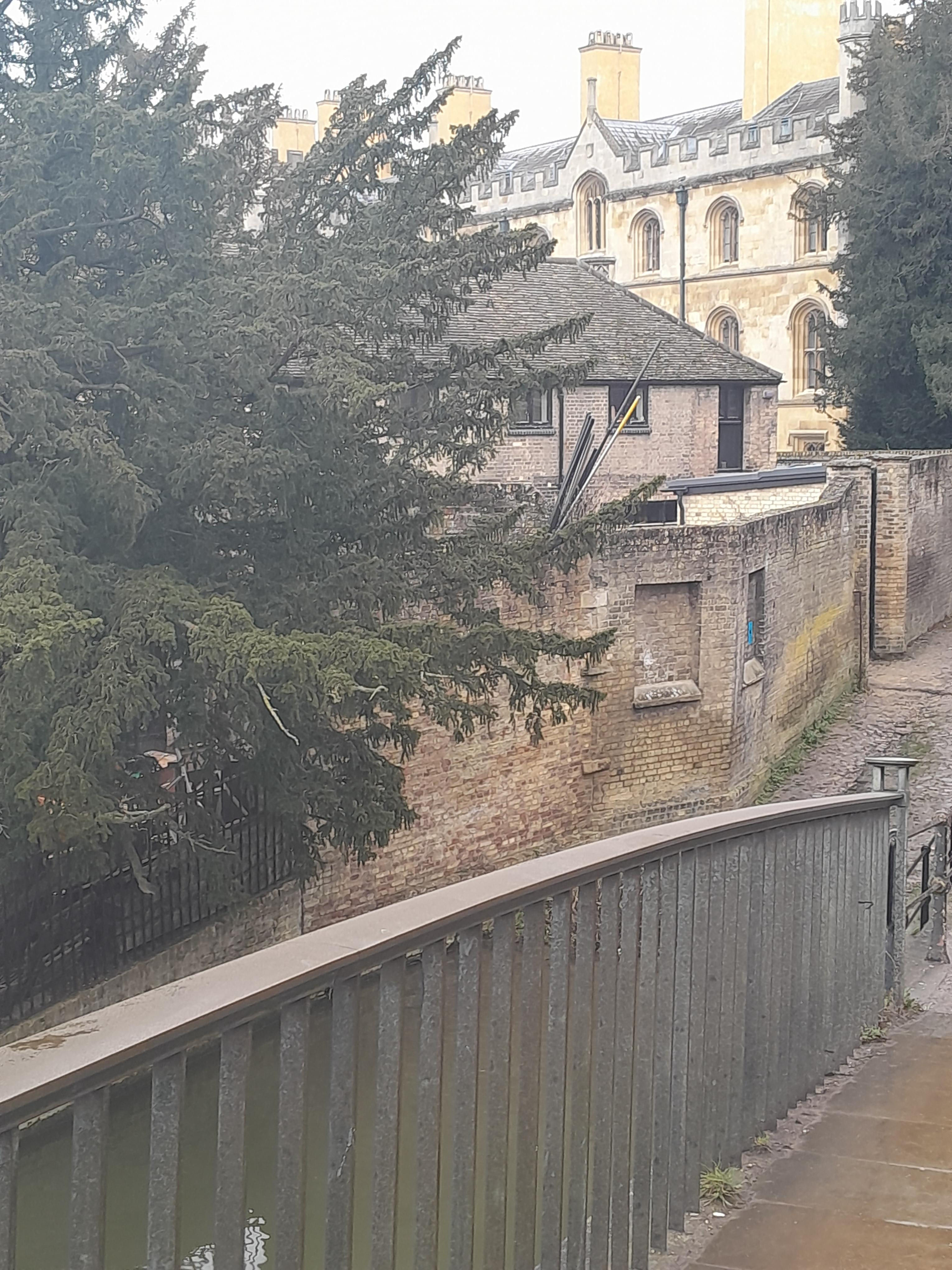

Looking forward, you can see a building over the wall. This is Trinity brewhouse, once used for brewing beer. I assume that it was close to the river for a supply of water! You can see more of the building if you enter Trinity (which we're not going to do!


This wall belongs to Trinity Hall. It is listed grade II. The listing says "C16 stone and brick wall with some later refacing approximately ten yards in length." So perhaps it is the original wall built in 1545.
There is a plaque on the river side of the sticking out bit, high up, saying "Plan - shewing Trinity Hall - line of boundary - outside stable buildings" and a very simple plan underneath. There is no date, but "shewing" is a spelling suggests that it is pre-Victorian.

A couple of Trinity gates: Neviles Gate is listed grade II*. It was built circa 1610. It has been moved round the place! At one point, it was at the end of the Avenue, off Queens Road. It was moved here in 1876.

Queens gate, Trinity, is listed grade I (along with most of the rest of Trinity!) It was built 1597.
Cross Trinity Street.

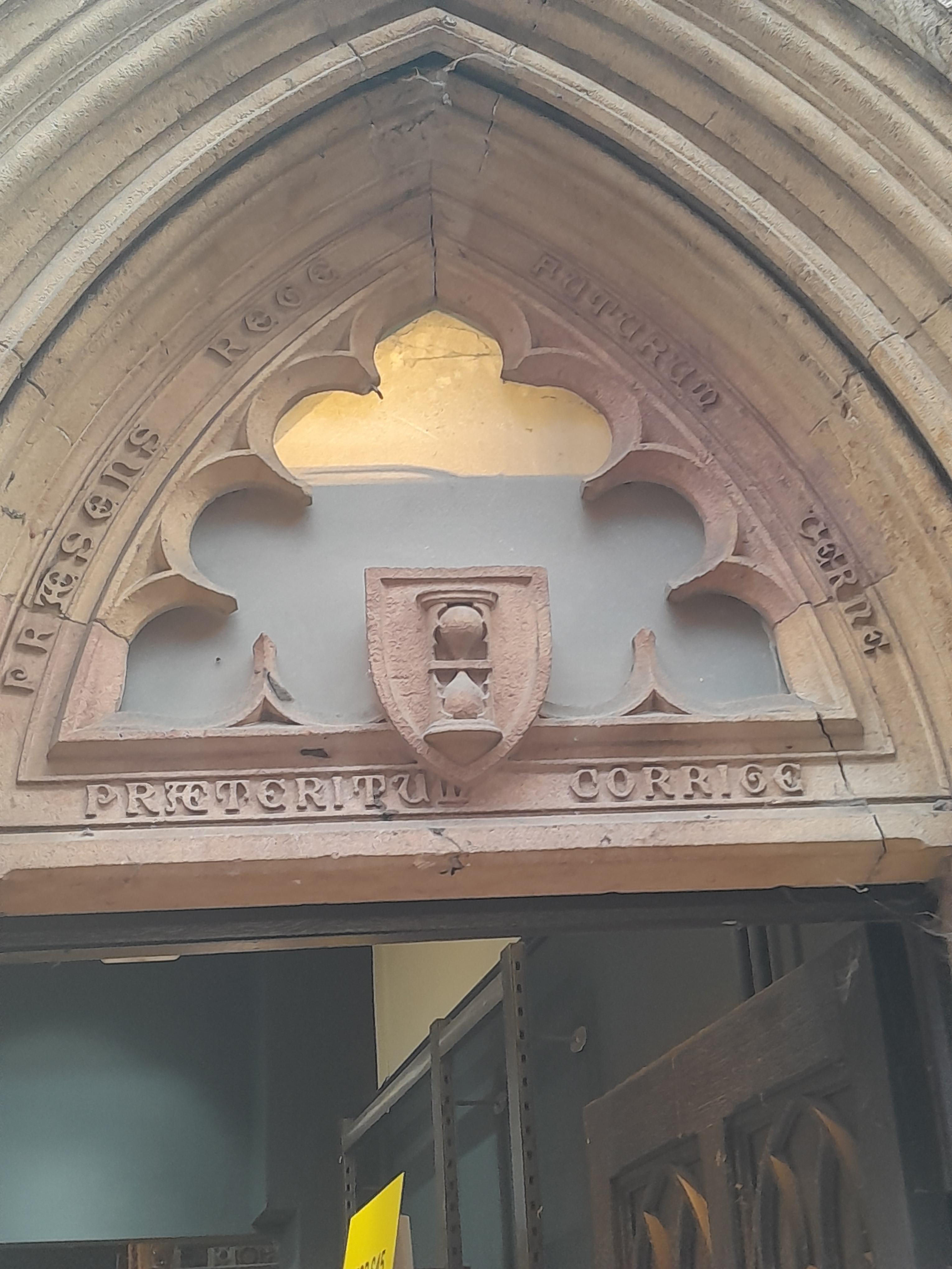
10 Trinity Street (corner of Green Street) is listed grade II. It was built in the early 1880's for a firm of solicitors. Over the door it has this feature. The hourglass indicates that the subject matter of the inscription is Time. The writing says "PRAETERITUM CORRIGE" (Correct the past), "PRAESENS REGE" (Control the present), "FUTURUM CERNE" (Perceive the future), which is rather a chilling motto for solicitors! The original is part of a short epigram by the 16th century Bavarian jurist called Nicolaus Reusner.
Green Street is not medieval, unlike most city centre streets. It's marked on a late 18C map. It was named after Dr Green, who owned the land and developed it.


Another Dinky Door. This rocket is being fuelled with bio-fuel - rocket salad!

10 Green Street is listed grade II. It was a book binders in 1861, right up to 1962, and later. I remember a book binder in this street. The house was built circa 1700 and refronteded later in the 18th cent. The shop-front is late 19th cent.
© Jo Edkins 2025 - Return to Walks index